Category:Political maps of Lawrence County, Ohio as of the 2000 United States Census
Jump to navigation
Jump to search
Media in category "Political maps of Lawrence County, Ohio as of the 2000 United States Census"
The following 24 files are in this category, out of 24 total.
-
 Map of Lawrence County Ohio Highlighting Aid Township.png 610 × 658; 28 KB
-
 Map of Lawrence County Ohio Highlighting Athalia Village.png 610 × 658; 28 KB
-
 Map of Lawrence County Ohio Highlighting Chesapeake Village.png 610 × 658; 28 KB
-
 Map of Lawrence County Ohio Highlighting Coal Grove Village.png 610 × 658; 28 KB
-
 Map of Lawrence County Ohio Highlighting Decatur Township.png 610 × 658; 28 KB
-
 Map of Lawrence County Ohio Highlighting Elizabeth Township.png 610 × 658; 28 KB
-
 Map of Lawrence County Ohio Highlighting Fayette Township.png 610 × 658; 28 KB
-
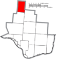
 Map of Lawrence County Ohio Highlighting Hamilton Township.png 610 × 658; 28 KB
-
 Map of Lawrence County Ohio Highlighting Hanging Rock Village.png 610 × 658; 28 KB
-
 Map of Lawrence County Ohio Highlighting Ironton City.png 610 × 658; 28 KB
-
 Map of Lawrence County Ohio Highlighting Lawrence Township.png 610 × 658; 28 KB
-
 Map of Lawrence County Ohio Highlighting Mason Township.png 610 × 658; 28 KB
-
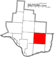
 Map of Lawrence County Ohio Highlighting Perry Township.png 610 × 658; 28 KB
-
 Map of Lawrence County Ohio Highlighting Proctorville Village.png 610 × 658; 28 KB
-
 Map of Lawrence County Ohio Highlighting Rome Township.png 610 × 658; 28 KB
-
 Map of Lawrence County Ohio Highlighting South Point Village.png 610 × 658; 28 KB
-
 Map of Lawrence County Ohio Highlighting Symmes Township.png 610 × 658; 28 KB
-
 Map of Lawrence County Ohio Highlighting Union Township.png 610 × 658; 28 KB
-
 Map of Lawrence County Ohio Highlighting Upper Township.png 610 × 658; 28 KB
-
 Map of Lawrence County Ohio Highlighting Washington Township.png 610 × 658; 28 KB
-
 Map of Lawrence County Ohio Highlighting Windsor Township.png 610 × 658; 28 KB
-
 Map of Lawrence County Ohio With Municipal and Township Labels.PNG 665 × 658; 49 KB
-
 Map of Lawrence County, Ohio No Text, Municipalities Distinct.png 610 × 658; 28 KB
-
 Map of Lawrence County, Ohio No Text.png 665 × 658; 29 KB


