Category:Political maps of Henry County, Ohio as of the 2000 United States Census
Jump to navigation
Jump to search
Media in category "Political maps of Henry County, Ohio as of the 2000 United States Census"
The following 25 files are in this category, out of 25 total.
-
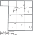
 Map of Henry County Ohio Highlighting Bartlow Township.png 496 × 521; 20 KB
-
 Map of Henry County Ohio Highlighting Damascus Township.png 496 × 521; 20 KB
-
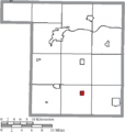
 Map of Henry County Ohio Highlighting Deshler Village.png 496 × 521; 20 KB
-
 Map of Henry County Ohio Highlighting Flatrock Township.png 496 × 521; 20 KB
-
 Map of Henry County Ohio Highlighting Florida Village.png 496 × 521; 20 KB
-
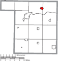
 Map of Henry County Ohio Highlighting Freedom Township.png 496 × 521; 20 KB
-
 Map of Henry County Ohio Highlighting Hamler Village.png 496 × 521; 20 KB
-
 Map of Henry County Ohio Highlighting Harrison Township.png 496 × 521; 20 KB
-
 Map of Henry County Ohio Highlighting Holgate Village.png 496 × 521; 20 KB
-
 Map of Henry County Ohio Highlighting Liberty Center Village.png 496 × 521; 20 KB
-
 Map of Henry County Ohio Highlighting Liberty Township.png 496 × 521; 20 KB
-
 Map of Henry County Ohio Highlighting Malinta Village.png 496 × 521; 20 KB
-
 Map of Henry County Ohio Highlighting Marion Township.png 496 × 521; 20 KB
-
 Map of Henry County Ohio Highlighting McClure Village.png 496 × 521; 20 KB
-
 Map of Henry County Ohio Highlighting Monroe Township.png 496 × 521; 20 KB
-
 Map of Henry County Ohio Highlighting Napoleon City.png 496 × 521; 20 KB
-
 Map of Henry County Ohio Highlighting Napoleon Township.png 496 × 521; 20 KB
-
 Map of Henry County Ohio Highlighting New Bavaria Village.png 496 × 521; 20 KB
-
 Map of Henry County Ohio Highlighting Pleasant Township.png 496 × 521; 20 KB
-
 Map of Henry County Ohio Highlighting Richfield Township.png 496 × 521; 20 KB
-
 Map of Henry County Ohio Highlighting Ridgeville Township.png 496 × 521; 20 KB
-
 Map of Henry County Ohio Highlighting Washington Township.png 496 × 521; 20 KB
-
 Map of Henry County Ohio With Municipal and Township Labels.PNG 496 × 521; 34 KB
-
 Map of Henry County, Ohio No Text, Municipalities Distinct.png 496 × 521; 20 KB
-
 Map of Henry County, Ohio No Text.png 496 × 521; 20 KB


