Category:Political maps of Clinton County, Ohio as of the 2000 United States Census
Jump to navigation
Jump to search
Media in category "Political maps of Clinton County, Ohio as of the 2000 United States Census"
The following 25 files are in this category, out of 25 total.
-
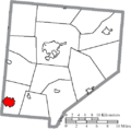
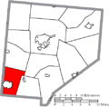
 Map of Clinton County Ohio Highlighting Adams Township.png 507 × 500; 25 KB
-
 Map of Clinton County Ohio Highlighting Blanchester Village.png 507 × 500; 25 KB
-
 Map of Clinton County Ohio Highlighting Chester Township.png 507 × 500; 25 KB
-
 Map of Clinton County Ohio Highlighting Clark Township.png 507 × 500; 25 KB
-
 Map of Clinton County Ohio Highlighting Clarksville Village.png 507 × 500; 25 KB
-
 Map of Clinton County Ohio Highlighting Green Township.png 507 × 500; 25 KB
-
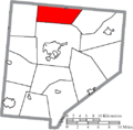
 Map of Clinton County Ohio Highlighting Jefferson Township.png 507 × 500; 25 KB
-
 Map of Clinton County Ohio Highlighting Liberty Township.png 507 × 500; 25 KB
-
 Map of Clinton County Ohio Highlighting Lynchburg Village.png 507 × 500; 25 KB
-
 Map of Clinton County Ohio Highlighting Marion Township.png 507 × 500; 25 KB
-
 Map of Clinton County Ohio Highlighting Martinsville Village.png 507 × 500; 25 KB
-
 Map of Clinton County Ohio Highlighting Midland Village.png 507 × 500; 25 KB
-
 Map of Clinton County Ohio Highlighting New Vienna Village.png 507 × 500; 25 KB
-
 Map of Clinton County Ohio Highlighting Port William Village.png 507 × 500; 25 KB
-
 Map of Clinton County Ohio Highlighting Richland Township.png 507 × 500; 25 KB
-
 Map of Clinton County Ohio Highlighting Sabina Village.png 507 × 500; 25 KB
-
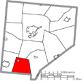
 Map of Clinton County Ohio Highlighting Union Township.png 507 × 500; 25 KB
-
 Map of Clinton County Ohio Highlighting Vernon Township.png 507 × 500; 25 KB
-
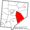
 Map of Clinton County Ohio Highlighting Washington Township.png 507 × 500; 25 KB
-
 Map of Clinton County Ohio Highlighting Wayne Township.png 507 × 500; 25 KB
-
 Map of Clinton County Ohio Highlighting Wilmington City.png 507 × 500; 25 KB
-
 Map of Clinton County Ohio Highlighting Wilson Township.png 507 × 500; 25 KB
-
 Map of Clinton County Ohio With Municipal and Township Labels.PNG 507 × 500; 41 KB
-
 Map of Clinton County, Ohio No Text, Municipalities Distinct.png 507 × 500; 25 KB
-
 Map of Clinton County, Ohio No Text.png 507 × 500; 24 KB


