Category:Political maps of Ashland County, Ohio as of the 2000 United States Census
Jump to navigation
Jump to search
Media in category "Political maps of Ashland County, Ohio as of the 2000 United States Census"
The following 27 files are in this category, out of 27 total.
-
 Map of Ashland County Ohio Highlighting Ashland City.png 345 × 782; 22 KB
-
 Map of Ashland County Ohio Highlighting Bailey Lakes Village.png 345 × 782; 22 KB
-
 Map of Ashland County Ohio Highlighting Clear Creek Township.png 345 × 782; 22 KB
-
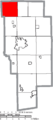
 Map of Ashland County Ohio Highlighting Green Township.png 345 × 782; 22 KB
-
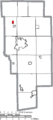
 Map of Ashland County Ohio Highlighting Hanover Township.png 345 × 782; 22 KB
-
 Map of Ashland County Ohio Highlighting Hayesville Village.png 345 × 782; 22 KB
-
 Map of Ashland County Ohio Highlighting Jackson Township.png 345 × 782; 22 KB
-
 Map of Ashland County Ohio Highlighting Jeromesville Village.png 345 × 782; 22 KB
-
 Map of Ashland County Ohio Highlighting Lake Township.png 345 × 782; 22 KB
-
 Map of Ashland County Ohio Highlighting Loudonville Village.png 345 × 782; 22 KB
-
 Map of Ashland County Ohio Highlighting Mifflin Township.png 345 × 782; 22 KB
-
 Map of Ashland County Ohio Highlighting Mifflin Village.png 345 × 782; 22 KB
-
 Map of Ashland County Ohio Highlighting Milton Township.png 345 × 782; 22 KB
-
 Map of Ashland County Ohio Highlighting Mohican Township.png 345 × 782; 22 KB
-
 Map of Ashland County Ohio Highlighting Montgomery Township.png 345 × 782; 22 KB
-
 Map of Ashland County Ohio Highlighting Orange Township.png 345 × 782; 22 KB
-
 Map of Ashland County Ohio Highlighting Perry Township.png 345 × 782; 22 KB
-
 Map of Ashland County Ohio Highlighting Perrysville Village.png 345 × 782; 22 KB
-
 Map of Ashland County Ohio Highlighting Polk Village.png 345 × 782; 22 KB
-
 Map of Ashland County Ohio Highlighting Ruggles Township.png 345 × 782; 22 KB
-
 Map of Ashland County Ohio Highlighting Savannah Village.png 345 × 782; 22 KB
-
 Map of Ashland County Ohio Highlighting Sullivan Township.png 345 × 782; 22 KB
-
 Map of Ashland County Ohio Highlighting Troy Township.png 345 × 782; 22 KB
-
 Map of Ashland County Ohio Highlighting Vermillion Township.png 345 × 782; 22 KB
-
 Map of Ashland County Ohio With Municipal and Township Labels.PNG 345 × 782; 38 KB
-
 Map of Ashland County, Ohio No Text, Municipalities Distinct.png 345 × 782; 22 KB
-
 Map of Ashland County, Ohio No Text.png 345 × 782; 21 KB


