Category:Plantaurel
Jump to navigation
Jump to search
mountain in France | |||||
| Upload media | |||||
| Instance of |
| ||||
|---|---|---|---|---|---|
| Made from material | |||||
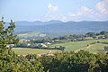
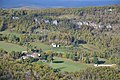
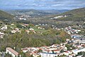
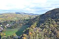
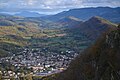
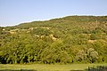
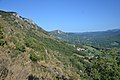
| Location | Ariège, Occitania, Metropolitan France, France | ||||
| Length |
| ||||
| Mountain range | |||||
| Highest point |
| ||||
| Area |
| ||||
| Elevation above sea level |
| ||||
 | |||||
Subcategories
This category has the following 4 subcategories, out of 4 total.
Media in category "Plantaurel"
The following 22 files are in this category, out of 22 total.
-
 Aigues-Vives et le Plantaurel.jpg 3,456 × 2,304; 1.99 MB
-
 Anticlinal Lavelanet Marne Calacaire3.jpg 2,048 × 1,536; 1.45 MB
-
 Combe de Dreuilhe (1).jpg 3,456 × 2,304; 1.99 MB
-
 Combe de Dreuilhe (2).jpg 3,456 × 2,304; 2.04 MB
-
 Combe de Dreuilhe (3).jpg 3,456 × 2,304; 2 MB
-
 Cos.jpg 3,456 × 2,304; 1.98 MB
-
 Crête Plantaurel.jpg 3,456 × 2,304; 2.08 MB
-
 Lavelanet (10).jpg 3,456 × 2,304; 2 MB
-
 Lavelanet (11).jpg 3,456 × 2,304; 1.94 MB
-
 Lavelanet (4).jpg 3,456 × 2,304; 2.02 MB
-
 Lavelanet (9).jpg 3,456 × 2,304; 2.05 MB
-
 Lavelanet depuis Montségur.jpg 3,456 × 2,304; 2 MB
-
 Leychert et Roquefixade.jpg 3,456 × 2,304; 1.97 MB
-
 Massif du Plantaurel vu de Laroque d-Olmes.jpg 5,184 × 3,456; 5.85 MB
-
 Pitons rocheux, Soula, Ariège.jpg 3,456 × 2,304; 1.99 MB
-
 Plantaurel, Lavelanet.jpg 3,456 × 2,304; 1.94 MB
-
 Plantaurel, Leychert.jpg 3,456 × 2,304; 1.96 MB
-
 Plantaurel, Rivel.jpg 3,456 × 2,304; 1.95 MB
-
 Saint-Martin-de-Caralp.jpg 3,456 × 2,304; 2.27 MB
-
 Vallée de Lesponne, Ariège (3).jpg 3,456 × 2,304; 1.99 MB
-
 Vallée de Lesponne, Ariège (5).jpg 3,456 × 2,304; 1.96 MB
-
 Vallée de Lesponne, Ariège.jpg 3,456 × 2,304; 1.98 MB


.jpg)
.jpg)
.jpg)


.jpg)
.jpg)
.jpg)
.jpg)


.jpg)
.jpg)
