Category:Pixley, Herefordshire
Jump to navigation
Jump to search
village in United Kingdom | |||||
| Upload media | |||||
| Instance of | |||||
|---|---|---|---|---|---|
| Location | Herefordshire, West Midlands, England | ||||
 | |||||
English: Pixley is a village in Herefordshire, England. The village consists of a church and small farming community. Pixley Berries produce juice for the local markets.

Subcategories
This category has the following 2 subcategories, out of 2 total.
A
T
Media in category "Pixley, Herefordshire"
The following 58 files are in this category, out of 58 total.
-

-

-
 A4172 at Pixley - geograph.org.uk - 2377050.jpg 2,592 × 1,944; 1.95 MB
-
 Approaching the A438-A417 junction - geograph.org.uk - 2284887.jpg 640 × 418; 38 KB
-
 Benchmark on Pixley Church - geograph.org.uk - 2333881.jpg 480 × 640; 114 KB
-
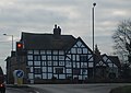
 Black and white house at Trumpet crossroads - geograph.org.uk - 4454254.jpg 1,600 × 1,067; 1.14 MB
-
 Cider apple orchard at Eastwood - geograph.org.uk - 876882.jpg 640 × 334; 78 KB
-
 Dangerous bridge - geograph.org.uk - 948667.jpg 640 × 480; 78 KB
-
 Entrance to Pixley - geograph.org.uk - 3240450.jpg 640 × 480; 84 KB
-
 Former tollhouse north of Trumpet - geograph.org.uk - 4454265.jpg 1,600 × 1,600; 2.03 MB
-
 Fruit crop by Birchall Lane - geograph.org.uk - 2656157.jpg 800 × 500; 312 KB
-
 Fruit field - geograph.org.uk - 5654050.jpg 1,024 × 768; 263 KB
-
 Fruit field - geograph.org.uk - 5654053.jpg 1,024 × 768; 358 KB
-

-
 Harmonium, St Andrew's church, Pixley - geograph.org.uk - 4462800.jpg 3,012 × 4,472; 6.87 MB
-
 House on Trumpet crossroads (geograph 6553389).jpg 1,024 × 768; 213 KB
-
 Inside St Andrew's Church, Pixley - geograph.org.uk - 2333887.jpg 640 × 480; 69 KB
-
 Interior, St Andrew's church, Pixley - geograph.org.uk - 4462793.jpg 4,829 × 3,199; 5.13 MB
-
 Land near Birchall - geograph.org.uk - 2555437.jpg 2,256 × 1,496; 894 KB
-
 Lane past Poolend - geograph.org.uk - 3620618.jpg 640 × 427; 78 KB
-
 Low Flying Hercules - geograph.org.uk - 5346041.jpg 1,600 × 1,200; 1.08 MB
-
 Old buildings at Poolend - geograph.org.uk - 1562530.jpg 640 × 424; 77 KB
-
 Old Toll House by the A417, Ashperton - geograph.org.uk - 6115247.jpg 640 × 480; 106 KB
-
 Park signage - geograph.org.uk - 6020663.jpg 1,600 × 1,152; 796 KB
-
 Pixley Court (geograph 7503262).jpg 1,024 × 788; 193 KB
-

-
 Polytunnels - geograph.org.uk - 5222114.jpg 1,024 × 768; 445 KB
-
 Poolend Farm - geograph.org.uk - 1562523.jpg 640 × 424; 75 KB
-
 Railway bridge at former Ashperton station - geograph.org.uk - 4454273.jpg 1,600 × 914; 1,021 KB
-
 Railway line towards Ledbury - geograph.org.uk - 2963259.jpg 2,256 × 1,496; 952 KB
-
 Relics of a cider mill - geograph.org.uk - 2333799.jpg 640 × 480; 110 KB
-
 Road bridge over the railway - geograph.org.uk - 6293262.jpg 640 × 480; 55 KB
-
 Sculpture in London Plane - geograph.org.uk - 3181188.jpg 1,199 × 1,200; 627 KB
-
 St Andrew's Church, Pixley - geograph.org.uk - 2333790.jpg 640 × 480; 72 KB
-
 St Andrew's Church, Pixley - geograph.org.uk - 2877913.jpg 4,320 × 3,240; 2.99 MB
-
 St Andrew's Church, Pixley - geograph.org.uk - 2877915.jpg 4,320 × 3,240; 2.95 MB
-
 St Andrew's church, Pixley - geograph.org.uk - 4462788.jpg 3,696 × 2,448; 2.23 MB
-
 St Andrew, Pixley - geograph.org.uk - 5236291.jpg 3,263 × 2,101; 2.25 MB
-
 St Andrew, Pixley - geograph.org.uk - 5236307.jpg 3,248 × 2,160; 1.41 MB
-
 St Andrew, Pixley - geograph.org.uk - 5236318.jpg 3,248 × 2,160; 1.51 MB
-
 St Andrew, Pixley - geograph.org.uk - 5237190.jpg 3,248 × 2,160; 1.45 MB
-
 St Andrew, Pixley - geograph.org.uk - 5237266.jpg 3,273 × 2,469; 1.39 MB
-
 St Andrew, Pixley - geograph.org.uk - 5237295.jpg 2,941 × 5,381; 2.74 MB
-
 St Andrew, Pixley - geograph.org.uk - 5237302.jpg 1,922 × 3,258; 1.45 MB
-
 St Andrew, Pixley - geograph.org.uk - 5237453.jpg 3,250 × 2,160; 2.42 MB
-

-
 The Trumpet Inn (Trumpet) - geograph.org.uk - 6232819.jpg 4,096 × 3,072; 3.84 MB
-
 The Trumpet Inn - geograph.org.uk - 2096745.jpg 640 × 480; 60 KB
-
 The Trumpet Inn - geograph.org.uk - 2284895.jpg 640 × 455; 47 KB
-
 The Trumpet Inn - geograph.org.uk - 3151871.jpg 640 × 480; 65 KB
-
 The Trumpet inn at Trumpet crossroads - geograph.org.uk - 4454258.jpg 1,600 × 1,199; 1.11 MB
-
 Tipsgrove signage - geograph.org.uk - 6021357.jpg 1,599 × 1,600; 1.12 MB
-
 Trumpet Corner (Trumpet) - geograph.org.uk - 6232811.jpg 3,648 × 2,736; 1.72 MB
-
 Trumpet Crossroads - geograph.org.uk - 2377055.jpg 2,592 × 1,944; 1.93 MB
-
 View south-west of the Station House - geograph.org.uk - 895202.jpg 640 × 379; 79 KB
-

-
 Window, St. Andrew's church, Pixley, 1 - geograph.org.uk - 5345943.jpg 1,600 × 1,200; 841 KB
-
 Window, St. Andrew's church, Pixley, 2 - geograph.org.uk - 5345957.jpg 1,200 × 1,600; 1.39 MB


.jpg)


.jpg)


_-_geograph.org.uk_-_6232819.jpg)


_-_geograph.org.uk_-_6232811.jpg)


,_St_Andrew%27s_church,_Pixley_-_geograph.org.uk_-_4462858.jpg)