Category:Pinus strobus range maps
Jump to navigation
Jump to search
Media in category "Pinus strobus range maps"
The following 11 files are in this category, out of 11 total.
-
 CL-06 Pinus monticola & Pinus strobus range map.png 3,620 × 2,808; 7.47 MB
-
 Munns (1938) 001 Pinus strobus.jpg 3,276 × 2,272; 3.17 MB
-
 Pinus strobus and chiapensis range map 2.png 4,675 × 6,817; 344 KB
-
 Pinus strobus levila.png 997 × 706; 115 KB
-
 Pinus strobus NY-dist-map.png 2,000 × 1,500; 62 KB
-
 Pinus strobus range map 0.png 9,624 × 12,505; 1,016 KB
-
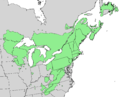
 Pinus strobus range map 1.png 2,176 × 2,176; 126 KB
-
 Pinus strobus range map 2.png 4,172 × 3,383; 213 KB
-
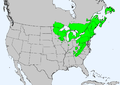
 Pinus strobus range map.jpg 375 × 347; 36 KB
-
 Pinus strobus range map.svg 2,000 × 2,000; 439 KB
-
 Tree Identification - Pine, Eastern White - DPLA - e7a203412c84a027a453e3acd4217866.jpg 5,162 × 4,044; 1.96 MB

_001_Pinus_strobus.jpg)


