Category:Pinus flexilis range maps
Jump to navigation
Jump to search
Media in category "Pinus flexilis range maps"
The following 8 files are in this category, out of 8 total.
-
 Biegsame Kiefer.jpg 3,294 × 2,327; 2.79 MB
-
 Bulletin of the U.S. Department of Agriculture (1913-1923.) (20312496029).jpg 1,714 × 2,862; 1.45 MB
-
 CL-08 Pinus flexilis & Pinus strobiformis range map.png 2,480 × 3,598; 5.87 MB
-
 Munns (1938) 004 Pinus flexilis.jpg 2,354 × 3,281; 2.68 MB
-
 Pinus flexilis levila.png 1,059 × 1,137; 118 KB
-
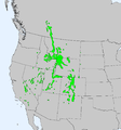
 Pinus flexilis range map 1.png 3,373 × 3,372; 165 KB
-
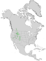 Pinus flexilis USGS range map.png 4,812 × 6,253; 500 KB
-
 Tree Identification - Pine, Limber - DPLA - 56b6ff0b5fbe9e3fc592182b8a11ecd5.jpg 5,302 × 4,246; 1.75 MB

_(20312496029).jpg)

_004_Pinus_flexilis.jpg)


