Category:Pinkneys Green
Jump to navigation
Jump to search
English: Pinkneys Green is a village within the north-western bounds of the town of Maidenhead in the English county of Berkshire.
village in United Kingdom | |||||
| Upload media | |||||
| Instance of | |||||
|---|---|---|---|---|---|
| Location | Windsor and Maidenhead, Berkshire, South East England, England | ||||
 | |||||
Subcategories
This category has only the following subcategory.
C
- Pinkneys Green Cricket Club (2 F)
Media in category "Pinkneys Green"
The following 34 files are in this category, out of 34 total.
-
 A4, Maidenhead - geograph.org.uk - 99275.jpg 640 × 480; 82 KB
-
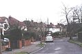 Allenby Road, Maidenhead - geograph.org.uk - 99576.jpg 640 × 429; 59 KB
-
 An Old Brick Pit - geograph.org.uk - 3976603.jpg 1,024 × 932; 326 KB
-
 Beverley Gardens ^ Cranbrook Drive - geograph.org.uk - 3976570.jpg 1,600 × 1,218; 532 KB
-
 Blenheim Free Church - geograph.org.uk - 3208457.jpg 2,272 × 1,704; 2.07 MB
-
 Cranbrook Drive public footpath - geograph.org.uk - 3208454.jpg 2,272 × 1,704; 2.32 MB
-
 Entering Pinkneys Green - geograph.org.uk - 5219453.jpg 640 × 426; 58 KB
-
 Farm Road at the junction of Pinkneys Road - geograph.org.uk - 4952620.jpg 2,304 × 1,728; 830 KB
-
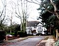
 Fernhurst, Pinkneys Green.png 851 × 687; 942 KB
-
 Greenways Drive at the junction of Pinkneys Road - geograph.org.uk - 4952611.jpg 2,304 × 1,728; 1.55 MB
-
 Harvest, Pinkneys Green - geograph.org.uk - 910771.jpg 640 × 480; 115 KB
-
 Harvest, Pinkneys Green - geograph.org.uk - 910773.jpg 640 × 480; 110 KB
-
 Harvested farmland, Pinkney's Green - geograph.org.uk - 910798.jpg 640 × 427; 100 KB
-
 Knowsley Close at the junction of Furze Platt Road - geograph.org.uk - 4879862.jpg 2,048 × 1,536; 1.47 MB
-
 Newlands Drive, Maidenhead - geograph.org.uk - 3976664.jpg 1,024 × 776; 278 KB
-
 Pinkneys Green - geograph.org.uk - 4937911.jpg 2,304 × 1,728; 832 KB
-
 Pinkneys Green - geograph.org.uk - 849563.jpg 640 × 480; 142 KB
-
 Pinkneys Green - geograph.org.uk - 856386.jpg 640 × 480; 149 KB
-
 Pinkneys Green by Furze Platt Road - geograph.org.uk - 4879960.jpg 2,048 × 1,536; 1.44 MB
-
 Pinkneys Stores - geograph.org.uk - 3976639.jpg 1,600 × 1,200; 431 KB
-
 Robin Hood pub, Pinkneys Green - geograph.org.uk - 2119585.jpg 1,945 × 1,458; 564 KB
-
 Silvertrees Drive, Maidenhead - geograph.org.uk - 99592.jpg 640 × 394; 57 KB
-
 St Mark's Crescent Church - geograph.org.uk - 3976634.jpg 1,600 × 1,246; 377 KB
-
 The Waggon and Horses - geograph.org.uk - 3976581.jpg 640 × 509; 96 KB
-
 Altwood , Maidenhead - geograph.org.uk - 99620.jpg 640 × 496; 115 KB
-
 Barley and footpath near Pinkneys Green - geograph.org.uk - 849555.jpg 640 × 480; 122 KB
-
 Compton Drive, Maidenhead - geograph.org.uk - 99559.jpg 640 × 436; 70 KB
-
 Frosty morning, Maidenhead Thicket - geograph.org.uk - 78545.jpg 597 × 400; 95 KB
-
 Frosty morning, Pinkneys Green - geograph.org.uk - 78556.jpg 597 × 400; 84 KB
-
 Halifax Road Estate, Maidenhead - geograph.org.uk - 99248.jpg 640 × 480; 80 KB
-
 Misty dawn, Maidenhead Thicket - geograph.org.uk - 78552.jpg 597 × 400; 70 KB
-
 Misty dawn, Pinkneys Green - geograph.org.uk - 78561.jpg 597 × 400; 107 KB
-
 Old Brickworks - geograph.org.uk - 505687.jpg 640 × 480; 130 KB
-
 Pinkneys Green - geograph.org.uk - 611198.jpg 640 × 480; 128 KB


