Category:Pietermaritzburg (ship, 1943)
Jump to navigation
Jump to search
| Object location | | View all coordinates using: OpenStreetMap |
|---|
| This category shows a South African Protected Site with SAHRA file reference SHIPWRECKID1512. |
Under other names:
Media in category "Pietermaritzburg (ship, 1943)"
The following 75 files are in this category, out of 75 total.
-
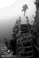 Adam on PMB stairs.jpg 319 × 480; 39 KB
-
 Anchor winch on the Pietermaritzburg P6116581.JPG 3,648 × 2,736; 2.1 MB
-
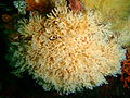
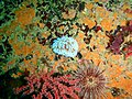
 Anemones and colonial ascidians at the wreck of SAS Pietermaritzburg P7260737.JPG 3,648 × 2,736; 4.08 MB
-
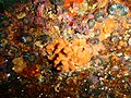
 Ascidian at the wreck of SAS Pietermaritzburg P7260799.JPG 3,648 × 2,736; 3.55 MB
-
 Bryozoans and Red bait at the wreck of the Pietermaritzburg P7260748.JPG 3,648 × 2,736; 3.89 MB
-
 Bryozoans at the wreck of SAS Pietermaritzburg P7260794.JPG 3,648 × 2,736; 4.08 MB
-
 Colonial ascidian at the wreck of the Pietermaritzburg P7260763.JPG 3,648 × 2,736; 4.16 MB
-
 Colonial ascidians at the wreck of the Pietermaritzburg P7260764.JPG 3,648 × 2,736; 4.13 MB
-
 Common feather star at the Pietermaritzburg P7260781.JPG 3,648 × 2,736; 4.74 MB
-
 Cylindrical false corals at the wreck of the Pietermaritzburg P7260739.JPG 3,648 × 2,736; 4.51 MB
-
 Elegant feather star at the wreck of SAS Pietermaritzburg P7260802.JPG 3,648 × 2,736; 4.54 MB
-
 Encrusting colonial ascidian at the wreck of SAS Pietermaritzburg P7260726.JPG 3,648 × 2,736; 4.76 MB
-
 False Plum anemone at the Pietermaritzburg P7260768.JPG 3,648 × 2,736; 4.5 MB
-
 Filigreed coral worms at the wreck of SAS Pietermaritzburg P7260792.JPG 3,648 × 2,736; 4.04 MB
-
 Fine hydroids at the wreck of the Pietermaritzburg P7260747.JPG 3,648 × 2,736; 4.74 MB
-
 Flabellina funeka white.jpg 1,395 × 903; 668 KB
-
 Gas flame nudibranch at the Pietermaritzburg P7260767.JPG 3,648 × 2,736; 3.96 MB
-
 Gas flame nudibranch at the Pietermaritzburg P7260784.JPG 3,648 × 2,736; 3.89 MB
-
 Gas flame nudibranch at the wreck of SAS Pietermaritzburg P7260801.JPG 3,648 × 2,736; 3.97 MB
-
 Gas flame nudibranch at the wreck of SAS Pietermaritzburg P7260808.JPG 3,648 × 2,736; 4.35 MB
-
 Golden sea cucumbers at the Pietermaritzburg P7260775.JPG 3,648 × 2,736; 4.1 MB
-
 Hydroids at at the Pietermaritzburg P7260774.JPG 3,648 × 2,736; 4.54 MB
-
 Hydroids at the Pietermaritzburg P7260772.JPG 3,648 × 2,736; 4.13 MB
-
 Hydroids at the wreck of SAS Pietermaritzburg P7260732.JPG 3,648 × 2,736; 4.6 MB
-
 Invertebrate encrustation on the Pietermaritzburg DSC00818.JPG 2,048 × 1,536; 1.4 MB
-
 Klipfish at the wreck of the Pietermaritzburg P7260750.JPG 3,648 × 2,736; 4.44 MB
-
 Knysna Museum 03.jpg 3,264 × 2,448; 2.85 MB
-
 Machinery showing through a hole in the deck P6116604.JPG 3,648 × 2,736; 2.08 MB
-
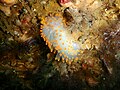
 Mauve sea cucumber at the wreck of the Pietermaritzburg P7260766.JPG 3,648 × 2,736; 4.25 MB
-
 Multicoloured sea fan at the wreck of SAS Pietermaritzburg P7260727.JPG 3,648 × 2,736; 4.36 MB
-
 Nudibranch and sea squirts at the wreck of the Pietermaritzburg P7260742.JPG 3,648 × 2,736; 3.94 MB
-
 Octopus on the Pietermaritzburg DSC00830.jpg 2,048 × 1,536; 1.31 MB
-
 P6116597 Looking out from under the quarterdeck.JPG 3,648 × 2,736; 2.01 MB
-
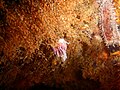
 Perlemoen at the wreck of SAS Pietermaritzburg P7260724.JPG 3,648 × 2,736; 4.67 MB
-
 Planar hydroids at the wreck of SAS Pietermaritzburg P7260795.JPG 3,648 × 2,736; 4.65 MB
-
 PMB (1).jpg 450 × 299; 37 KB
-
 PMB (2).jpg 450 × 299; 49 KB
-
 PMB (3).jpg 600 × 398; 41 KB
-
 PMB (4) furniture.jpg 640 × 426; 47 KB
-
 Purple lady nudibranch at the wreck of SAS Pietermaritzburg P7260725.JPG 3,648 × 2,736; 4.34 MB
-
 Red bait pod at the wreck of SAS Pietermaritzburg P7260785.JPG 3,648 × 2,736; 4.65 MB
-
 Red fanworm at the wreck of SAS Pietermaritzburg P7260731.JPG 3,648 × 2,736; 3.8 MB
-
 Reef life at the wreck of SAS Pietermaritzburg P7260796.JPG 3,648 × 2,736; 4.3 MB
-
 Rock crab at the wreck of SAS Pietermaritzburg P7260789.JPG 3,648 × 2,736; 4.07 MB
-
 SAS Pietermaritzburg banner 1.JPG 2,100 × 300; 446 KB
-
 SAS Pietermaritzburg banner 10.JPG 2,100 × 300; 632 KB
-
 SAS Pietermaritzburg banner 11.JPG 2,100 × 300; 566 KB
-
 SAS Pietermaritzburg banner 12.JPG 2,100 × 300; 523 KB
-
 SAS Pietermaritzburg banner 13.JPG 2,100 × 300; 513 KB
-
 SAS Pietermaritzburg banner 14.JPG 2,100 × 300; 505 KB
-
 SAS Pietermaritzburg banner 15.JPG 2,100 × 300; 555 KB
-
 SAS Pietermaritzburg banner 2.JPG 2,100 × 300; 526 KB
-
 SAS Pietermaritzburg banner 3.JPG 2,100 × 300; 532 KB
-
 SAS Pietermaritzburg banner 4.JPG 2,100 × 300; 507 KB
-
 SAS Pietermaritzburg banner 5.JPG 2,100 × 300; 501 KB
-
 SAS Pietermaritzburg banner 6.JPG 2,100 × 300; 385 KB
-
 SAS Pietermaritzburg banner 7.JPG 2,100 × 300; 387 KB
-
 SAS Pietermaritzburg banner 8.JPG 2,100 × 300; 482 KB
-
 SAS Pietermaritzburg banner 9.JPG 2,100 × 300; 443 KB
-
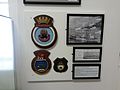
 SAS Pietermaritzburg display Naval Museum Simonstown.jpg 896 × 592; 179 KB
-
 SAS Pietermaritzburg site 150dpi.jpg 1,275 × 1,755; 1.93 MB
-
 Scrolled false coral at the wreck of SAS Pietermaritzburg P7260717.JPG 3,648 × 2,736; 4 MB
-
 Sea cucumbers at the Pietermaritzburg P7260773.JPG 3,648 × 2,736; 4.5 MB
-
 Site map of wreck of SAS Pietermaritzburg.png 3,000 × 2,999; 868 KB
-
 Sketch of the wreck of SAS Pietermaritzburg.png 2,000 × 858; 166 KB
-
 Smoothskin scorpionfish at the wreck of the Pietermaritzburg P7260751.JPG 3,648 × 2,736; 4.27 MB
-
 Solitary sqirts on the Pietermaritzburg DSC00838.JPG 2,048 × 1,536; 1.41 MB
-
 Sponge at the wreck of SAS Pietermaritzburg P7260734.JPG 3,648 × 2,736; 3.59 MB
-
 Staghorn false corals at the Pietermaritzburg P7260779.JPG 3,648 × 2,736; 3.99 MB
-
 Striped anemones at the wreck of SAS Pietermaritzburg P7260793.JPG 3,648 × 2,736; 3.94 MB
-
 Walking anemone at the wreck of the Pietermaritzburg P7260755.JPG 3,648 × 2,736; 3.95 MB
-
 Whelk at the wreck of SAS Pietermaritzburg P7260797.JPG 3,648 × 2,736; 3.97 MB
-
 Whelks at the Pietermaritzburg P7260782.JPG 3,648 × 2,736; 4.02 MB
-
 White edged nudibranch at the wreck of SAS Pietermaritzburg P7260718.JPG 3,648 × 2,736; 4.06 MB
-
 White edged nudibranch at the wreck of SAS Pietermaritzburg P7260806.JPG 3,648 × 2,736; 4.06 MB


.jpg)
.jpg)
.jpg)
_furniture.jpg)


