Category:Photographs taken on 1973-08-01
Jump to navigation
Jump to search
| Photographs of the previous week | · | Photographs of the previous day | ← | 1973-08-01 | → | Photographs of the next day | · | Photographs of the next week |
| 25 | · | 26 | · | 27 | · | 28 | · | 29 | · | 30 | · | 31 | · | 1 | · | 2 | · | 3 | · | 4 | · | 5 | · | 6 | · | 7 | · | 8 |

Photographs taken on August 1, 1973.
Files or subcategories can be added here using a direct categorization tag. Image files can be categorized here also automatically using {{Taken on}} template.
Subcategories
This category has the following 4 subcategories, out of 4 total.
Media in category "Photographs taken on 1973-08-01"
The following 130 files are in this category, out of 130 total.
-

-
 "Leg-stretcher Trail" at Boston Knob Overlook (9610777854314f6180dce6785d122a2b).tif 2,448 × 1,557; 10.91 MB
-

-
 Accomodations Bulletin Board (bc6b57d880ad43a5be28d45f48cc42b1) (cropped).tif 1,350 × 1,057; 4.08 MB
-
 Accomodations Bulletin Board (bc6b57d880ad43a5be28d45f48cc42b1).tif 2,474 × 1,571; 11.13 MB
-
 Big Spring at Peaks of Otter (61c48de89a5b4b218bcf288ff1d814d8) (cropped).tif 1,352 × 1,048; 4.05 MB
-
 Big Spring at Peaks of Otter (61c48de89a5b4b218bcf288ff1d814d8).tif 2,474 × 1,571; 11.13 MB
-
 Big Spring in Peaks of Otter Picnic Area (cdd22ba5016343d99ea909f0f62b1a01) (cropped).tif 1,341 × 1,051; 4.03 MB
-
 Big Spring in Peaks of Otter Picnic Area (cdd22ba5016343d99ea909f0f62b1a01).tif 2,474 × 1,571; 11.13 MB
-
 Big Spring interpretive sign (b2336658927e46bfad2c487d9a459b40).tif 2,474 × 1,571; 11.13 MB
-
 Big Spring interpretive sign (b88de75be084482ab387866170940812).tif 2,474 × 1,571; 11.13 MB
-
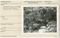
 Big toothed Aspen (Populus grandidentata) (93cd1516f9524545a3226db43d9fe8f3) (cropped).tif 1,355 × 1,052; 4.08 MB
-
 Big toothed Aspen (Populus grandidentata) (93cd1516f9524545a3226db43d9fe8f3).tif 2,448 × 1,557; 10.91 MB
-
 Big toothed Aspen (Populus grandidentata) (bcead39f964e4824a56e5a9cd5d54ee8).tif 2,448 × 1,557; 10.91 MB
-
 Big toothed Aspen (Populus grandidentata) (d2c936786fb6496c900ce6a3401a7246) (cropped).tif 1,348 × 1,046; 4.03 MB
-
 Big toothed Aspen (Populus grandidentata) (d2c936786fb6496c900ce6a3401a7246).tif 2,448 × 1,557; 10.91 MB
-
-
-

-
 Blue Ridge Parkway, Milepost 0.2 (8aae5bb1cf4c49ad8e2e5ea5a1e458c7).tif 2,448 × 1,567; 10.98 MB
-
 Boston Knob Overlook sign (1f84458171cd4a108c8f2b4532e38724) (cropped).tif 1,355 × 1,065; 4.13 MB
-
 Boston Knob Overlook sign (1f84458171cd4a108c8f2b4532e38724).tif 2,448 × 1,557; 10.91 MB
-
 Buena Vista Overlook near US 60 (a279e04907a947b6b0d29c084ca19002) (cropped).tif 1,338 × 1,008; 3.86 MB
-
 Buena Vista Overlook near US 60 (a279e04907a947b6b0d29c084ca19002).tif 2,448 × 1,557; 10.91 MB
-
 Buena Vista Overlook near US 60 (c55fc86c178f4152988c5b41d38a6bca) (cropped).tif 1,348 × 1,020; 3.93 MB
-
 Buena Vista Overlook near US 60 (c55fc86c178f4152988c5b41d38a6bca).tif 2,448 × 1,557; 10.91 MB
-
 Bus from Sharp Top (bc0821b1ce994f83802d163c2aeecf60).tif 2,470 × 1,545; 10.93 MB
-
 Cars at Boston Knob Parking Area (d85e48d03fa64c32af0df133b5c6675b) (cropped).tif 1,350 × 1,054; 4.07 MB
-
 Cars at Boston Knob Parking Area (d85e48d03fa64c32af0df133b5c6675b).tif 2,448 × 1,557; 10.91 MB
-
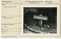
 Close up of campground bulletin board (3c836ff0c139407193a336bd89cd6ffe) (cropped).tif 1,352 × 1,041; 4.03 MB
-
 Close up of campground bulletin board (3c836ff0c139407193a336bd89cd6ffe).tif 2,470 × 1,545; 10.93 MB
-
 Comfort station near picnic area (a4c976e761724ef4a06017fd685d277a).tif 2,470 × 1,545; 10.93 MB
-
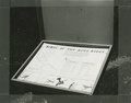 Easel "Birds of the Blue Ridge" (3f09ab8b27df496394873d0858d08568) (cropped).tif 1,342 × 1,052; 4.04 MB
-
 Easel "Birds of the Blue Ridge" (3f09ab8b27df496394873d0858d08568).tif 2,448 × 1,557; 10.91 MB
-
 Easel "Birds of the Blue Ridge" (d7e8ee9d326946799fdfa261a59f2e77) (cropped).tif 1,346 × 1,059; 4.08 MB
-
 Easel "Birds of the Blue Ridge" (d7e8ee9d326946799fdfa261a59f2e77).tif 2,448 × 1,557; 10.91 MB
-
 Easel at Headforemost Parking Area on Tulip Poplar Tree (af7ccd654dfc4d0783b46910cfcde44c).tif 2,448 × 1,567; 10.98 MB
-
 Easel at Headforemost Parking Area on Tulip Poplar Tree (f6f0c76847724bc8b5b9b771f3153459).tif 2,448 × 1,567; 10.98 MB
-
 Entrance sign, Rockfish Gap (55b1ee35960b4175ae0404a0974feba1).tif 2,448 × 1,567; 10.98 MB
-
 Entrance sign, Rockfish Gap (7804bf66043d472e9fb3a38f2b8388d1).tif 2,448 × 1,567; 10.98 MB
-
 Entrance sign, Rockfish Gap (9958e1c1b3eb437799ecf84850176f2d).tif 2,448 × 1,567; 10.98 MB
-
 Entrance sign, Rockfish Gap (a1c2f4a5d9594ee9b006e27d430a9bb4).tif 2,448 × 1,567; 10.98 MB
-
 Entrance sign, Rockfish Gap (c0aa4c6cc1af4ef4bf4e9af7be94b52c).tif 2,448 × 1,567; 10.98 MB
-
 Environmental Message label near bench (b45a2354ebdb457ca328d5033c90de81).tif 2,448 × 1,557; 10.91 MB
-
 Environmental Message label sign (34b285ba7efd43bbb310df6d415f9fd8).tif 2,448 × 1,557; 10.91 MB
-
 Fence with Stile (49c738354a57485587dc1ec93c98f818).tif 2,448 × 1,567; 10.98 MB
-
 Garden - buckwheat, corn, etc. (7397f7004d82444f9d4e9bd2f04aac84).tif 2,448 × 1,567; 10.98 MB
-
 Grade crossing at Milepost 4.4 (2a9489a81c3e4a2782019cf37e1efc60).tif 2,448 × 1,567; 10.98 MB
-
 Grade crossing at Route 814 (988b9043a9454e0a87b897acdc8fd609).tif 2,448 × 1,557; 10.91 MB
-
 Grade crossing by Reeds Gap (bd2e1e4be28b436784c0d0d2b7f934fe).tif 2,448 × 1,567; 10.98 MB
-
 Grade crossing near Milepost 2.2 (dab75a9b3509498b8c9c2e315363774d).tif 2,448 × 1,567; 10.98 MB
-
 Grade crossing near Milepost 2.2 (daf0ed374db9452ca083a56cf841808b).tif 2,448 × 1,567; 10.98 MB
-
 Grandfather Mountain construction progress (76585d4af36b48a289979500268bbe34).tif 2,409 × 1,500; 10.34 MB
-
 Grandfather Mountain construction with equipment (b2cbd3df1f30404ba557bd69404c97af).tif 2,409 × 1,498; 10.33 MB
-
 Humpback Gap Pull-off, Milepost 6 (9f419f28aae049d1965f47404985db2d).tif 2,448 × 1,567; 10.98 MB
-
 Humpback Rocks Visitor Center (29ced6c72e1d4aa49d48ff7370c501bf).tif 2,448 × 1,567; 10.98 MB
-
 Humpback Rocks Visitor Center (afd819480577431c86a09b9088e41c39).tif 2,448 × 1,567; 10.98 MB
-
 Humpback Rocks Visitor Center (bb988eb2a8dc4dd2b498d214cfb8c507).tif 2,448 × 1,567; 10.98 MB
-
 Humpback Rocks Visitor Center (d4960fb1437142ed95441215cc8758f5).tif 2,448 × 1,567; 10.98 MB
-
 Interpretive sign with program schedule (ece3ee66c0244ba2bba24fab651d93e4).tif 2,474 × 1,571; 11.13 MB
-
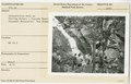
 Interpretive Walk on Falling Water Cascades Trail (22b0bfb290fa4035be5fe3dfccc14ff8).tif 2,448 × 1,567; 10.98 MB
-

-

-
-
-
-

-
-
 Johnson Farmhouse during second phase of restoration (a48298a725b74c4dab7b4de654ecbeda).tif 2,448 × 1,567; 10.98 MB
-
 Johnson Farmhouse, closed for second phase of restoration (6de968f1ccf1482fb59d2f1b3ae7f1c8).tif 2,448 × 1,567; 10.98 MB
-
 Johnson Farmhouse, closed for second phase of restoration (7e41e043f6884ab8b29a3750d305fbbb).tif 2,448 × 1,567; 10.98 MB
-
 Johnson Farmhouse, closed for second phase of restoration (cb9ef109c3c64742b0c2909694a92de0).tif 2,448 × 1,567; 10.98 MB
-
 Johnson Farmhouse, closed for second phase of restoration (f2e2b92eda5f4c2d8c1d382098079b20).tif 2,448 × 1,567; 10.98 MB
-
 Johnson Farmhouse, closed for second phase of restoration (ffaa2b1c89be4e54a5cb1522f2112d07).tif 2,448 × 1,567; 10.98 MB
-
 Men hand trimming guardrails (89bba1e75a8d443c99c9384f1f3a26f8).tif 2,448 × 1,567; 10.98 MB
-
 Men hand trimming guardrails (c808c539382c4cd48e31aecdf6dc18ee).tif 2,448 × 1,567; 10.98 MB
-
 Milepost 3.3, Blue Ridge Parkway (3ca8d7dde9a94cc6b739fca4f124d3c4).tif 2,448 × 1,567; 10.98 MB
-
 Milepost 4, Blue Ridge Parkway (60389b993c694de9978bc78c029e87ba).tif 2,448 × 1,567; 10.98 MB
-
 Milepost 6, Humpback Rocks Pioneer Farm (5b47761482cb43c1bda51559770dc297).tif 2,448 × 1,567; 10.98 MB
-
 Milepost 60, Blue Ridge Parkway (8779f0f0e20d41069dd88d722b2006c1).tif 2,448 × 1,567; 10.98 MB
-
 Milepost 63.7, Blue Ridge Parkway (cf9af17e8e3c457cba222fcbba9de7ca).tif 2,448 × 1,567; 10.98 MB
-
 Miscellaneous signs near Peaks of Otter (26208d4bb8f147f99c560dac0a08609e).tif 2,474 × 1,571; 11.13 MB
-
 Miscellaneous signs near Peaks of Otter (e73819201cc94a46b8bef33f12dc5384).tif 2,474 × 1,571; 11.13 MB
-
 Miscellaneous signs near Peaks of Otter (f1cbd0f96247431dbd9d691134c4adcd).tif 2,474 × 1,571; 11.13 MB
-
 Miscellaneous signs near Peaks of Otter (fdb260900115454d8842cb0d3dbac0b5).tif 2,474 × 1,571; 11.13 MB
-
 Montebello District, Milepost 6 (4c6013b50a594862bded5960bd810e47).tif 2,448 × 1,567; 10.98 MB
-
 Montebello Subdistrict, Milepost 16 (637b299207b8439993a6469e916c2ec2).tif 2,448 × 1,557; 10.91 MB
-
 Montebello Subdistrict, Reeds Gap, Milepost 13.7 (f7fea0d5900f4708821ac6ff155253af).tif 2,448 × 1,567; 10.98 MB
-
 Non-conforming "No Parking" sign (2a18d158cd0b40e0a12ec05d4efb26cb).tif 2,474 × 1,571; 11.13 MB
-
 Parkway showing morning mist (f4c9b4c3cae947188cd07531bd4fe1e5).tif 2,425 × 1,508; 10.46 MB
-
 Parkway Sign at Rockfish Gap (ab93e1cd205b4017a89e43e7580804d4).tif 2,448 × 1,567; 10.98 MB
-
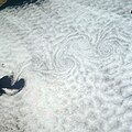 Pattern of downstream eddies in stratocumulus clouds over Pacific Ocean.jpg 3,870 × 3,862; 1.59 MB
-
 Peaks of Otter Campground (3a255ba93f9940909bf72e4f77380235).tif 2,470 × 1,545; 10.93 MB
-
 Peaks of Otter Lodge with Sharp Top in background (4ac74419dfee420cb05eb70231caebda).tif 2,474 × 1,571; 11.13 MB
-
 Peaks of Otter Picnic Area (4df94d40096c4e7dbe0330fb21d11a9a).tif 2,470 × 1,545; 10.93 MB
-
 Peaks of Otter sign (3c3c87b591384c338fbfc89246401d6f).tif 2,474 × 1,571; 11.13 MB
-
 Peaks of Otter sign at VA Route 43 intersection (ad4c3ba5fc804726810a15665cbb3151).tif 2,474 × 1,571; 11.13 MB
-
 Peaks of Otter Subdistrict, Milepost 105 (8434c62c7b2e4575b7a709bcc9c9aa80).tif 2,474 × 1,571; 11.13 MB
-
 Peaks of Otter Subdistrict, Milepost 105 (ae731c0bddb64422b4640aba9f45bf8a).tif 2,474 × 1,571; 11.13 MB
-
 Peaks of Otter, Blue Ridge Parkway (82bd25a25e7d4e55b53baee52cb4fdf3).tif 2,474 × 1,571; 11.13 MB
-
 Peaks of Otter, Blue Ridge Parkway (ffe813d0aa424907a0ef7212345b52ed).tif 2,474 × 1,571; 11.13 MB
-
 Peaks of Otter, Milepost 85.9, Blue Ridge Parkway (4f60061eeb69443a9eb8b0bd9fa253e2).tif 2,474 × 1,571; 11.13 MB
-
 Rockfish Gap (039f2121103245378bc88a7c536f0480).tif 2,448 × 1,567; 10.98 MB
-
 Rockfish Gap (d74ecd8918c44390a0e28c397928274a).tif 2,448 × 1,567; 10.98 MB
-
 Rockfish Gap (e781ebbf49cc49b492afd40a455f6e97).tif 2,448 × 1,567; 10.98 MB
-
 Rockfish Gap (eda18d182e7b4096ba1943ea64ed0355).tif 2,448 × 1,567; 10.98 MB
-
 Rockfish Gap (f4efa9db466c4547a83698ae4a742438).tif 2,448 × 1,567; 10.98 MB
-
 Scenic, Humpback Rocks (e4be9b5788ae432e9dcc925e39d14791).tif 2,448 × 1,567; 10.98 MB
-
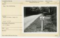
 Shenandoah Overlook Sign, Milepost 2.9 (02f867b57ad64e3388e0829d5891d7f3).tif 2,448 × 1,567; 10.98 MB
-
 Sign - James River Visitor Center (2dd8bd2a72154cfca7e403399a503426).tif 2,448 × 1,567; 10.98 MB
-
 Sign at Peaks of Otter Visitor Center (569f30328e574096a05bfa6baae0b7d2).tif 2,474 × 1,571; 11.13 MB
-
 Sign for "12 Miles to Otter Creek" (56cd79fc73474e98bd1084a163a054db).tif 2,448 × 1,567; 10.98 MB
-
 Sign for "5 Miles to Humpback Rocks" (bd1be9f26c9d45afb919aae425109a91).tif 2,448 × 1,557; 10.91 MB
-
 Sign for George Washington National Forest (0b478e10922a40eaa0c808bd70e05576).tif 2,448 × 1,567; 10.98 MB
-
 Sign for Humpback Rocks Recreational Area (7b0ce8199cae44d89c749f4debc9c78f).tif 2,448 × 1,567; 10.98 MB
-
 Sign for Otter Creek (f59219b8c7784d64ba6cd69653afcb75).tif 2,448 × 1,557; 10.91 MB
-
 Sign for Sharp Top Trail (497867f43fb441448f2f1fc9d46ab047).tif 2,474 × 1,571; 11.13 MB
-
 Sign for Sharp Top Trail (d86af451dac34e1d9dcc180377753785).tif 2,474 × 1,571; 11.13 MB
-
 Sign for Sherando Lake Recreation Area (f092594628aa413da0e6e05f785dbdfd).tif 2,448 × 1,557; 10.91 MB
-
 Sign indicating Parkway ahead (72cdcefd9e4d45868c0210462ed0e117).tif 2,474 × 1,571; 11.13 MB
-
 Sign near Peaks of Otter Campground (357e11cc1d744a0b8e298804cdaa2aad).tif 2,470 × 1,545; 10.93 MB
-
 Sign near Peaks of Otter Campground (e01379f1cc2c467e8b9c4e9434116d27).tif 2,470 × 1,545; 10.93 MB
-
 Sign, Flat Top Trail (6bff29540908437ab8985ae36776d8a7).tif 2,448 × 1,567; 10.98 MB
-
 Sign, Humpback Rocks Visitor Center (2313198278194ad89492965fbcdf134b).tif 2,448 × 1,567; 10.98 MB
-
 Sign, Humpback Rocks Visitor Center (639b20c40f8b44eeb21acc1f2155634f).tif 2,448 × 1,567; 10.98 MB
-
 Sign, Humpback Rocks Visitor Center (713d13b5d026439ba600b878fdeddd85).tif 2,448 × 1,567; 10.98 MB
-
 Sign, Sharp Top Trail (7dfa9c207bfa4de9bb726b0f16516fbe).tif 2,461 × 1,587; 11.6 MB
-
 Sign, Sharp Top Trail (af28f496271e4bcf90b18253842ca265).tif 2,461 × 1,587; 11.6 MB
-
 Vandalism on Black Mountains sign (3f93a9c1c6524387ad5576b19ae107ad).tif 2,425 × 1,508; 10.46 MB
-
 Viaduct of Rt. 250, Rockfish Gap (0ca22b320ac042d5bbcd445a10b1042a).tif 2,448 × 1,567; 10.98 MB
.jpg)
