Category:Photographs of maps in the United States
Jump to navigation
Jump to search
Media in category "Photographs of maps in the United States"
The following 28 files are in this category, out of 28 total.
-

-

-

-
 2016-03-03 0153n amand (28050857126).jpg 2,000 × 1,423; 716 KB
-
 2016-03-06 0555n illustrators (28084846675).jpg 1,595 × 2,000; 638 KB
-

-
 3D Printed United States od America (16862339261).jpg 5,184 × 2,912; 5.52 MB
-

-

-

-
 Collister School (5).jpg 6,000 × 4,000; 6.55 MB
-

-
-
 Election 2020 Watch Function, 4 November 2020 (50564145023).jpg 5,568 × 3,712; 5.09 MB
-
 Election 2020 Watch Function, 4 November 2020 (50564146003).jpg 5,568 × 3,712; 4.52 MB
-
 Election 2020 Watch Function, 4 November 2020 (50565492667).jpg 5,568 × 3,712; 4.36 MB
-
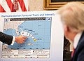
 Hurricane Dorian Briefing (48648405897).jpg 3,000 × 2,000; 1.36 MB
-
 Jamestown-Scotland Ferry map.jpg 4,032 × 3,024; 2.48 MB
-
 LoafNJugMap.JPG 640 × 480; 36 KB
-
 Man at board - DPLA - 475ea285a1d45c998b68936e0541b4f5.jpg 1,007 × 800; 194 KB
-
 Maryland National Guard (49659921402).jpg 5,184 × 3,888; 929 KB
-
 Never stop exploring (Unsplash).jpg 5,000 × 3,333; 8.74 MB
-
 Playground Map, Washington Elementary.jpg 4,016 × 2,259; 3.1 MB
-
 Rockefeller Plaza Ice Rink.JPG 2,304 × 1,728; 761 KB
-
 Secretary Blinken Visits English Language Programs (52719745723).jpg 1,280 × 854; 145 KB
-
 The Home Front in Britain 1939-1945 TR2580.jpg 800 × 594; 70 KB
-

-
 Washington-Carver-commem-rev.jpg 468 × 468; 112 KB
.jpg)


.jpg)
.jpg)

.jpg)

.jpg)

_(cropped).jpg)
.jpg)
.jpg)
.jpg)
.jpg)


.jpg)
.jpg)


.jpg)


