Category:Pfarrkirche hll. Peter und Paul, Kindberg
Jump to navigation
Jump to search
| Object location | | View all coordinates using: OpenStreetMap |
|---|
church building in Kindberg, Austria   | |||||
| Upload media | |||||
| Instance of | |||||
|---|---|---|---|---|---|
| Location | Kindberg, Bruck-Mürzzuschlag District, Styria, Austria | ||||
| Street address |
| ||||
| Heritage designation | |||||
 | |||||
Subcategories
This category has the following 2 subcategories, out of 2 total.
Media in category "Pfarrkirche hll. Peter und Paul, Kindberg"
The following 10 files are in this category, out of 10 total.
-
 DSC 4436 7 8 tonemapped.jpg 2,585 × 3,872; 8.18 MB
-
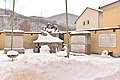 Kriegerdenkmalanlage (Kindberg).jpg 6,016 × 4,016; 11.86 MB
-
 Kriegerdenkmalanlage 2 (Kindberg).jpg 5,990 × 3,976; 7.14 MB
-
 Pfarrkirche hll. Peter und Paul, Kindberg 01.jpg 3,588 × 5,382; 4.84 MB
-
 Pfarrkirche hll. Peter und Paul, Kindberg 02.jpg 4,000 × 6,000; 11.44 MB
-
 Pfarrkirche hll. Peter und Paul, Kindberg 03.jpg 4,000 × 6,000; 11.59 MB
-
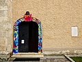 Pfarrkirche Kindberg Portal.jpg 4,350 × 3,270; 3.59 MB
-
 Pfarrkirche Kindberg.jpg 3,264 × 1,836; 2.09 MB
-
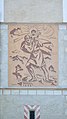 Sgraffito Saint Christopher, parish church, Kindberg.jpg 2,528 × 4,480; 5.47 MB
-
 Window parish church Kindberg.jpg 2,584 × 4,368; 6.06 MB

.jpg)
.jpg)


