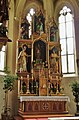
Category:Pfarrkirche hl. Rupert, Wagrain
Jump to navigation
Jump to search
| Object location | | View all coordinates using: OpenStreetMap |
|---|
church building in Wagrain, Austria .jpg) .jpg) | |||||
| Upload media | |||||
| Instance of | |||||
|---|---|---|---|---|---|
| Location | Wagrain, Sankt Johann im Pongau District, Salzburg, Austria | ||||
| Street address |
| ||||
| Heritage designation | |||||
 | |||||
| This category shows the protected monument with the number 25106 in Austria. (Commons, de, Wikidata) |
Deutsch: Wagrain, katholische Pfarrkirche hl. Rupert
Subcategories
This category has only the following subcategory.
Media in category "Pfarrkirche hl. Rupert, Wagrain"
The following 5 files are in this category, out of 5 total.
-
 Wagrain (1).jpg 2,840 × 3,588; 3.01 MB
-
 Wagrain (2).JPG 1,926 × 2,933; 1.18 MB
-
 Wagrain (Kath. Pfarrkirche hl. Rupert-1).jpg 1,920 × 2,560; 578 KB
-
 Wagrain, Kirche 01.jpg 1,536 × 2,304; 720 KB
-
 Wagrain, Kirche 02.jpg 1,536 × 2,304; 1.02 MB
.JPG)

