Category:Pfarrkirche hl. Kunigunde, Mürzzuschlag
Jump to navigation
Jump to search
| Object location | | View all coordinates using: OpenStreetMap |
|---|
church building in Mürzzuschlag, Austria  | |||||
| Upload media | |||||
| Instance of | |||||
|---|---|---|---|---|---|
| Location | Mürzzuschlag, Bruck-Mürzzuschlag District, Styria, Austria | ||||
| Heritage designation | |||||
 | |||||
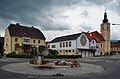
Deutsch: Katholische Pfarrkirche hl. Kunigunde in der steirischen Bezirkshauptstadt Mürzzuschlag.
Subcategories
This category has the following 2 subcategories, out of 2 total.
Media in category "Pfarrkirche hl. Kunigunde, Mürzzuschlag"
The following 14 files are in this category, out of 14 total.
-
 Kirche Muerzzuschlag.JPG 3,456 × 4,608; 3.06 MB
-
 Municial office Ganz, rectory Mürzzuschlag.jpg 4,602 × 3,032; 4.48 MB
-
 Murzzuschlag kosciol sw Kunegundy 1.jpg 4,000 × 6,000; 6.34 MB
-
 MZ Kath Pfarrkirche.JPG 960 × 1,280; 190 KB
-
 Mürzzuschlag - katholische Pfarrkirche.JPG 1,670 × 2,362; 3.51 MB
-
 Mürzzuschlag pfk me 14.2.08 (19).jpg 1,107 × 1,482; 1.64 MB
-
 Pfarrkirche hl. Kunigunde 01.jpg 4,752 × 3,168; 4.78 MB
-
 Pfarrkirche hl. Kunigunde 02.jpg 4,752 × 3,168; 6.3 MB
-
 Pfarrkirche hl. Kunigunde, Mürzzuschlag - back door.jpg 3,048 × 4,296; 5.86 MB
-
 Pfarrkirche hl. Kunigunde, Mürzzuschlag - crucifix 01.jpg 3,040 × 4,704; 4.75 MB
-
 Pfarrkirche hl. Kunigunde, Mürzzuschlag - crucifix 02.jpg 2,656 × 4,672; 5.5 MB
-
 Pfarrkirche hl. Kunigunde, Mürzzuschlag - front door.jpg 3,088 × 4,192; 4.82 MB
-
 Pfarrkirche hl. Kunigunde, Mürzzuschlag 08.JPG 6,000 × 4,000; 13.91 MB
-
 Tor der Kirche St. Kunigunde, Mürzzuschlag.jpg 3,840 × 5,760; 12.13 MB


.jpg)


