Category:Pfarrkirche hl. Georg, St. Georgen im Attergau
Jump to navigation
Jump to search
| Object location | | View all coordinates using: OpenStreetMap |
|---|
| This category shows the protected monument with the number 59752 in Austria. (Commons, de, Wikidata) |
church building in Sankt Georgen im Attergau, Austria   | |||||
| Upload media | |||||
| Instance of | |||||
|---|---|---|---|---|---|
| Named after | |||||
| Location | Sankt Georgen im Attergau, Vöcklabruck District, Upper Austria, Austria | ||||
| Street address |
| ||||
| Heritage designation | |||||
 | |||||
Subcategories
This category has only the following subcategory.
Media in category "Pfarrkirche hl. Georg, St. Georgen im Attergau"
The following 11 files are in this category, out of 11 total.
-
 Jugendlager 2017 Anmeldung Zeltaufbau afkvb thalhammer (7) (35226092004).jpg 3,072 × 2,048; 1.42 MB
-
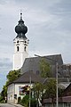
 Kirche St Georgen im Attergau.jpg 3,072 × 2,048; 1.72 MB
-
 Sankt Georgen im Attergau Kirche 1.jpg 1,998 × 3,000; 1.55 MB
-
 Sankt Georgen im Attergau Kirche 2.jpg 5,056 × 3,691; 4.42 MB
-
 Sankt Georgen im Attergau Kriegerdenkmal bei der Kirche.jpg 3,696 × 2,467; 3.87 MB
-
 St. Georgen im Attergau Pfarrkirche - Fresko Georg.jpg 3,972 × 2,524; 4.62 MB
-
 St. Georgen im Attergau Pfarrkirche - Grabstein Gründer.jpg 2,490 × 3,744; 5.17 MB
-
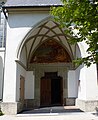 St. Georgen im Attergau Pfarrkirche - Portal 1.jpg 2,850 × 3,495; 4.54 MB
-
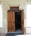 St. Georgen im Attergau Pfarrkirche - Portal 2.jpg 2,880 × 3,396; 3.58 MB
-
 St. Georgen im Attergau Pfarrkirche - Portal 3.jpg 3,000 × 4,000; 4.33 MB
-
 St.Georgen im Attergau Pfarrkirche - Grabstein Lober.jpg 3,000 × 4,000; 6.37 MB
_(35226092004).jpg)


