Category:Pfarrkirche hl. Agatha, Hausleiten
Jump to navigation
Jump to search
| Object location | | View all coordinates using: OpenStreetMap |
|---|
church building in Hausleiten, Austria   | |||||
| Upload media | |||||
| Instance of | |||||
|---|---|---|---|---|---|
| Named after | |||||
| Location | Hausleiten, Korneuburg District, Lower Austria, Austria | ||||
| Architectural style | |||||
| Diocese | |||||
| Heritage designation | |||||
 | |||||
Media in category "Pfarrkirche hl. Agatha, Hausleiten"
The following 14 files are in this category, out of 14 total.
-
 Erlebnisweg Hausleiten Blick auf St. Agatha.JPG 3,216 × 2,136; 1.71 MB
-
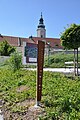 Erlebnisweg Hausleiten Start.JPG 2,136 × 3,216; 1.73 MB
-
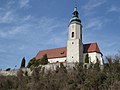
 Hausleiten - Pfarrkirche an der Wagramkante (2012).jpg 2,316 × 1,544; 448 KB
-
 Hausleiten - Pfarrkirche mit Blitz bei Nacht.jpg 1,914 × 1,276; 726 KB
-
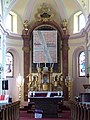
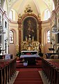 Hausleiten - Pfarrkirche, Altar.JPG 1,670 × 2,362; 3.34 MB
-
 Hausleiten - Pfarrkirche, innen.JPG 1,772 × 1,181; 1.78 MB
-
 Hausleiten - Pfarrkirche.JPG 835 × 1,181; 950 KB
-
 Hausleiten - Pfarrkirche2.JPG 1,772 × 1,181; 1.68 MB
-
 Hausleiten - Pfarrkirche3.JPG 1,181 × 1,772; 1.76 MB
-
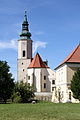
 Hausleiten Pfarrkirche01.jpg 4,000 × 3,000; 4.71 MB
-
 Hausleiten Pfarrkirche02.jpg 3,000 × 4,000; 3.99 MB
-
 Hausleiten Pfarrkirche03.jpg 3,000 × 4,000; 3.94 MB
-
 Hausleiten Pfarrkirche04.jpg 3,000 × 4,000; 4.2 MB
-
 Pfarrkirche Hausleiten.jpg 685 × 1,024; 463 KB


.jpg)


