Category:Pfarrkirche Wagram
Jump to navigation
Jump to search
| Object location | | View all coordinates using: OpenStreetMap |
|---|
| This category shows the protected monument with the number 29421 in Austria. (Commons, de, Wikidata) |
building in St. Pölten, Austria  | |||||
| Upload media | |||||
| Instance of | |||||
|---|---|---|---|---|---|
| Location | St. Pölten, Lower Austria, Austria | ||||
| Street address |
| ||||
| Heritage designation | |||||
 | |||||
Media in category "Pfarrkirche Wagram"
The following 9 files are in this category, out of 9 total.
-
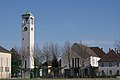 Kirche Wagram.JPG 3,872 × 2,592; 3.29 MB
-
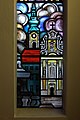
 Pfarrkirche Wagram Bleiglas Dom.JPG 2,607 × 3,919; 2.09 MB
-
 Pfarrkirche Wagram Bleiglas Englische Fräulein.JPG 2,527 × 3,791; 2.12 MB
-
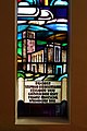
 Pfarrkirche Wagram Bleiglas Franziskanerkirche.JPG 2,659 × 3,988; 2.31 MB
-
 Pfarrkirche Wagram Bleiglas Josefskirche.JPG 2,486 × 3,729; 2.2 MB
-
 Pfarrkirche Wagram Bleiglas Pfarrkirche Spratzern.JPG 2,567 × 3,850; 2.44 MB
-
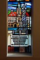 Pfarrkirche Wagram Bleiglas Rathaus.JPG 2,728 × 4,103; 2.68 MB
-
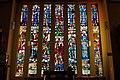 Pfarrkirche Wagram Bleiglas.JPG 3,894 × 2,587; 2.48 MB
-
 Pfarrkirche Wagram Innen.JPG 4,164 × 2,770; 2.51 MB


