Category:Pfarrkirche St. Vitus, Edlitz
Jump to navigation
Jump to search
| Object location | | View all coordinates using: OpenStreetMap |
|---|
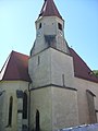
church building in Edlitz, Austria  | |||||
| Upload media | |||||
| Instance of | |||||
|---|---|---|---|---|---|
| Named after | |||||
| Location | Edlitz, Neunkirchen District, Lower Austria, Austria | ||||
| Heritage designation | |||||
 | |||||
Media in category "Pfarrkirche St. Vitus, Edlitz"
The following 8 files are in this category, out of 8 total.
-
 Edlitz Orgel Prospekt.jpg 3,456 × 4,608; 3.99 MB
-
 Edlitz Orgel Prospektdetail.jpg 4,608 × 3,456; 5.11 MB
-
 Edlitz-Niederösterreich.JPG 4,000 × 3,000; 6.07 MB
-
 EdlitzStVitus.JPG 4,263 × 3,164; 4.25 MB
-
 EdlitzStVitus2.JPG 3,240 × 4,320; 5.47 MB
-
 EdlitzStVitusInnenraum.JPG 3,240 × 4,320; 5.29 MB
-
 EdlitzStVitusOrgel.JPG 4,320 × 3,240; 5.49 MB
-
 Kath Pfarrkirche Veit Edlitz.JPG 2,304 × 3,072; 2.98 MB


