Category:Pfarrkirche Niederkreuzstetten
Jump to navigation
Jump to search
| Object location | | View all coordinates using: OpenStreetMap |
|---|
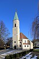
| This category shows the protected monument with the number 17953 in Austria. (Commons, de, Wikidata) |
Deutsch: Pfarrkirche Niederkreuzstetten
building in Kreuzstetten, Austria  | |||||
| Upload media | |||||
| Instance of | |||||
|---|---|---|---|---|---|
| Named after | |||||
| Location | Kreuzstetten, Mistelbach District, Lower Austria, Austria | ||||
| Street address |
| ||||
| Diocese | |||||
| Heritage designation | |||||
 | |||||
Media in category "Pfarrkirche Niederkreuzstetten"
The following 19 files are in this category, out of 19 total.
-
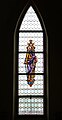
 Kirche 17953 Buntglasfenster in A-2124 Niederkreuzstetten (01).jpg 3,692 × 5,300; 2.76 MB
-
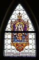
 Kirche 17953 Buntglasfenster in A-2124 Niederkreuzstetten (02).jpg 3,594 × 5,293; 2.37 MB
-
 Kirche 17953 Buntglasfenster in A-2124 Niederkreuzstetten (03).jpg 3,615 × 5,321; 2.68 MB
-
 Kirche 17953 Buntglasfenster in A-2124 Niederkreuzstetten (04).jpg 3,609 × 5,300; 2.97 MB
-
 Kirche 17953 Buntglasfenster in A-2124 Niederkreuzstetten (05).jpg 2,999 × 4,110; 2.74 MB
-
 Kirche 17953 Buntglasfenster in A-2124 Niederkreuzstetten (06).jpg 3,146 × 4,331; 2.85 MB
-
 Kirche 17953 Buntglasfenster in A-2124 Niederkreuzstetten (07).jpg 2,733 × 5,312; 1.52 MB
-
 Kirche 17953 Buntglasfenster in A-2124 Niederkreuzstetten (08).jpg 2,761 × 5,310; 1.72 MB
-
 Kirche 17953 Buntglasfenster in A-2124 Niederkreuzstetten (09).jpg 2,737 × 5,310; 1.57 MB
-
 Kirche 17953 Buntglasfenster in A-2124 Niederkreuzstetten (10).jpg 2,855 × 4,390; 1.85 MB
-
 Kirche 17953 Buntglasfenster in A-2124 Niederkreuzstetten (11).jpg 3,228 × 4,303; 3.08 MB
-
 Kirche 17953 Buntglasfenster in A-2124 Niederkreuzstetten (12).jpg 3,045 × 4,051; 2.81 MB
-
 Kirche 17953 Grabstein in A-2124 Niederkreuzstetten.jpg 3,431 × 4,105; 3.8 MB
-
 Kirche 17953 Hauptaltar in A-2124 Niederkreuzstetten.jpg 4,296 × 4,016; 2.45 MB
-
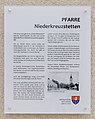 Kirche 17953 Infotafel in A-2124 Niederkreuzstetten.jpg 3,620 × 4,545; 2.32 MB
-
 LanghausfensterNiederkreuzstetten.JPG 1,536 × 2,048; 414 KB
-
 LanghausZumChor.JPG 2,048 × 1,536; 567 KB
-
 Niederkreuzstetten - Pfarrkirche.JPG 2,624 × 3,937; 9.24 MB
-
 Niederkreuzstetten.jpg 2,112 × 2,816; 3.61 MB
.jpg)
.jpg)
.jpg)
.jpg)
.jpg)
.jpg)
.jpg)
.jpg)
.jpg)
.jpg)
.jpg)
.jpg)


