Category:Pfarrkirche Mariae Himmelfahrt, Hollenthon
Jump to navigation
Jump to search
| Object location | | View all coordinates using: OpenStreetMap |
|---|
| This category shows the protected monument with the number 26893 in Austria. (Commons, de, Wikidata) |
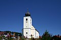
church building in Hollenthon, Austria .JPG) Southwest view of the parish church  | |||||
| Upload media | |||||
| Instance of | |||||
|---|---|---|---|---|---|
| Named after | |||||
| Location | Hollenthon, Wiener Neustadt District, Lower Austria, Austria | ||||
| Street address |
| ||||
| Heritage designation | |||||
 | |||||
Media in category "Pfarrkirche Mariae Himmelfahrt, Hollenthon"
The following 34 files are in this category, out of 34 total.
-
 Hollenthon - Erntedank (01).jpg 2,000 × 3,000; 1.32 MB
-
 Hollenthon - Erntedank (02).jpg 3,000 × 2,000; 1.57 MB
-
 Hollenthon - Erntedank (03).jpg 2,000 × 3,000; 752 KB
-
 Hollenthon - katholische Pfarrkirche Mariae Himmelfahrt (01).jpg 2,000 × 3,000; 1.06 MB
-
 Hollenthon - katholische Pfarrkirche Mariae Himmelfahrt (02).jpg 3,000 × 2,000; 1.27 MB
-
 Hollenthon - katholische Pfarrkirche Mariae Himmelfahrt (03).jpg 3,000 × 2,000; 904 KB
-
 Hollenthon - katholische Pfarrkirche Mariae Himmelfahrt (04).jpg 3,168 × 4,752; 1.78 MB
-
 Hollenthon - katholische Pfarrkirche Mariae Himmelfahrt (05).jpg 2,000 × 3,000; 1.22 MB
-
 Hollenthon - katholische Pfarrkirche Mariae Himmelfahrt (06).jpg 2,000 × 3,000; 1.31 MB
-
 Hollenthon - katholische Pfarrkirche Mariae Himmelfahrt (07).jpg 2,000 × 3,000; 1.05 MB
-
 Hollenthon - katholische Pfarrkirche Mariae Himmelfahrt (09).jpg 2,000 × 3,000; 1.38 MB
-
 Hollenthon - katholische Pfarrkirche Mariae Himmelfahrt (10).jpg 3,000 × 2,000; 972 KB
-
 Hollenthon - katholische Pfarrkirche Mariae Himmelfahrt (11).jpg 3,000 × 2,000; 1.1 MB
-
 Hollenthon - katholische Pfarrkirche Mariae Himmelfahrt (12).jpg 2,000 × 3,000; 1.59 MB
-
 Hollenthon - katholische Pfarrkirche Mariae Himmelfahrt (13).jpg 2,000 × 3,000; 1.02 MB
-
 Hollenthon - katholische Pfarrkirche Mariae Himmelfahrt (14).jpg 2,000 × 3,000; 1.32 MB
-
 Hollenthon - katholische Pfarrkirche Mariae Himmelfahrt (15).jpg 2,400 × 2,400; 1.14 MB
-
 Hollenthon - katholische Pfarrkirche Mariae Himmelfahrt (16).jpg 2,400 × 2,400; 1.37 MB
-
 Hollenthon - katholische Pfarrkirche Mariae Himmelfahrt (17).jpg 2,000 × 3,000; 1.62 MB
-
 Hollenthon - katholische Pfarrkirche Mariae Himmelfahrt (18).jpg 2,000 × 3,000; 1,011 KB
-
 Hollenthon - katholische Pfarrkirche Mariae Himmelfahrt (19).jpg 2,000 × 3,000; 1.41 MB
-
 Hollenthon - katholische Pfarrkirche Mariae Himmelfahrt (20).jpg 2,000 × 3,000; 1.15 MB
-
 Hollenthon - katholische Pfarrkirche Mariae Himmelfahrt (21).jpg 2,000 × 3,000; 1.3 MB
-
 Hollenthon - katholische Pfarrkirche Mariae Himmelfahrt (22).jpg 2,000 × 3,000; 1.42 MB
-
 Hollenthon - katholische Pfarrkirche Mariae Himmelfahrt (23).jpg 2,000 × 3,000; 1.68 MB
-
 Hollenthon - katholische Pfarrkirche Mariae Himmelfahrt (24).jpg 2,000 × 3,000; 1.61 MB
-
 Hollenthon - katholische Pfarrkirche Mariae Himmelfahrt (25).jpg 2,000 × 3,000; 1.27 MB
-
 Hollenthon - Kirche (a).JPG 2,940 × 3,920; 8.35 MB
-
 Hollenthon - Kirche (b).JPG 5,040 × 3,780; 8.56 MB
-
 Hollenthon Pfarrkirche 01.JPG 3,008 × 2,000; 3.04 MB
-
 Hollenthon Pfarrkirche 02.JPG 1,603 × 2,413; 1.59 MB
-
 Hollenthon Pfarrkirche Innenraum.JPG 3,008 × 2,000; 2.3 MB
-
 Hollenthon Pfarrkirche Taufbecken.JPG 1,438 × 2,650; 1.81 MB
-
 Reichersberg - Stiftsmuseum - Gemälde inkorporierter Pfarrkirchen - Hollnthon.jpg 3,527 × 2,650; 3.15 MB
.jpg)
.jpg)
.jpg)
.jpg)
.jpg)
.jpg)
.jpg)
.jpg)
.jpg)
.jpg)
.jpg)
.jpg)
.jpg)
.jpg)
.jpg)
.jpg)
.jpg)
.jpg)
.jpg)
.jpg)
.jpg)
.jpg)
.jpg)
.jpg)
.jpg)
.jpg)
.jpg)
.JPG)


