Category:Pfarrkirche Hanfthal
Jump to navigation
Jump to search
| Object location | | View all coordinates using: OpenStreetMap |
|---|
| This category shows the protected monument with the number 10244 in Austria. (Commons, de, Wikidata) |
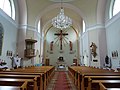
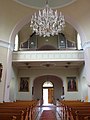
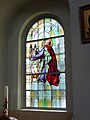
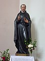
church building in Laa an der Thaya, Austria   | |||||
| Upload media | |||||
| Instance of | |||||
|---|---|---|---|---|---|
| Named after | |||||
| Location | Laa an der Thaya, Mistelbach District, Lower Austria, Austria | ||||
| Heritage designation | |||||
 | |||||
Media in category "Pfarrkirche Hanfthal"
The following 12 files are in this category, out of 12 total.
-
 Hanfthal Pfarrkirche1.jpg 3,648 × 2,736; 4.15 MB
-
 Hanfthal Pfarrkirche2.jpg 3,648 × 2,736; 3.85 MB
-
 Hanfthal Pfarrkirche3.jpg 2,736 × 3,648; 3.52 MB
-
 Hanfthal Pfarrkirche4.jpg 2,736 × 3,648; 4.14 MB
-
 Hanfthal Pfarrkirche5.jpg 2,736 × 3,648; 3.81 MB
-
 Hanfthal Pfarrkirche6.jpg 2,736 × 3,648; 3.27 MB
-
 Hanfthal Pfarrkirche7.jpg 1,905 × 2,900; 3.87 MB
-
 Hanfthal Pfarrkirche8.jpg 1,608 × 2,697; 2.92 MB
-
 Kirche 10244 in A-2136 Hanfthal.jpg 3,800 × 5,633; 3.81 MB
-
 Kirche 14020 Innen in A-2136 Hanfthal (a).jpg 6,074 × 4,016; 4.48 MB
-
 Kirche 14020 Innen in A-2136 Hanfthal (b).jpg 6,016 × 4,016; 2.88 MB
-
 NOE Hanfthal Pfarrkirche.jpg 3,264 × 2,176; 2.66 MB


.jpg)
.jpg)