Category:Pfarrkirche Goggendorf
Jump to navigation
Jump to search
| Object location | | View all coordinates using: OpenStreetMap |
|---|
church building in Lower Austria, Austria   | |||||
| Upload media | |||||
| Instance of | |||||
|---|---|---|---|---|---|
| Named after | |||||
| Location | Sitzendorf an der Schmida, Hollabrunn District, Lower Austria, Austria | ||||
| Architectural style | |||||
| Diocese | |||||
| Heritage designation | |||||
 | |||||
| This category shows the protected monument with the number 12824 in Austria. (Commons, de, Wikidata) |
Deutsch: Pfarrkirche Maria Verkündigung in Goggendorf, Sitzendorf an der Schmida
Media in category "Pfarrkirche Goggendorf"
The following 15 files are in this category, out of 15 total.
-
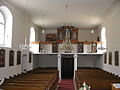
 Goggendorf Kirche.jpg 1,244 × 1,191; 910 KB
-
 Pfarrkirche Goggendorf Ambo.jpg 1,682 × 2,753; 2.87 MB
-
 Pfarrkirche Goggendorf Decke Chor 1.jpg 3,008 × 2,000; 3.61 MB
-
 Pfarrkirche Goggendorf Decke Chor.jpg 2,891 × 1,908; 3.59 MB
-
 Pfarrkirche Goggendorf Florian 1.jpg 1,394 × 2,134; 2.07 MB
-
 Pfarrkirche Goggendorf Florian.jpg 1,205 × 1,915; 1.6 MB
-
 Pfarrkirche Goggendorf Grabstein.jpg 1,944 × 2,961; 4.31 MB
-
 Pfarrkirche Goggendorf Grundriss.jpg 5,211 × 3,610; 840 KB
-
 Pfarrkirche Goggendorf Hochaltar.jpg 1,900 × 2,927; 3.65 MB
-
 Pfarrkirche Goggendorf Kanzel.jpg 1,339 × 2,600; 2.26 MB
-
 Pfarrkirche Goggendorf Sebastian.jpg 1,266 × 2,000; 1.51 MB
-
 Pfarrkirche Goggendorf Seitenaltar rechts.jpg 1,711 × 3,000; 3.26 MB
-
 Pfarrkirche Goggendorf Seitenaltar.jpg 1,522 × 2,350; 2.47 MB
-
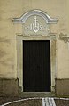 Pfarrkirche Goggendorf Westportal.jpg 1,850 × 2,832; 3.41 MB
-
 Pfarrkirche Goggendorf.JPG 1,600 × 1,200; 465 KB


