Category:Pfarrkirche (Witzelsdorf)
Jump to navigation
Jump to search
| Object location | | View all coordinates using: OpenStreetMap |
|---|
church building in Eckartsau, Austria .JPG)  | |||||
| Upload media | |||||
| Instance of | |||||
|---|---|---|---|---|---|
| Named after | |||||
| Location | Eckartsau, Gänserndorf District, Lower Austria, Austria | ||||
| Heritage designation | |||||
 | |||||
Media in category "Pfarrkirche (Witzelsdorf)"
The following 13 files are in this category, out of 13 total.
-
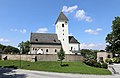
 Witzelsdorf - Kirche (1).JPG 3,898 × 2,852; 9.45 MB
-
 Witzelsdorf - Kirche (2).JPG 4,209 × 2,726; 9.53 MB
-
 Witzelsdorf Kirche innen 2.jpg 3,804 × 2,536; 2.24 MB
-
 Witzelsdorf Kirche.jpg 3,636 × 2,424; 2.09 MB
-
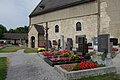 Witzelsdorf Kirchhof.jpg 1,920 × 1,280; 827 KB
-
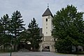
 Witzelsdorf Pfarrkirche 2.jpg 1,920 × 1,280; 870 KB
-
 Witzelsdorf Pfarrkirche Fenster.jpg 1,280 × 1,920; 814 KB
-
 Witzelsdorf Pfarrkirche innen.jpg 1,920 × 1,280; 532 KB
-
 Witzelsdorf Pfarrkirche Kreuz.jpg 1,920 × 1,280; 364 KB
-
 Witzelsdorf Pfarrkirche.jpg 1,920 × 1,280; 653 KB
-
 Witzelsdorf Pfarrkirche3.jpg 2,736 × 3,648; 4.05 MB
-
 Witzelsdorf Pfarrkirche4.jpg 2,736 × 3,648; 4.63 MB
-
 Witzelsdorf Pfarrkirche5.jpg 2,736 × 3,648; 3.9 MB
.JPG)


