Category:Pfarrhof St. Dionysen
Jump to navigation
Jump to search
| Object location | | View all coordinates using: OpenStreetMap |
|---|
 | |||||
| Upload media | |||||
| Instance of | |||||
|---|---|---|---|---|---|
| Location | Bruck an der Mur, Bruck-Mürzzuschlag District, Styria, Austria | ||||
| Street address |
| ||||
| Heritage designation | |||||
 | |||||
Media in category "Pfarrhof St. Dionysen"
The following 9 files are in this category, out of 9 total.
-
 Church St. Dionysen 02.jpg 5,503 × 3,669; 5.63 MB
-
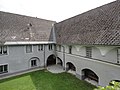
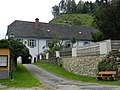
 Pfarrhof St. Dionysen Oberaich 01.JPG 4,320 × 3,240; 5.07 MB
-
 Pfarrhof St. Dionysen Oberaich 02.JPG 4,320 × 3,240; 5.59 MB
-
 Pfarrhof St. Dionysen Oberaich 03.JPG 4,320 × 3,240; 5.25 MB
-
 Pfarrhof, St. Dionysen, 1.jpg 4,000 × 3,000; 4.39 MB
-
 Pfarrhof, St. Dionysen, 2.jpg 4,000 × 3,000; 4.85 MB
-
 Pfarrhof, St. Dionysen, 3.jpg 4,000 × 3,000; 4.07 MB
-
 Pfarrhof, St. Dionysen, 4.jpg 4,000 × 3,000; 4.86 MB
-
 Pfarrhof, St. Dionysen, 5.jpg 3,000 × 4,000; 4.37 MB


