Category:Pfarrhof Klöch
Jump to navigation
Jump to search
| Object location | | View all coordinates using: OpenStreetMap |
|---|
 | |||||
| Upload media | |||||
| Instance of | |||||
|---|---|---|---|---|---|
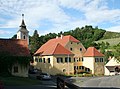
| Location | Klöch, Südoststeiermark District, Styria, Austria | ||||
| Street address |
| ||||
| Heritage designation | |||||
 | |||||
Deutsch: Pfarrhof Klöch
Media in category "Pfarrhof Klöch"
The following 7 files are in this category, out of 7 total.
-
 Klöch 9238.JPG 3,456 × 5,184; 5.61 MB
-
 Klöch 9269.JPG 5,184 × 3,456; 6.81 MB
-
 Klöch 9271.JPG 5,184 × 3,456; 6.32 MB
-
 Klöch 9272.JPG 3,456 × 5,184; 5.45 MB
-
 Klöch 9273.JPG 5,184 × 3,456; 7.17 MB
-
 Klöch me 044.jpg 2,475 × 1,836; 3.02 MB
-
 Ortseingang Kloech.JPG 6,000 × 4,000; 11.1 MB


