Category:Pelsall
Jump to navigation
Jump to search
English: Pelsall is an area of Walsall in the West Midlands, England. The suburban area of Pelsall is covered by Bloxwich, also in Walsall.
suburban village and former civil parish, situated in the Metropolitan Borough of Walsall in the West Midlands, England  | |||||
| Upload media | |||||
| Instance of | |||||
|---|---|---|---|---|---|
| Location | Walsall, West Midlands, England | ||||
 | |||||
Subcategories
This category has the following 3 subcategories, out of 3 total.
B
P
- Pelsall railway station (1 F)
Media in category "Pelsall"
The following 62 files are in this category, out of 62 total.
-

-

-
 Canalside allotments - geograph.org.uk - 264036.jpg 500 × 375; 198 KB
-
 Cannock Extension Canal from the Bridge - geograph.org.uk - 144245.jpg 640 × 427; 116 KB
-
 Chapel Street - geograph.org.uk - 898324.jpg 640 × 480; 69 KB
-
 Culvert on the Ford Brook - geograph.org.uk - 2710609.jpg 640 × 480; 85 KB
-
 Daw End Moorings - geograph.org.uk - 2606710.jpg 800 × 600; 290 KB
-
 Disused Railway - geograph.org.uk - 196278.jpg 640 × 480; 133 KB
-
 Ducks and Geese and Horses - geograph.org.uk - 210516.jpg 640 × 480; 73 KB
-
 Fishley Church - geograph.org.uk - 847224.jpg 640 × 480; 298 KB
-
 Ford Brook - downstream of Vicarage Road - geograph.org.uk - 3132378.jpg 480 × 640; 101 KB
-

-
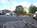
 Hall Lane, Pelsall - geograph.org.uk - 265607.jpg 640 × 480; 76 KB
-
 Heathland on Pelsall Common - geograph.org.uk - 848598.jpg 640 × 480; 249 KB
-
 Lych Gate, Pelsall Parish Church - geograph.org.uk - 264209.jpg 640 × 480; 113 KB
-

-
 Mouse hill.jpg 837 × 1,333; 125 KB
-
 Northywood Bridge - geograph.org.uk - 2606675.jpg 800 × 600; 258 KB
-
 Pelsall Common - geograph.org.uk - 3539477.jpg 1,024 × 768; 266 KB
-
 Pelsall Common - geograph.org.uk - 516149.jpg 640 × 480; 351 KB
-
 Pelsall Common - geograph.org.uk - 516161.jpg 575 × 431; 300 KB
-
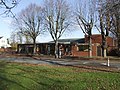 Pelsall Community Centre - geograph.org.uk - 2709984.jpg 640 × 480; 90 KB
-
 Pelsall Garage - geograph.org.uk - 3539419.jpg 1,024 × 768; 140 KB
-
 Pelsall Junction Footbridge.jpg 2,304 × 3,072; 4.13 MB
-

-
 Pelsall Junction.jpg 3,640 × 1,932; 1.57 MB
-
 Pelsall Methodist Church - geograph.org.uk - 3539483.jpg 1,024 × 756; 168 KB
-
 Pelsall Millennium Stone - geograph.org.uk - 899239.jpg 640 × 480; 98 KB
-
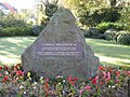 Pelsall Millennium Stone - geograph.org.uk - 899449.jpg 640 × 480; 131 KB
-
 Pelsall Post Office - geograph.org.uk - 3539415.jpg 1,024 × 763; 152 KB
-
 Pelsall Village - geograph.org.uk - 899226.jpg 640 × 480; 81 KB
-
 Pelsall Village Common - geograph.org.uk - 899457.jpg 640 × 480; 115 KB
-
-
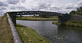
 Pelsall Works Bridge.jpg 3,072 × 2,304; 3.69 MB
-
 Pelsall, war memorial - geograph.org.uk - 3539409.jpg 1,024 × 768; 289 KB
-
 Play Ground - geograph.org.uk - 1724167.jpg 1,600 × 1,200; 641 KB
-

-
 Railway bridge - geograph.org.uk - 2332004.jpg 3,648 × 2,736; 3.59 MB
-
 Rough grazing next to Wolverhampton Road. - geograph.org.uk - 516168.jpg 640 × 480; 248 KB
-
 Rushall Canal, Daw End Branch - geograph.org.uk - 2606509.jpg 800 × 600; 311 KB
-
 Rushall Canal, Daw End Branch - geograph.org.uk - 2606513.jpg 800 × 600; 287 KB
-
 Rushall Canal, Daw End Branch - geograph.org.uk - 2606514.jpg 800 × 600; 256 KB
-
 Rushall Canal, Daw End Branch - geograph.org.uk - 2606517.jpg 800 × 600; 279 KB
-
 Rushall Canal, Daw End Branch - geograph.org.uk - 2606659.jpg 800 × 600; 213 KB
-
 Rushall Canal, Daw End Branch - geograph.org.uk - 2606667.jpg 800 × 600; 275 KB
-
 The Fingerpost - geograph.org.uk - 13361 (cropped).jpg 204 × 363; 32 KB
-
 The Fingerpost - geograph.org.uk - 13361.jpg 640 × 426; 80 KB
-
 Timberland Trail, Forest of Mercia - geograph.org.uk - 516154.jpg 640 × 480; 363 KB
-
 Upstream on the Ford Brook - geograph.org.uk - 2710053.jpg 640 × 480; 82 KB
-
 Victoria Road, Pelsall - geograph.org.uk - 264218.jpg 640 × 480; 94 KB
-
 Wyrley and Essington Canal - geograph.org.uk - 169871.jpg 640 × 426; 149 KB
-
 Wyrley and Essington Canal - geograph.org.uk - 854288.jpg 640 × 480; 284 KB
-

-
 Wyrley and Essington Canal aqueduct - geograph.org.uk - 854522.jpg 640 × 480; 304 KB
-
 Yorks Bridge, Pelsall - geograph.org.uk - 264230.jpg 640 × 480; 80 KB
-
 Bricks - geograph.org.uk - 210513.jpg 640 × 480; 74 KB
-
 Field and Copse - geograph.org.uk - 264066.jpg 640 × 480; 73 KB
-
 Field Near Grange Farm, Pelsall - geograph.org.uk - 265612.jpg 640 × 480; 108 KB
-
-
 Pelsall Wood Common - geograph.org.uk - 365861.jpg 640 × 480; 58 KB
-
 Wyrley Common looking East - geograph.org.uk - 201489.jpg 640 × 480; 100 KB
-
 Wyrley Common looking West - geograph.org.uk - 201490.jpg 640 × 480; 115 KB


.jpg)


