Category:Peaslake
Jump to navigation
Jump to search
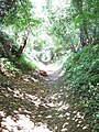
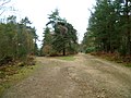
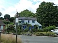
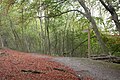
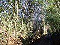
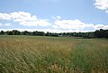
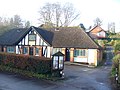
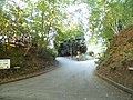
English: Peaslake is in the centre of the Surrey Hills area, close to the market town of Guildford, England. Surrounded by acres of forest and downland, visitors come here to walk and cycle and to enjoy the views of the local countryside. Nearby to the south is Pitch Hill (sometimes called "Coneyhurst Hill") which at of surrounding forest, the Hurtwood, is maintained by the Hurtwood Control. This includes Holmbury Hill, Pitch Hill, Winterfold, Shere Heath, Farley Heath and part of Blackheath Common.

village in Surrey, England, UK  | |||||
| Upload media | |||||
| Instance of | |||||
|---|---|---|---|---|---|
| Location | Shere, Guildford, Surrey, South East England, England | ||||
 | |||||
Subcategories
This category has the following 5 subcategories, out of 5 total.
Media in category "Peaslake"
The following 83 files are in this category, out of 83 total.
-
 A London Country bus at Peaslake - geograph.org.uk - 3752911.jpg 2,161 × 1,830; 528 KB
-
 Abinger Hammer in Spring - geograph.org.uk - 106506.jpg 640 × 431; 141 KB
-
 Bikers in Peaslake - geograph.org.uk - 2070618.jpg 1,024 × 684; 299 KB
-
 Bridleway - geograph.org.uk - 200827.jpg 480 × 640; 187 KB
-
 Bridleway junction south of Peaslake - geograph.org.uk - 2886703.jpg 1,024 × 768; 235 KB
-

-

-
 Cemetery path, Peaslake - geograph.org.uk - 3619915.jpg 640 × 480; 103 KB
-
 Cottage opposite St Mark, Peaslake - geograph.org.uk - 3619888.jpg 640 × 480; 91 KB
-
 Coverwood Lakes - geograph.org.uk - 1285848.jpg 640 × 480; 103 KB
-
 East View Cottage, Peaslake - geograph.org.uk - 2087342.jpg 640 × 430; 164 KB
-

-
 Ewhurst Road, Peaslake - geograph.org.uk - 1582981.jpg 640 × 480; 84 KB
-
 Footpath descends to road at Peaslake - geograph.org.uk - 2887597.jpg 1,024 × 768; 275 KB
-
 Footpath entering Peaslake - geograph.org.uk - 2087240.jpg 640 × 430; 188 KB
-
 Footpath reaches road south of Peaslake - geograph.org.uk - 2887575.jpg 768 × 1,024; 339 KB
-
 Footpath to Broadfield Road - geograph.org.uk - 147565.jpg 640 × 480; 188 KB
-
 Hackhurst Downs - geograph.org.uk - 72214.jpg 640 × 428; 77 KB
-
 Hoe - geograph.org.uk - 164315.jpg 640 × 480; 138 KB
-
 Hound House - geograph.org.uk - 656111.jpg 640 × 480; 112 KB
-
 Hound House Road, Peaslake - geograph.org.uk - 2353275.jpg 1,600 × 1,200; 538 KB
-
 Hound House Road, Peaslake - geograph.org.uk - 2353317.jpg 1,600 × 1,200; 598 KB
-
 Hound House Road, Peaslake - geograph.org.uk - 2353324.jpg 1,600 × 1,200; 586 KB
-
 Hurt Wood south of Peaslake - geograph.org.uk - 2091726.jpg 640 × 430; 216 KB
-
 Hurthill Copse - geograph.org.uk - 1250203.jpg 640 × 360; 75 KB
-
 Junction of tracks in the Hurt Wood - geograph.org.uk - 46545.jpg 640 × 427; 119 KB
-
 Lockhurst Hatch Lane - geograph.org.uk - 656032.jpg 640 × 480; 185 KB
-

-
 Mackies Hill, Peaslake - geograph.org.uk - 2737454.jpg 2,560 × 1,920; 1.71 MB
-
 Oil seed rape near Peaslake - geograph.org.uk - 2087147.jpg 640 × 430; 141 KB
-
 Oil seed rape to the west of Peaslake - geograph.org.uk - 2087107.jpg 640 × 430; 135 KB
-
 Oil seed rape west of Peaslake - geograph.org.uk - 2087126.jpg 640 × 430; 127 KB
-
 Peaslake Ewhurst Road pre-Worboys sign 2.JPG 2,088 × 3,712; 3.17 MB
-
 Peaslake Ewhurst Road pre-Worboys sign 3.JPG 3,712 × 2,088; 3.03 MB
-
 Peaslake Ewhurst Road pre-Worboys sign.JPG 3,712 × 2,088; 3.4 MB
-
 Peaslake Village Hall - geograph.org.uk - 2736214.jpg 2,560 × 1,920; 1.77 MB
-
 Peaslake Village Hall - geograph.org.uk - 3619892.jpg 640 × 480; 129 KB
-
 Peaslake Village Sign - geograph.org.uk - 2087274.jpg 640 × 430; 159 KB
-
 Peaslake village sign - geograph.org.uk - 2887600.jpg 768 × 1,024; 148 KB
-
 Peaslake Village Stores - geograph.org.uk - 2087300.jpg 640 × 430; 171 KB
-
 Peaslake Village Stores - geograph.org.uk - 2736250.jpg 2,560 × 1,920; 1.7 MB
-
 Peaslake, Coverwood House.jpg 4,500 × 2,998; 3.31 MB
-
 Peaslake, Village Centre - geograph.org.uk - 108979.jpg 635 × 419; 338 KB
-
 Pedal and Spoke, Peaslake - geograph.org.uk - 2087247.jpg 640 × 430; 149 KB
-
 Plaws Hill, Peaslake - geograph.org.uk - 2736245.jpg 2,560 × 1,920; 1.99 MB
-
 Pre-Worboys Road Sign Ewhurst.jpg 1,600 × 1,200; 426 KB
-
 Rhododendron in the Hurtwood - geograph.org.uk - 1302050.jpg 640 × 480; 450 KB
-
 Shelter and Postbox, Peaslake - geograph.org.uk - 2087294.jpg 640 × 430; 166 KB
-
 Small woodland west of Peaslake - geograph.org.uk - 2087232.jpg 640 × 430; 126 KB
-
 Step This Way, Peaslake - geograph.org.uk - 2737456.jpg 2,560 × 1,920; 1.62 MB
-
 The entrance to Bentley Copse Scout Camp on Hound House Road (geograph 4166646).jpg 2,560 × 1,920; 1.97 MB
-
 The Old School House, Peaslake - geograph.org.uk - 2087363.jpg 640 × 430; 129 KB
-
 The Old School, Peaslake - geograph.org.uk - 3619891.jpg 640 × 480; 88 KB
-

-
 View of Peaslake from footpath - geograph.org.uk - 2887595.jpg 1,024 × 768; 305 KB
-

-
 Village Hall, Peaslake - geograph.org.uk - 2091667.jpg 640 × 430; 140 KB
-
 Western Cottages, Ewhurst Rd, Peaslake - geograph.org.uk - 2087330.jpg 640 × 430; 172 KB
-
 Western Cottages, Peaslake - geograph.org.uk - 2087324.jpg 640 × 430; 170 KB
-
 Alderbrook Road - Steep Hill 1-7 - geograph.org.uk - 1429901.jpg 640 × 400; 111 KB
-
 Barhatch Lane - Steep Hill 21^ - geograph.org.uk - 1429948.jpg 640 × 400; 89 KB
-
 Country Living - geograph.org.uk - 656103.jpg 640 × 480; 93 KB
-
 Descending to Peaslake - geograph.org.uk - 656149.jpg 640 × 480; 111 KB
-
 Ewhurst Road, Peaslake - geograph.org.uk - 656175.jpg 640 × 480; 114 KB
-
 Footpath from Peaslake - geograph.org.uk - 656218.jpg 640 × 480; 102 KB
-
 Grazing Cattle - geograph.org.uk - 147563.jpg 640 × 480; 136 KB
-
 Hazel Hall - geograph.org.uk - 656211.jpg 640 × 480; 100 KB
-
 Holmbury Hill - geograph.org.uk - 101733.jpg 640 × 434; 196 KB
-
 Jesses Lane - geograph.org.uk - 656231.jpg 640 × 480; 115 KB
-
 Lawbrook - geograph.org.uk - 656256.jpg 640 × 480; 108 KB
-
 Lockhurst Hatch Farm - geograph.org.uk - 656042.jpg 640 × 480; 68 KB
-
 Lockhurst Hatch Skyline - geograph.org.uk - 656092.jpg 640 × 480; 152 KB
-
 Memorial Hall and Jasmine Cottage - geograph.org.uk - 656154.jpg 640 × 480; 94 KB
-
 New Barn Farm - geograph.org.uk - 72219.jpg 640 × 428; 44 KB
-
 North Downs Line - geograph.org.uk - 72217.jpg 640 × 428; 43 KB
-
 Peaslake Church Hall - geograph.org.uk - 656163.jpg 640 × 480; 74 KB
-
 Peaslake Village Stores - geograph.org.uk - 80913.jpg 640 × 480; 116 KB
-
 Pond by Hound House - geograph.org.uk - 656119.jpg 640 × 480; 101 KB
-
 Pond by Lawbrook - geograph.org.uk - 656249.jpg 640 × 480; 86 KB
-
 Pond Lane - geograph.org.uk - 656192.jpg 640 × 480; 90 KB
-
 Ridge Hill - geograph.org.uk - 381763.jpg 640 × 480; 156 KB
-
 Some prize Belted Galloways - geograph.org.uk - 20681.jpg 640 × 442; 75 KB
-
 Surrey Hills Stream - geograph.org.uk - 656240.jpg 480 × 640; 120 KB


.jpg)


