Category:Panoramics of Falkirk council area
Jump to navigation
Jump to search
Council areas (municipalities) of Scotland: Aberdeen · Aberdeenshire · Angus · Argyll and Bute · Clackmannanshire · Dumfries and Galloway · Dundee · East Ayrshire · East Dunbartonshire · East Lothian · East Renfrewshire · Edinburgh · Falkirk · Fife · Glasgow · Highland · Inverclyde · Midlothian · Moray · North Ayrshire · North Lanarkshire · Outer Hebrides · Orkney Islands · Perth and Kinross · Renfrewshire · Scottish Borders · Shetland Islands · Stirling · West Dunbartonshire · West Lothian
Media in category "Panoramics of Falkirk council area"
The following 9 files are in this category, out of 9 total.
-
 Bo'ness, view over town - geograph.org.uk - 448349.jpg 640 × 430; 96 KB
-
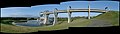 Falkirk Wheel panoramic01 2002-08-31.jpg 5,427 × 1,537; 2.49 MB
-
 Grangemouth from Airngath Hill. - geograph.org.uk - 65197.jpg 640 × 480; 58 KB
-
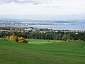
 Grangemouth view - geograph.org.uk - 370602.jpg 640 × 380; 51 KB
-
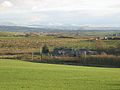 Greencraig. - geograph.org.uk - 85240.jpg 640 × 480; 64 KB
-
 Kelpies panorama.jpg 4,282 × 800; 1.59 MB
-
 Panorama of Falkirk. - geograph.org.uk - 148928.jpg 640 × 421; 45 KB
-
 View of Grangemouth BP Oil Refinery - geograph.org.uk - 241067.jpg 640 × 480; 75 KB
-
 West end of Shieldhill village - geograph.org.uk - 81910.jpg 640 × 427; 60 KB


