Category:Palmengarten (Leipzig)
Jump to navigation
Jump to search
| Object location | | View all coordinates using: OpenStreetMap |
|---|
park  | |||||
| Upload media | |||||
| Instance of | |||||
|---|---|---|---|---|---|
| Location | Leipzig, Saxony, Germany | ||||
| Street address |
| ||||
| Heritage designation | |||||
| Inception |
| ||||
| official website | |||||
 | |||||
Subcategories
This category has the following 6 subcategories, out of 6 total.
K
- Kuhturm (Leipzig) (4 F)
P
- Palmengartenbrücke (Leipzig) (2 F)
T
- Palmengartenteich (Leipzig) (13 F)
Media in category "Palmengarten (Leipzig)"
The following 13 files are in this category, out of 13 total.
-
 Bäume im Palmengarten (Leipzig).jpg 4,000 × 3,000; 3.59 MB
-
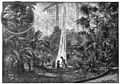 Die Gartenlaube (1899) b 0341.jpg 3,953 × 2,777; 1.56 MB
-
 Fotothek df hauptkatalog 0108982 Leipzig, Palmengarten.jpg 1,600 × 1,105; 713 KB
-

-
 Leipzig - Bowmanstraße 01 ies.jpg 5,618 × 3,744; 26.63 MB
-
 Leipzig - Palmengarten 06 ies.jpg 5,616 × 3,744; 18.97 MB
-
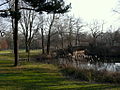 Leipzig Palmengarten.JPG 1,024 × 768; 392 KB
-
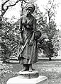 Manon Lescaut Palmengarten.jpg 387 × 537; 114 KB
-
 Morgen im Palmengarten 01.JPG 1,251 × 1,801; 883 KB
-
 Morgen im Palmengarten 02.JPG 3,264 × 2,448; 3.48 MB
-
 Morgen im Palmengarten 03.JPG 1,157 × 1,681; 1.08 MB
-
 T00 024 Kleine Luppe.jpg 4,096 × 2,736; 2.78 MB
-
 Theater-palmengarten.jpg 1,080 × 810; 223 KB
.jpg)
_b_0341.jpg)


