Category:Outwell
Jump to navigation
Jump to search
English: Outwell is a village and a civil parish in the English county of Norfolk The village is north west of the village. The Village is on the route of the A1101 Bury St. Edmunds to Long Sutton road. The nearest railway station is at Downham Market for the Fen Line which runs between King's Lynn and Cambridge. The nearest airport is Norwich International Airport. The parish of Upwell in the 2001 census, has a population of 1,880. For the purposes of local government, the parish falls within the district of King's Lynn and West Norfolk.
village and civil parish in Norfolk, UK  | |||||
| Upload media | |||||
| Instance of | |||||
|---|---|---|---|---|---|
| Location | King's Lynn and West Norfolk, Norfolk, East of England, England | ||||
| Area |
| ||||
| Said to be the same as | Outwell (Wikimedia duplicated page, civil parish) | ||||
 | |||||
Subcategories
This category has the following 4 subcategories, out of 4 total.
Media in category "Outwell"
The following 200 files are in this category, out of 232 total.
(previous page) (next page)-
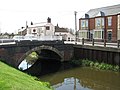 17th century bridge - geograph.org.uk - 1241561.jpg 640 × 480; 78 KB
-
 A fine lawn - geograph.org.uk - 1261432.jpg 640 × 480; 74 KB
-
 A fine red-brick house - geograph.org.uk - 1241724.jpg 620 × 563; 81 KB
-
 A flowering tree - geograph.org.uk - 1261940.jpg 525 × 640; 123 KB
-
 A relic from the Wisbech Canal - geograph.org.uk - 1241690.jpg 640 × 526; 163 KB
-

-
 A serpentine road - geograph.org.uk - 1267692.jpg 480 × 640; 88 KB
-
 A1011 Church Drove, Outwell - geograph.org.uk - 6179970.jpg 4,608 × 3,456; 4.37 MB
-
 A1011 Church Terrace, Outwell - geograph.org.uk - 6179966.jpg 4,608 × 3,456; 3.93 MB
-
 A1011 Church Terrace, Outwell - geograph.org.uk - 6180010.jpg 3,895 × 2,705; 2.69 MB
-
 A1101 approaching roundabout - geograph.org.uk - 3559557.jpg 1,600 × 932; 276 KB
-
 A1101 Church Terrace, Outwell - geograph.org.uk - 6179953.jpg 3,963 × 2,805; 3.18 MB
-
 A1101 Church Terrace, Outwell - geograph.org.uk - 6179982.jpg 4,608 × 3,456; 3.99 MB
-
 A1101 Isle road - geograph.org.uk - 3559560.jpg 1,600 × 958; 310 KB
-

-
 A1101 Outwell Road, Holly End, Emneth - geograph.org.uk - 6180312.jpg 4,000 × 3,000; 2.89 MB
-
 A1101 Outwell Road, Outwell - geograph.org.uk - 6180903.jpg 3,918 × 2,939; 2.67 MB
-

-
 A1101 southbound - geograph.org.uk - 5586310.jpg 640 × 480; 44 KB
-
 A1101 southbound - geograph.org.uk - 5586312.jpg 640 × 480; 88 KB
-
 A1101 Wisbech Road from Basin Road - geograph.org.uk - 6146141.jpg 3,354 × 2,509; 5.61 MB
-
 A1101 Wisbech Road in Outwell - geograph.org.uk - 5237484.jpg 800 × 594; 142 KB
-
 A1122 and overhead power lines - geograph.org.uk - 3639841.jpg 640 × 481; 44 KB
-
 A1122 at Parkfield Farm - geograph.org.uk - 3639863.jpg 640 × 481; 48 KB
-

-
 A1122 Downham Road in Outwell - geograph.org.uk - 5234609.jpg 800 × 549; 83 KB
-
 A1122 Downham Road, Outwell - geograph.org.uk - 6179790.jpg 4,608 × 3,456; 4.3 MB
-
 A1122 Downham Road, Outwell - geograph.org.uk - 6180018.jpg 4,608 × 3,456; 3.99 MB
-
 A1122 near West Farm - geograph.org.uk - 3639836.jpg 640 × 481; 42 KB
-
 A1122 Wisbech Road, Outwell - geograph.org.uk - 3641478.jpg 640 × 481; 64 KB
-
 A1122 Wisbech Road, Outwell - geograph.org.uk - 6180094.jpg 4,000 × 3,000; 3.82 MB
-
 A1122 Wisbech Road, Outwell - geograph.org.uk - 6180096.jpg 4,608 × 3,456; 3.77 MB
-
 A1122 Wisbech Road, Outwell - geograph.org.uk - 6180102.jpg 4,608 × 3,456; 4.15 MB
-
 Angle Road near Outwell - geograph.org.uk - 3126155.jpg 4,320 × 3,240; 5.83 MB
-
 Aqueduct and footpath near Outwell - geograph.org.uk - 3097421.jpg 4,320 × 3,240; 5.59 MB
-
 Beaupre Hall Farm, Outwell - geograph.org.uk - 3073872.jpg 4,320 × 3,240; 5.48 MB
-
 Boat on Well Creek at Outwell - geograph.org.uk - 3074007.jpg 4,320 × 3,240; 5.99 MB
-

-
 Boyce Fen Farm along Marsh Road - geograph.org.uk - 5237475.jpg 800 × 533; 131 KB
-
 Bramble Lane - geograph.org.uk - 2038588.jpg 1,600 × 1,200; 576 KB
-
 Bramble Lane, Holly End, Emneth - geograph.org.uk - 6180563.jpg 4,608 × 3,456; 3.9 MB
-
 Bridge over the River Nene - geograph.org.uk - 1241538.jpg 480 × 640; 109 KB
-
 Bungalow overlooking Well Creek near Nordelph - geograph.org.uk - 3095528.jpg 4,320 × 3,240; 5.96 MB
-
 Bungalow, The Cottons - geograph.org.uk - 4715643.jpg 640 × 480; 50 KB
-
 Byway to Molls Drove - geograph.org.uk - 2038683.jpg 1,600 × 1,200; 894 KB
-
 Cattle near Boyce Fen Farm - geograph.org.uk - 5237472.jpg 800 × 591; 126 KB
-
 Church Bridge, Outwell - geograph.org.uk - 3409826.jpg 640 × 480; 332 KB
-

-
 Converted building, Rectory Road, Outwell - geograph.org.uk - 5982936.jpg 1,600 × 1,142; 823 KB
-
 Cottages on Wisbech Road (A1122) - geograph.org.uk - 1241695.jpg 640 × 480; 81 KB
-
 Cottages on Wisbech Road (A1122) - geograph.org.uk - 1241725.jpg 640 × 480; 88 KB
-
 Cotton's Drove - geograph.org.uk - 2038651.jpg 1,600 × 1,200; 722 KB
-
 Crop field off The Common - geograph.org.uk - 4715640.jpg 640 × 480; 76 KB
-
 Daffodil reflection in Well Creek - geograph.org.uk - 4444556.jpg 4,214 × 3,094; 4.53 MB
-
 Date stone on bridge - geograph.org.uk - 1241568.jpg 480 × 640; 79 KB
-
 Ditch off Cotton's Drove - geograph.org.uk - 2038633.jpg 1,600 × 1,200; 752 KB
-
 Downham Road (A1122) at Outwell on a Misty November Morning - geograph.org.uk - 4254769.jpg 4,000 × 3,000; 1.94 MB
-

-
 Drain through Bluick Fen - geograph.org.uk - 1267713.jpg 531 × 640; 106 KB
-
 Entering Outwell on the A1122 Downham Road - geograph.org.uk - 6179358.jpg 4,608 × 3,456; 4.07 MB
-
 Farm track (byway) off The Common - geograph.org.uk - 4715627.jpg 640 × 480; 55 KB
-
 Farm track by the bank of the Well Creek - geograph.org.uk - 3409889.jpg 640 × 480; 293 KB
-
 Farmland at Scott's Field near Outwell - geograph.org.uk - 5237481.jpg 800 × 558; 124 KB
-
 Fenland sky and pylon chain. - geograph.org.uk - 71510.jpg 640 × 370; 50 KB
-

-

-
 Field off Cotton's Drove - geograph.org.uk - 2038619.jpg 1,600 × 1,200; 875 KB
-
 Flat farmland near Upwell - geograph.org.uk - 4715625.jpg 640 × 480; 63 KB
-
 Flying the flag on Basin Road, Outwell - geograph.org.uk - 6146145.jpg 3,387 × 2,499; 4.01 MB
-
 Free Methodist School - geograph.org.uk - 1241708.jpg 640 × 480; 74 KB
-
 George VI postbox - geograph.org.uk - 1241591.jpg 393 × 640; 83 KB
-
 Glenshee house along Hall Road - geograph.org.uk - 5237480.jpg 800 × 604; 141 KB
-
 Grazing off The Common - geograph.org.uk - 4715634.jpg 640 × 480; 59 KB
-
 Green Drove, Outwell - geograph.org.uk - 2038614.jpg 1,600 × 1,200; 634 KB
-
 Gulf filling station and garage, Outwell - geograph.org.uk - 5982919.jpg 1,600 × 1,201; 736 KB
-
 Harvesting on The Edge - geograph.org.uk - 3095418.jpg 4,320 × 3,240; 5.37 MB
-
 Horse paddock off Cotton's Drove - geograph.org.uk - 2038644.jpg 1,600 × 1,200; 775 KB
-
 House on The Common - geograph.org.uk - 4715639.jpg 640 × 480; 52 KB
-
 Houses on The Cottons - geograph.org.uk - 4715646.jpg 640 × 480; 40 KB
-
 Isle Road - geograph.org.uk - 5586319.jpg 640 × 446; 51 KB
-
 Isle Road, Outwell - geograph.org.uk - 3559574.jpg 1,722 × 1,119; 2.21 MB
-
 Langhorn's Lane in Outwell - geograph.org.uk - 5234696.jpg 800 × 593; 180 KB
-
 Langhorn's Lane in Outwell - geograph.org.uk - 5234711.jpg 800 × 622; 156 KB
-
 Large new housing, Outwell - geograph.org.uk - 2038600.jpg 1,600 × 1,200; 558 KB
-
 Low Side - geograph.org.uk - 1241442.jpg 640 × 480; 96 KB
-
 Marsh Road junction near Outwell - geograph.org.uk - 5237476.jpg 800 × 608; 123 KB
-

-
 Middle Level Main Drain - again^ - geograph.org.uk - 69170.jpg 640 × 480; 52 KB
-
 Middle Level Main Drain - geograph.org.uk - 656439.jpg 3,008 × 2,000; 3.26 MB
-
 Middle Level Main Drain - geograph.org.uk - 69164.jpg 640 × 480; 71 KB
-

-

-
 Milepost on the Downham-Wisbech road - geograph.org.uk - 946521.jpg 2,304 × 3,072; 2.8 MB
-
 Mullicourt Aqueduct - geograph.org.uk - 2226154.jpg 640 × 480; 148 KB
-
 Mullicourt Aqueduct - geograph.org.uk - 6225633.jpg 5,472 × 3,648; 3.73 MB
-
 Mullicourt Road - geograph.org.uk - 1267687.jpg 640 × 480; 93 KB
-
 Northeasterly view along Low Side - geograph.org.uk - 1241518.jpg 480 × 640; 121 KB
-
 Off the rails - Small diesel shunting engine near Outwell (geograph 3073899).jpg 4,320 × 3,240; 6.09 MB
-
 Old farm buildings off The Common - geograph.org.uk - 4715636.jpg 640 × 480; 55 KB
-
 On the aqueduct near Outwell - geograph.org.uk - 3097429.jpg 4,320 × 3,240; 5.92 MB
-

-
 On the bank of Well Creek near Nordelph - geograph.org.uk - 3095554.jpg 4,320 × 3,240; 5.9 MB
-
 Ordnance Survey Cut Mark - geograph.org.uk - 4294151.jpg 4,000 × 3,000; 4.27 MB
-
 Ordnance Survey Flush Bracket G2944 - geograph.org.uk - 4294176.jpg 4,000 × 3,000; 4.11 MB
-
 Ordnance Survey Flush Bracket G2945 - geograph.org.uk - 4293855.jpg 4,000 × 3,000; 2.99 MB
-
 Outwell - new housing on Isle Road - geograph.org.uk - 1261377.jpg 640 × 480; 85 KB
-
 Outwell Boat Basin - geograph.org.uk - 3409816.jpg 640 × 480; 346 KB
-
 Outwell fire station - geograph.org.uk - 836150.jpg 640 × 427; 201 KB
-

-
 Outwell Post Office - geograph.org.uk - 1241585.jpg 640 × 480; 115 KB
-
 Outwell Road, Holly End, Emneth - geograph.org.uk - 6180988.jpg 3,890 × 2,853; 4.52 MB
-
 Outwell Road, Outwell - geograph.org.uk - 6180930.jpg 3,874 × 2,837; 3.6 MB
-
 Outwell Road, Outwell - geograph.org.uk - 6181897.jpg 3,680 × 2,760; 2.73 MB
-
 Outwell Road, Outwell - geograph.org.uk - 6184167.jpg 3,817 × 2,863; 3.02 MB
-
 Outwell Village Hall - geograph.org.uk - 6180091.jpg 4,000 × 2,953; 3.92 MB
-
 Outwell Village Hall ^ Playing Field sign - geograph.org.uk - 6180093.jpg 4,608 × 3,456; 3.66 MB
-
 Outwell Village Name sign - geograph.org.uk - 6179370.jpg 4,608 × 3,456; 4.05 MB
-
 Outwell's colourful eatery - geograph.org.uk - 3159544.jpg 640 × 427; 85 KB
-
 Outwell, St Clement - geograph.org.uk - 6364099.jpg 3,456 × 4,608; 5.21 MB
-
 Parish cemetery in Outwell - geograph.org.uk - 2656109.jpg 3,648 × 2,736; 1.93 MB
-
 Path linking A1101 with A1122 - geograph.org.uk - 1241681.jpg 480 × 640; 116 KB
-
 Pig in a field - geograph.org.uk - 2038673.jpg 1,600 × 1,200; 747 KB
-

-
 Postbox on Basin Road, Outwell - geograph.org.uk - 5237488.jpg 800 × 569; 126 KB
-

-
 Power lines crossing Well Creek - geograph.org.uk - 3095463.jpg 4,320 × 3,240; 5.97 MB
-
 Pylons marching across the Fens. - geograph.org.uk - 69165.jpg 480 × 640; 78 KB
-
 Redundant sluice paddle - geograph.org.uk - 1241692.jpg 480 × 640; 167 KB
-
 Reflections in the River Nene - geograph.org.uk - 1241509.jpg 620 × 564; 115 KB
-
 River flyover - geograph.org.uk - 2226165.jpg 640 × 480; 166 KB
-

-
 Road Junction - geograph.org.uk - 1714612.jpg 1,600 × 1,200; 271 KB
-
 Roadsign on Outwell Road - geograph.org.uk - 6181909.jpg 4,608 × 3,456; 3.89 MB
-
 Roadsign on the A1101 Outwell Road - geograph.org.uk - 6180909.jpg 4,608 × 3,456; 3.96 MB
-
 Roadsign on the A1101 Well Road - geograph.org.uk - 6180110.jpg 4,608 × 3,456; 3.87 MB
-
 Roadsign on the A1122 Wisbech Road - geograph.org.uk - 6180106.jpg 4,608 × 3,456; 3.83 MB
-
 Roadsign ^ Wisbech Road sign - geograph.org.uk - 6180047.jpg 3,827 × 2,800; 4.89 MB
-
 Roadsigns on the Tramway - geograph.org.uk - 6179978.jpg 3,456 × 4,608; 3.79 MB
-
 Robbs Lane - geograph.org.uk - 1267644.jpg 480 × 640; 83 KB
-
 Safely moored on the River Nene - geograph.org.uk - 1241544.jpg 480 × 640; 91 KB
-

-
 Signpost on the A1101 Outwell Road - geograph.org.uk - 6180299.jpg 4,608 × 3,456; 3.94 MB
-
 Small car park at the end of Angle Road - geograph.org.uk - 5234735.jpg 800 × 626; 134 KB
-
 Spraying a wheatfield on Edge Bank - geograph.org.uk - 3073433.jpg 4,320 × 3,240; 5.38 MB
-
 Stormy skies and pylons - geograph.org.uk - 5031671.jpg 800 × 613; 74 KB
-
 Stow Road on the eastern edge of Outwell - geograph.org.uk - 5237467.jpg 800 × 587; 183 KB
-
 Stubble field and power lines near Scariff Farm, Outwell - geograph.org.uk - 3126124.jpg 4,320 × 3,240; 5.96 MB
-
 Sugar beet, Hall Dike, Outwell - geograph.org.uk - 3073571.jpg 4,320 × 3,240; 5.45 MB
-
 The Aqueduct near Upwell - geograph.org.uk - 3097392.jpg 4,320 × 3,240; 5.84 MB
-
 The Common - geograph.org.uk - 4715637.jpg 640 × 480; 74 KB
-
 The Common - geograph.org.uk - 4715641.jpg 640 × 480; 46 KB
-
 The Cottons - geograph.org.uk - 4715645.jpg 640 × 480; 44 KB
-
 The Crown - geograph.org.uk - 1241582.jpg 640 × 480; 94 KB
-
 The Crown in Outwell - geograph.org.uk - 5234595.jpg 800 × 538; 108 KB
-
 The Crown Lodge Hotel, Outwell - geograph.org.uk - 3409838.jpg 640 × 427; 289 KB
-
 The Crown public house, Outwell - geograph.org.uk - 6146223.jpg 3,456 × 2,592; 3.8 MB
-
 The former route of the Wisbech and Upwell tramway - geograph.org.uk - 3073609.jpg 4,320 × 3,240; 5.91 MB
-
 The Middle Level Main Drain flowing under Well Creek - geograph.org.uk - 3097405.jpg 4,320 × 3,240; 6.14 MB
-
 The River Nene (old course) in Outwell and Upwell, Norfolk - geograph.org.uk - 5333864.jpg 3,959 × 3,008; 3.46 MB
-
 The sign of The Crown public house at Outwell - geograph.org.uk - 6146221.jpg 3,456 × 2,592; 3.6 MB
-
 The Well Creek and Walsingham Fen near Nordelph - geograph.org.uk - 3095502.jpg 4,320 × 3,240; 5.57 MB
-
 The Well Creek east of Outwell - geograph.org.uk - 3073939.jpg 4,320 × 3,240; 5.38 MB
-

-
 Traffic Lights - geograph.org.uk - 1714620.jpg 1,600 × 1,200; 291 KB
-
 Trains once used to pass here - geograph.org.uk - 1241472.jpg 640 × 519; 83 KB
-
 Tree lined track to Little Sandy Field - geograph.org.uk - 3073879.jpg 4,320 × 3,240; 5.9 MB
-
 Triangular plantation south of Suckling Drove - geograph.org.uk - 3095479.jpg 4,320 × 3,240; 5.51 MB
-
 Truncated silver birch trees, Outwell Basin - geograph.org.uk - 3073576.jpg 4,320 × 3,240; 5.5 MB
-

-
 View across Well Creek - geograph.org.uk - 1241735.jpg 640 × 480; 84 KB
-
 View along Low Side - geograph.org.uk - 1241552.jpg 640 × 480; 91 KB
-
 View along Mullicourt Road - geograph.org.uk - 1267688.jpg 480 × 640; 63 KB
-
 View east along Angle Road - geograph.org.uk - 1267698.jpg 620 × 528; 85 KB
-
 View north along Isle Road (A1101) - geograph.org.uk - 1241612.jpg 480 × 640; 72 KB
-

-
 View south along Wisbech Road - geograph.org.uk - 1241699.jpg 640 × 480; 67 KB
-
 View towards Middle Level Main Drain - geograph.org.uk - 1267685.jpg 640 × 480; 95 KB
-
 Village Sign. - geograph.org.uk - 3083293.jpg 900 × 675; 212 KB
-
 Wall of Remembrance on Outwell cemetery - geograph.org.uk - 5620769.jpg 3,456 × 2,592; 3.93 MB
-
 Waste management yard near Outwell - geograph.org.uk - 3073886.jpg 4,320 × 3,240; 5.79 MB
-
 Well Creek - geograph.org.uk - 1241730.jpg 640 × 480; 92 KB
-
 Well Creek beside the A1122 - geograph.org.uk - 3409843.jpg 640 × 480; 268 KB
-
 Well Creek by Downham Road - geograph.org.uk - 4990890.jpg 1,500 × 1,109; 153 KB
-
 Well Creek by Downham Road - geograph.org.uk - 4990893.jpg 1,500 × 1,125; 212 KB
-
 Well Creek Road in Outwell with Church Bridge to the right - geograph.org.uk - 2656117.jpg 2,729 × 2,269; 2.11 MB
-
 Well Creek Road, Outwell - geograph.org.uk - 6180016.jpg 4,000 × 2,827; 3.52 MB
-
 Well Creek, Outwell - geograph.org.uk - 6156347.jpg 1,024 × 768; 245 KB
-
 Wheatfield and distant pylon on Edge Bank - geograph.org.uk - 3073479.jpg 4,320 × 3,240; 5.36 MB
-

-

-

-

-

-

-

-

-

-

-

-


_-_geograph.org.uk_-_1241695.jpg)
_-_geograph.org.uk_-_1241725.jpg)


_at_Outwell_on_a_Misty_November_Morning_-_geograph.org.uk_-_4254769.jpg)


_off_The_Common_-_geograph.org.uk_-_4715627.jpg)


_-_geograph.org.uk_-_1241606.jpg)


.jpg)


_on_the_Outwell-Upwell_border_-_geograph.org.uk_-_5333870.jpg)


_in_Outwell_and_Upwell,_Norfolk_-_geograph.org.uk_-_5333864.jpg)


_-_geograph.org.uk_-_1241612.jpg)
_-_geograph.org.uk_-_1241711.jpg)


_crossing_-_geograph.org.uk_-_1242074.jpg)


