Category:Oude RKZ
Jump to navigation
Jump to search
| Object location | | View all coordinates using: OpenStreetMap |
|---|
former hospital in Groningen, Netherlands _Groningen_NL.jpg) | |||||
| Upload media | |||||
| Instance of | |||||
|---|---|---|---|---|---|
| Location | Groningen, Netherlands | ||||
| Heritage designation | |||||
 | |||||
Nederlands: Het Oude RKZ aan de Verlengde Hereweg in Helpman, Groningen
|
This is a category about a municipal monument in Groningen with number 101604 |
Media in category "Oude RKZ"
The following 22 files are in this category, out of 22 total.
-
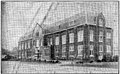
 20090624 Verlengde Hereweg 92 (ORKZ) Groningen NL.jpg 5,000 × 2,000; 6.28 MB
-
 De Zuidkant van het nieuwe R.K Ziekenhuis, 1925.jpg 1,254 × 798; 355 KB
-
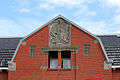
 Groningen - Oude RKZ.jpg 5,493 × 3,090; 12.95 MB
-
 Het nieuwe R.K. Ziekenhuis te Groningen, 1925.jpg 1,562 × 969; 591 KB
-

-
-

-
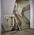 INTERIEUR, VLEUGEL A, TRAPPENHUIS - Groningen - 20284910 - RCE.jpg 1,182 × 1,200; 225 KB
-

-
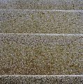
 INTERIEUR, VLEUGEL A, TRAPPENHUIS, TREDEN (TERRAZZO) - Groningen - 20284911 - RCE.jpg 1,200 × 1,182; 517 KB
-
 INTERIEUR, VLEUGEL B, BOVENGANG, VLOER (TERRAZZO) - Groningen - 20284917 - RCE.jpg 1,190 × 1,200; 418 KB
-
 INTERIEUR, VLEUGEL B, KAMER, VLOER (TERRAZZO) - Groningen - 20284915 - RCE.jpg 1,186 × 1,200; 316 KB
-
 INTERIEUR, VLEUGEL B, KAMER, VLOER (TERRAZZO) - Groningen - 20284916 - RCE.jpg 1,192 × 1,200; 416 KB
-
 INTERIEUR, VLEUGEL B, TRAPPENHUIS, TREDEN (TERRAZZO) - Groningen - 20284918 - RCE.jpg 1,183 × 1,200; 226 KB
-
 Oude RKZ in Groningen 01.jpg 3,000 × 4,000; 3.46 MB
-
 Oude RKZ in Groningen 02.jpg 4,000 × 3,000; 3.61 MB
-
 Oude RKZ in Groningen 03.jpg 3,000 × 4,000; 3.71 MB
-
 Oude RKZ in Groningen 04.jpg 4,000 × 3,000; 4.28 MB
-
 Oude RKZ in Groningen 05.jpg 4,000 × 3,000; 3.92 MB
-
 RKZbios foyer.jpg 3,008 × 2,000; 2.75 MB
-
 RKZbios zaal.jpg 2,048 × 1,365; 224 KB
-
 Wim Haver & Willem Valk - Behoudenis der Kranken.jpg 2,136 × 1,424; 963 KB


,_DETAIL_-_Groningen_-_20284913_-_RCE.jpg)
,_DETAIL_-_Groningen_-_20284914_-_RCE.jpg)

,_DETAIL_-_Groningen_-_20284912_-_RCE.jpg)
_-_Groningen_-_20284911_-_RCE.jpg)
_-_Groningen_-_20284917_-_RCE.jpg)
_-_Groningen_-_20284915_-_RCE.jpg)
_-_Groningen_-_20284916_-_RCE.jpg)
_-_Groningen_-_20284918_-_RCE.jpg)


