Category:Ottershaw
Jump to navigation
Jump to search
English: Ottershaw is a village in the Runnymede district of Surrey, England about 20 miles to the south-west of London. It is part of the Foxhills ward in the census, and formed part of the former Chertsey Urban District.
village in the borough of Runnymede, Surrey, United Kingdom  | |||||
| Upload media | |||||
| Instance of | |||||
|---|---|---|---|---|---|
| Location | Runnymede, Surrey, South East England, England | ||||
| Area |
| ||||
 | |||||
Subcategories
This category has the following 3 subcategories, out of 3 total.
O
- Ottershaw War Memorial (1 F)
Media in category "Ottershaw"
The following 34 files are in this category, out of 34 total.
-
 Basingstoke Canal, Sheerwater, Woking - geograph.org.uk - 22252.jpg 640 × 480; 195 KB
-
 Bridleway bridge over the River Bourne - geograph.org.uk - 168231.jpg 640 × 480; 300 KB
-
 Cross Lane, Ottershaw - geograph.org.uk - 1773151.jpg 480 × 640; 145 KB
-

-
 Estate Agents, Ottershaw - geograph.org.uk - 1742013.jpg 640 × 480; 66 KB
-
 Golf course at Foxhills (geograph 2477643).jpg 2,464 × 1,485; 3.04 MB
-
 Greatwood Dwelling, Ottershaw, the hall.png 678 × 688; 838 KB
-
 Hare Hill - geograph.org.uk - 978444.jpg 640 × 480; 70 KB
-
 House near Ottershaw, Surrey.jpg 2,358 × 1,450; 966 KB
-
 Ottershaw Memorial Garden - geograph.org.uk - 1773192.jpg 640 × 480; 155 KB
-
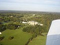 Ottershaw Park From the Air - geograph.org.uk - 1019634.jpg 640 × 480; 56 KB
-
 River Bourne by Horsell Common, Woking - geograph.org.uk - 168450.jpg 480 × 640; 249 KB
-
 Ten acre wood, Ottershaw - geograph.org.uk - 1773167.jpg 640 × 480; 152 KB
-
 Ten Acre Wood, Ottershaw - geograph.org.uk - 1773175.jpg 480 × 640; 154 KB
-
 Ten Acre Wood, Ottershaw - geograph.org.uk - 1773185.jpg 480 × 640; 149 KB
-
 The Bourne, river near Woodham - geograph.org.uk - 172077.jpg 480 × 640; 319 KB
-
 The Castle pub, Brox Road, Ottershaw (June 2015).jpg 4,600 × 3,000; 2.95 MB
-
 The Castle, Ottershaw - geograph.org.uk - 4497983.jpg 2,048 × 1,536; 2.2 MB
-
 The Common, Ottershaw - geograph.org.uk - 1165376.jpg 640 × 480; 144 KB
-
 Brox Road, north of Woking - geograph.org.uk - 171633.jpg 640 × 480; 126 KB
-
 Cottages at Anthonys, Horsell Common - geograph.org.uk - 168426.jpg 640 × 480; 134 KB
-
 Field by The Wey farm, north of Woking - geograph.org.uk - 168229.jpg 640 × 480; 184 KB
-
 Hare Hill Open Space, near Addlestone - geograph.org.uk - 171637.jpg 640 × 480; 305 KB
-

-

-

-
 Ottershaw - geograph.org.uk - 7845.jpg 640 × 427; 283 KB
-
 Ottershaw - geograph.org.uk - 7847.jpg 640 × 427; 225 KB
-

-
 Slade Road, Ottershaw - geograph.org.uk - 172057.jpg 640 × 480; 121 KB
-
 Stonehill Road - geograph.org.uk - 73396.jpg 640 × 480; 149 KB
-
 Windsock, Fairoaks airport - geograph.org.uk - 168444.jpg 480 × 640; 75 KB
-
 Wood and Lake off Hillswood Drive - geograph.org.uk - 131595.jpg 640 × 480; 109 KB
-
 Woodlands Close, north of Woking - geograph.org.uk - 172053.jpg 640 × 480; 123 KB


.jpg)


.jpg)


