Category:Oswestry Rural
Jump to navigation
Jump to search
English: Oswestry Rural is a civil parish in Shropshire, England, close to the Welsh border. It is south of the town of Oswestry.
civil parish in Shropshire, UK  | |||||
| Upload media | |||||
| Instance of | |||||
|---|---|---|---|---|---|
| Location | Shropshire, West Midlands, England | ||||
| Population |
| ||||
| Area |
| ||||
| Different from | |||||
| official website | |||||
 | |||||
Subcategories
This category has the following 11 subcategories, out of 11 total.
B
- Ball, Shropshire (2 F)
M
- Maesbury Marsh (25 F)
- Middleton, Oswestry Rural (2 F)
- Morton, Shropshire (3 F)
R
W
- Wootton, Oswestry Rural (2 F)
Media in category "Oswestry Rural"
The following 200 files are in this category, out of 561 total.
(previous page) (next page)-
 2mph speed limit, near Queen's Head - geograph.org.uk - 5183587.jpg 768 × 1,024; 259 KB
-
 A483 at Mile Oak - geograph.org.uk - 5503445.jpg 640 × 427; 322 KB
-
 A483 near Lower Sweeney - geograph.org.uk - 3291308.jpg 640 × 481; 39 KB
-
 A483 near Mile Oak - geograph.org.uk - 3291331.jpg 640 × 480; 44 KB
-
 A483 south of Weston - geograph.org.uk - 3291323.jpg 640 × 480; 59 KB
-

-
 A483, Level Crossing near Mile Oak - geograph.org.uk - 5503442.jpg 640 × 427; 332 KB
-
 A483-B5069 junction - geograph.org.uk - 3291312.jpg 640 × 481; 55 KB
-

-
 A5 approaches Aston Gates Junction - geograph.org.uk - 3711090.jpg 3,648 × 2,736; 1.58 MB
-
 A5 approaches the Mile End Roundabout - geograph.org.uk - 3711099.jpg 3,648 × 2,736; 1.74 MB
-
 A5 approaching Aston Gates junction - geograph.org.uk - 2248682.jpg 640 × 480; 66 KB
-
 A5 approaching Mile End roundabout - geograph.org.uk - 2248685.jpg 640 × 480; 67 KB
-
 A5 heading south - geograph.org.uk - 3134379.jpg 640 × 430; 74 KB
-
 A5 heading south - geograph.org.uk - 3134385.jpg 640 × 392; 51 KB
-
 A5 near Aston Park - geograph.org.uk - 3138622.jpg 640 × 466; 67 KB
-
 A5 near Wootton - geograph.org.uk - 2248675.jpg 640 × 480; 67 KB
-
 A5 nearing Mile End services - geograph.org.uk - 5249202.jpg 640 × 512; 48 KB
-
 A5 north of Aston Hall - geograph.org.uk - 5249201.jpg 640 × 512; 62 KB
-
 A5 north of Oswestry Golf Course - geograph.org.uk - 3711088.jpg 3,648 × 2,736; 1.63 MB
-
 A5 north west of Queen's Head - geograph.org.uk - 5249200.jpg 640 × 480; 51 KB
-
 A5 passing Mile End Services - geograph.org.uk - 3134365.jpg 640 × 461; 68 KB
-
 A5 south of Middleton - geograph.org.uk - 3711096.jpg 3,648 × 2,736; 999 KB
-
 A5 southbound - geograph.org.uk - 3138619.jpg 640 × 430; 67 KB
-
 A5, Aston Park - geograph.org.uk - 3138625.jpg 640 × 430; 74 KB
-

-
 Alcove beside Offa's Dyke Path - geograph.org.uk - 2914953.jpg 640 × 480; 149 KB
-
 All Saints' Church, Trefonen - geograph.org.uk - 6364132.jpg 5,184 × 3,888; 4.2 MB
-
 An assortment of trees - geograph.org.uk - 4481725.jpg 1,600 × 1,200; 1.34 MB
-
 Approaching Aston Gates Junction - geograph.org.uk - 6393423.jpg 2,686 × 987; 927 KB
-
 Approaching hairpin bend at ford - geograph.org.uk - 3540223.jpg 640 × 480; 159 KB
-

-

-
 Arable land, Aston - geograph.org.uk - 3924412.jpg 640 × 480; 247 KB
-
 Derelict Chapel at Aston Hall - geograph.org.uk - 204139.jpg 640 × 480; 114 KB
-
 Aston Bottom Lock - geograph.org.uk - 1002147.jpg 640 × 428; 126 KB
-
 Aston Bottom Lock - geograph.org.uk - 1002701.jpg 640 × 428; 122 KB
-
 Aston Bottom Lock - geograph.org.uk - 1002707.jpg 640 × 428; 121 KB
-
 Aston Middle Lock - geograph.org.uk - 1002135.jpg 640 × 428; 121 KB
-

-

-
 Avenue of trees along road - geograph.org.uk - 2086621.jpg 640 × 470; 92 KB
-
 B4058 enters Shropshire - geograph.org.uk - 3671244.jpg 4,000 × 3,000; 2.02 MB
-
 B4396 east of Lloyds Animal Foods - geograph.org.uk - 3232616.jpg 640 × 350; 51 KB
-
 B4396, Morton - geograph.org.uk - 5238152.jpg 1,024 × 683; 323 KB
-
 B5009 junction, A5 - geograph.org.uk - 3138627.jpg 640 × 430; 48 KB
-
 Barn at Moelydd Uchaf - geograph.org.uk - 6276891.jpg 5,184 × 3,888; 5.3 MB
-
 Barn at Red House - geograph.org.uk - 6276874.jpg 5,184 × 3,888; 2.4 MB
-
 Beech trees on Offa's Dyke in Candy Wood - geograph.org.uk - 2914942.jpg 640 × 480; 151 KB
-
 Bench near Racecourse Wood, Oswestry - geograph.org.uk - 2914970.jpg 640 × 480; 139 KB
-
 Bend in road at Moverhill Cottage - geograph.org.uk - 3539855.jpg 640 × 456; 75 KB
-

-
 Bridge 77 on the Montgomery canal - geograph.org.uk - 4945837.jpg 3,264 × 2,448; 3.69 MB
-

-
 Bridge 78, Montgomery Canal - geograph.org.uk - 2934533.jpg 1,600 × 1,200; 429 KB
-
 Bridge 78, Montgomery Canal - geograph.org.uk - 5852315.jpg 1,280 × 851; 589 KB
-
 Bridge 85 at Crickheath Wharf - geograph.org.uk - 6317740.jpg 4,896 × 3,264; 6.77 MB
-
 Bridge No. 78 on Montgomery Canal - geograph.org.uk - 4945847.jpg 3,264 × 2,448; 3.79 MB
-
 Bridge over the canal (1) - geograph.org.uk - 1860169.jpg 1,024 × 768; 99 KB
-
 British Ironwork Centre - geograph.org.uk - 6143172.jpg 7,074 × 4,716; 7.54 MB
-
 British Ironwork Centre - geograph.org.uk - 6143225.jpg 7,381 × 4,920; 7.55 MB
-
 British Ironwork Centre - geograph.org.uk - 6143265.jpg 6,665 × 4,444; 5.18 MB
-
 British Ironwork Centre, African Bush Elephant - geograph.org.uk - 6143243.jpg 6,732 × 4,488; 7.39 MB
-
 British Ironwork Centre, African Bush Elephant 1 - geograph.org.uk - 6143235.jpg 6,644 × 4,429; 5.56 MB
-
 British Ironwork Centre, African Bush Elephant 2 - geograph.org.uk - 6143238.jpg 7,406 × 4,937; 7.56 MB
-
 British Ironwork Centre, African Forest and Bush Elephants - geograph.org.uk - 6143229.jpg 6,867 × 4,579; 6.81 MB
-
 British Ironwork Centre, Angolan Giraffe - geograph.org.uk - 6143216.jpg 7,040 × 4,694; 7.64 MB
-
 British Ironwork Centre, Chimpanzee 1 - geograph.org.uk - 6143207.jpg 4,319 × 6,479; 6.65 MB
-
 British Ironwork Centre, Chimpanzee 2 - geograph.org.uk - 6143210.jpg 7,261 × 4,841; 5.39 MB
-
 British Ironwork Centre, Eagle - geograph.org.uk - 6143258.jpg 4,867 × 7,299; 5.17 MB
-
 British Ironwork Centre, Eagles - geograph.org.uk - 6143271.jpg 4,334 × 6,500; 6.47 MB
-

-

-

-

-

-
 British Ironwork Centre, Iron dogs - geograph.org.uk - 6143274.jpg 6,456 × 4,304; 5.51 MB
-
 British Ironwork Centre, Iron horses - geograph.org.uk - 6143277.jpg 6,868 × 4,578; 6.23 MB
-
 British Ironwork Centre, Iron pigs - geograph.org.uk - 6143261.jpg 7,302 × 4,867; 6.98 MB
-
 British Ironwork Centre, Kingsburgh Kordofan Giraffe - geograph.org.uk - 6143213.jpg 5,474 × 3,649; 5.58 MB
-
 British Ironwork Centre, Lion and Lioness - geograph.org.uk - 6143248.jpg 6,086 × 4,057; 4.33 MB
-
 British Ironwork Centre, Wyvern on top of a car - geograph.org.uk - 6143175.jpg 7,413 × 4,942; 4.81 MB
-
 British Ironwork Centre, Wyvern on top of a car - geograph.org.uk - 6143180.jpg 6,347 × 4,231; 4.72 MB
-
 Bronynant Ford - geograph.org.uk - 4041502.jpg 3,872 × 2,592; 4.85 MB
-
 Bwlchydonge - geograph.org.uk - 2782027.jpg 4,320 × 3,240; 3.05 MB
-
 Bwlchydonge 2012 - geograph.org.uk - 2782023.jpg 4,320 × 3,240; 2.86 MB
-
 B^B at Peartree Cottage - geograph.org.uk - 2097536.jpg 640 × 480; 73 KB
-
 Canal Bridge no 79 - geograph.org.uk - 1827296.jpg 640 × 480; 89 KB
-
 Canal east from Maesbury Marsh - geograph.org.uk - 1827292.jpg 640 × 480; 68 KB
-
 Canal maintenance boat - geograph.org.uk - 4945768.jpg 3,264 × 2,448; 3.62 MB
-
 Canal restoration at Canal House Bridge - geograph.org.uk - 1921040.jpg 1,600 × 1,071; 583 KB
-
 Canal restoration, the final phase - geograph.org.uk - 563834.jpg 640 × 480; 110 KB
-
 Canal restoration, the final touches - geograph.org.uk - 585216.jpg 640 × 480; 95 KB
-
 Canal services - geograph.org.uk - 1827289.jpg 640 × 480; 106 KB
-
 Candy Woods - geograph.org.uk - 5810281.jpg 1,080 × 810; 291 KB
-
 Car park at Old Oswestry Racecourse Common - geograph.org.uk - 6384082.jpg 3,974 × 2,678; 2.79 MB
-
 Cerflun Janus Sculpture - geograph.org.uk - 4523577.jpg 640 × 443; 95 KB
-
 Chain Lane at Foxhall Cottages - geograph.org.uk - 3568398.jpg 640 × 480; 72 KB
-
 Chain lane looking towards Maesbury - geograph.org.uk - 1875265.jpg 640 × 480; 69 KB
-
 Chapel and cottages at Craig-llwyn - geograph.org.uk - 6364155.jpg 5,184 × 3,888; 3.68 MB
-

-

-
 Clearing scrub from the derelict canal - geograph.org.uk - 602258.jpg 640 × 480; 119 KB
-
 Conifers felled above the Cynllaith - geograph.org.uk - 3693046.jpg 3,475 × 2,515; 1.23 MB
-
 Corbett's Bridge - geograph.org.uk - 5849669.jpg 5,184 × 3,888; 5.84 MB
-
 Corbett's Bridge No 75 on the Montgomery Canal - geograph.org.uk - 4639458.jpg 3,264 × 2,448; 4.39 MB
-
 Corbett's Bridge, Montgomery Canal - geograph.org.uk - 1001996.jpg 640 × 428; 125 KB
-
 Corbetts Bridge No. 75 on the Montgomery Canal - geograph.org.uk - 4952019.jpg 3,264 × 2,448; 3.72 MB
-
 Corbetts Bridge No. 75 on the Montgomery Canal - geograph.org.uk - 4952030.jpg 3,264 × 2,448; 3.74 MB
-
 Cottage with pond nearby - geograph.org.uk - 2332758.jpg 640 × 480; 102 KB
-
 Cottages at Bryn-aber near Coed y go - geograph.org.uk - 2332666.jpg 640 × 480; 91 KB
-
 Course of Montgomery Canal - geograph.org.uk - 4955118.jpg 3,264 × 2,448; 3.61 MB
-
 Craig-llwyn church - geograph.org.uk - 3540150.jpg 640 × 480; 77 KB
-
 Crickheath Wharf - geograph.org.uk - 6317764.jpg 4,896 × 3,264; 6.28 MB
-
 Croft's Mill lift bridge - geograph.org.uk - 6317702.jpg 4,896 × 3,264; 6.42 MB
-
 Crofts Mill Lift Bridge, Montgomery Canal - geograph.org.uk - 5851976.jpg 1,280 × 851; 512 KB
-
 Crossroads at Croesau Bach - geograph.org.uk - 3540093.jpg 640 × 480; 88 KB
-
 Crossroads just west of Crickheath - geograph.org.uk - 2097525.jpg 640 × 480; 73 KB
-
 Crossroads on Sweeney Mountain - geograph.org.uk - 1859020.jpg 1,024 × 768; 201 KB
-
 Current limit of navigation on the Montgomery Canal - geograph.org.uk - 4954476.jpg 3,264 × 2,448; 3.76 MB
-
 Cyrn y Bwch-Old Oswestry Racecourse - geograph.org.uk - 6384077.jpg 4,000 × 3,000; 2.9 MB
-
 Deciduous trees in summer foliage - geograph.org.uk - 6182629.jpg 5,184 × 3,888; 4.67 MB
-

-

-
 Disused and overgrown - geograph.org.uk - 6182625.jpg 5,184 × 3,888; 5.11 MB
-
 Down the hill through the woods - geograph.org.uk - 3540114.jpg 640 × 480; 112 KB
-
 Down the lane from Sweeney Mountain - geograph.org.uk - 1858977.jpg 1,024 × 768; 200 KB
-
 Drive to Hisland House - geograph.org.uk - 1875261.jpg 640 × 480; 75 KB
-
 Dry canal bed at Crickheath - geograph.org.uk - 6317778.jpg 4,896 × 3,264; 6.82 MB
-
 Dry canal bed at Crickheath - geograph.org.uk - 6320465.jpg 4,896 × 3,264; 6.37 MB
-
 Dry canal, south of Redwith - geograph.org.uk - 1858481.jpg 1,024 × 768; 233 KB
-
 East Farm, Crickheath.jpg 640 × 480; 72 KB
-
 Edge of woodland - geograph.org.uk - 6298382.jpg 4,032 × 3,024; 4.25 MB
-
 End of the road at Bromwich Park - geograph.org.uk - 3568402.jpg 640 × 501; 74 KB
-
 Entrance gate to Aston Hall - geograph.org.uk - 1875246.jpg 640 × 480; 97 KB
-
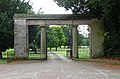 Entrance Gateway, Aston Hall.jpg 640 × 424; 202 KB
-
 Entrance to Chapel House - geograph.org.uk - 3540228.jpg 640 × 480; 130 KB
-

-
 Entrance to Fox Hall - geograph.org.uk - 3568409.jpg 640 × 497; 85 KB
-
 Entrance to Hisland Farm - geograph.org.uk - 3568395.jpg 640 × 480; 87 KB
-

-

-
 Entrance to Middleton Farm - geograph.org.uk - 3540433.jpg 640 × 480; 92 KB
-
 Entrance to Peartree Cottage B^B - geograph.org.uk - 2097543.jpg 640 × 480; 83 KB
-
 Entrance to Rednal Basin, from the north-east - geograph.org.uk - 5183151.jpg 1,024 × 768; 189 KB
-
 Entrance to Rednal Basin, from the south-east - geograph.org.uk - 5183148.jpg 1,024 × 768; 215 KB
-
 Entrance to Rockwood - geograph.org.uk - 1858961.jpg 1,024 × 768; 257 KB
-
 Entrance to Tankard Hall from B4396 - geograph.org.uk - 3232604.jpg 640 × 426; 61 KB
-

-
 Entrance to track to Panthir - geograph.org.uk - 3540158.jpg 640 × 480; 94 KB
-
 Entrance to Treflach Farm - geograph.org.uk - 3539793.jpg 640 × 480; 104 KB
-

-
 Entrance to Woodland View - geograph.org.uk - 3539809.jpg 640 × 480; 102 KB
-
 Entrance to Woolston House - geograph.org.uk - 3568411.jpg 640 × 480; 58 KB
-
 Entry to basin (now derelict) - geograph.org.uk - 2087936.jpg 640 × 480; 77 KB
-
 Evening at Maesbury Marsh - geograph.org.uk - 2934578.jpg 1,600 × 1,078; 494 KB
-
 Evening over Craig-y-Rhiw - geograph.org.uk - 1862217.jpg 640 × 480; 81 KB
-
 Farm buildings at Bromwich Park - geograph.org.uk - 3568404.jpg 640 × 480; 60 KB
-
 Farm on Albridge Lane - geograph.org.uk - 3014977.jpg 640 × 451; 64 KB
-
 Farm track off Bwlch Lane - geograph.org.uk - 4620522.jpg 640 × 422; 93 KB
-
 Farmland at Wootton House - geograph.org.uk - 2289104.jpg 640 × 480; 68 KB
-
 Farmland north of Woolston - geograph.org.uk - 5183876.jpg 1,024 × 768; 223 KB
-

-
 Field above the Shropshire Plain - geograph.org.uk - 6298373.jpg 4,032 × 3,024; 2.44 MB
-
 Field by the A5 - geograph.org.uk - 3263136.jpg 3,872 × 2,592; 4.77 MB
-

-
 Field entrance - geograph.org.uk - 1858932.jpg 1,024 × 768; 176 KB
-
 Field entrance - geograph.org.uk - 1858984.jpg 1,024 × 768; 169 KB
-
 Field near Moelydd Uchaf, 1988 - geograph.org.uk - 5771556.jpg 1,024 × 683; 179 KB
-

-
 Field off Penylan Lane near Oswestry - geograph.org.uk - 2789730.jpg 640 × 480; 86 KB
-
 Field with a pool, Maesbury Marsh - geograph.org.uk - 5183898.jpg 1,024 × 768; 201 KB
-
 Field, Aston - geograph.org.uk - 4294900.jpg 800 × 533; 321 KB
-
 Field, Morton - geograph.org.uk - 5238156.jpg 1,024 × 683; 314 KB
-
 Final jobs nearly completed - geograph.org.uk - 601687.jpg 640 × 480; 136 KB
-
 Fingerpost and post box at Aston Square - geograph.org.uk - 6060431.jpg 4,000 × 3,000; 2.84 MB
-

-
 Flat farmland - geograph.org.uk - 4468151.jpg 640 × 426; 41 KB
-
 Flat Shropshire landscape - geograph.org.uk - 4468173.jpg 640 × 426; 41 KB
-
 Footbridge over the River Morda - geograph.org.uk - 532756.jpg 640 × 480; 134 KB
-
 Footpath across the field - geograph.org.uk - 2789736.jpg 640 × 480; 114 KB
-
 Footpath along a street in Trefonen - geograph.org.uk - 2332639.jpg 640 × 480; 75 KB
-

-
 Footpath to Wootton Farm - geograph.org.uk - 5870729.jpg 851 × 1,280; 313 KB
-
 Footpath under an arbour of Laurel - geograph.org.uk - 2332729.jpg 640 × 480; 171 KB
-
 Ford at Trefonen Hall - geograph.org.uk - 4041486.jpg 3,872 × 2,592; 4.86 MB
-
 Frosted fields, Maesbury - geograph.org.uk - 5238169.jpg 1,024 × 683; 199 KB
-
 Fully restored crane at Maesbury - geograph.org.uk - 4945820.jpg 3,264 × 2,448; 3.58 MB
-
 Gate at T junction at Fox Hall - geograph.org.uk - 3568400.jpg 640 × 471; 74 KB
-
 Gated footbridge near Trefonen - geograph.org.uk - 2332653.jpg 640 × 480; 118 KB
-

-
 Generator field - geograph.org.uk - 4954186.jpg 3,264 × 2,448; 3.71 MB
-
 Ghost gates on Offa's Dyke Path - geograph.org.uk - 2059364.jpg 640 × 480; 139 KB
-
 Green pastures - geograph.org.uk - 1858952.jpg 1,024 × 768; 197 KB
-
 Gronwen Wharf - geograph.org.uk - 2934698.jpg 640 × 480; 70 KB
-
 Gronwyn Wharf, Montgomery Canal - geograph.org.uk - 5183913.jpg 1,024 × 768; 130 KB
-
 Hard to believe this is only 3 years old - geograph.org.uk - 1920648.jpg 1,600 × 1,071; 414 KB
-
 Heading out of Trefonen - geograph.org.uk - 6277943.jpg 5,184 × 3,888; 2.67 MB
-
 Heading out of Trefonen - geograph.org.uk - 6364136.jpg 5,184 × 3,888; 4.5 MB
-
 Highland cattle on Aston Hall Estate - geograph.org.uk - 1875259.jpg 640 × 480; 123 KB


_-_Middleton_Road_overbridge_-_geograph.org.uk_-_2248778.jpg)


_-_geograph.org.uk_-_1860169.jpg)


_-_geograph.org.uk_-_2087936.jpg)


