Category:Ortskapelle hl. Veit, Rosenau Dorf
Jump to navigation
Jump to search
| Object location | | View all coordinates using: OpenStreetMap |
|---|
building in Zwettl, Austria  | |||||
| Upload media | |||||
| Instance of | |||||
|---|---|---|---|---|---|
| Location | Zwettl, Zwettl District, Lower Austria, Austria | ||||
| Heritage designation | |||||
 | |||||
Media in category "Ortskapelle hl. Veit, Rosenau Dorf"
The following 3 files are in this category, out of 3 total.
-
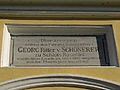 Ortskapelle hl. Veit in Rosenau Dorf - Detail.jpg 3,648 × 2,736; 1.73 MB
-
 Ortskapelle hl. Veit in Rosenau Dorf II.jpg 3,648 × 2,736; 2.39 MB
-
 Ortskapelle hl. Veit in Rosenau Dorf.jpg 3,648 × 2,736; 2.35 MB

