Category:OpenStreetMap maps of Europe
Jump to navigation
Jump to search
Subcategories
This category has the following 48 subcategories, out of 48 total.
A
- OpenStreetMap maps of Armenia (12 F)
B
C
- OpenStreetMap maps of Cyprus (12 F)
D
E
F
G
- OpenStreetMap maps of Georgia (20 F)
H
I
K
L
- OpenStreetMap maps of Latvia (13 F)
- OpenStreetMap maps of Luxembourg (46 F)
M
- OpenStreetMap maps of Malta (3 F)
- OpenStreetMap maps of Moldova (17 F)
N
P
R
- OpenStreetMap maps of Romania (90 F)
S
- OpenStreetMap maps of San Marino (11 F)
T
U
V
Media in category "OpenStreetMap maps of Europe"
The following 23 files are in this category, out of 23 total.
-
 Capture d’écran 2023-04-01 page openstreetmap.org.png 1,920 × 919; 2.36 MB
-
 Europe-NorthAfrica map.png 853 × 791; 1.08 MB
-
 Events map Discourse.png 755 × 589; 832 KB
-
 Iskander-Kaliningrad-Crimea-Khmeimim.png 602 × 645; 152 KB
-
 Karlsruhe Letzte Reise.jpg 1,380 × 631; 156 KB
-
 Mapper4SDG.png 900 × 523; 432 KB
-
 Markers4Map 2 Map with markers.png 864 × 704; 889 KB
-
 Markers4Map 3 Map popups.png 864 × 703; 851 KB
-
 Markers4Map 4 Select Geolocation.png 1,132 × 478; 595 KB
-
 Olc-beispiel.png 570 × 782; 297 KB
-
 OpenSeaMap Dephts by crowdsourcing EU 17-03-25.jpg 1,249 × 832; 320 KB
-
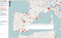
 OpenSeaMap-ChartBundleArea-Adria-2016-05.png 668 × 531; 345 KB
-
 OpenStreetBugs.png 1,280 × 800; 475 KB
-
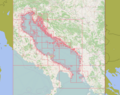
 OSM 2023 Black Sea.png 1,806 × 1,188; 2.33 MB
-
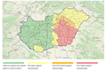
 OSM name data for Sweden.png 1,301 × 858; 431 KB
-
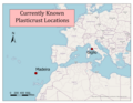 PlasticrustLocationsGeneral.png 3,300 × 2,550; 987 KB
-
 Pytheas itineraire.png 547 × 657; 228 KB
-
 Radio România Actualități AM coverage.png 1,070 × 1,018; 1.24 MB
-
 Reisen der Hochdeutschen Hofcomödianten 1693–1712.jpg 1,344 × 1,036; 292 KB
-
 Reisen der Hochdeutschen Hofcomödianten.png 1,852 × 2,017; 5.31 MB
-
-

-
 WIWOSM-map-12,30,50,65.png 3,000 × 3,000; 2.5 MB


