Category:Olive Mount cutting
Jump to navigation
Jump to search
| Object location | | View all coordinates using: OpenStreetMap |
|---|
railway cutting on the Liverpool-Manchester line in England .JPG) | |||||
| Upload media | |||||
| Instance of | |||||
|---|---|---|---|---|---|
| Location |
| ||||
| Owned by | |||||
| Date of official opening |
| ||||
 | |||||
Subcategories
This category has the following 3 subcategories, out of 3 total.
Media in category "Olive Mount cutting"
The following 20 files are in this category, out of 20 total.
-

-
 Along Olive Mount cutting 1.jpg 5,184 × 3,456; 9.06 MB
-
 Along Olive Mount cutting 2.jpg 5,184 × 3,456; 8.09 MB
-
 Charter train passes through Olive Mount Cutting - geograph.org.uk - 2905324.jpg 683 × 1,024; 193 KB
-
 Mill Lane bridge from Rathbone Road bridge 1.jpg 4,592 × 3,728; 9.81 MB
-
 Mill Lane bridge from Rathbone Road bridge 2.jpg 4,864 × 3,448; 6.93 MB
-
 Mill Lane bridge from Sturdee Road bridge.jpg 3,584 × 2,616; 5.31 MB
-
 Mill Lane bridge from under Rathbone Road bridge.jpg 4,904 × 3,640; 8.92 MB
-
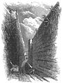 Olive Mount Cutting (Percival Skelton).jpg 403 × 529; 114 KB
-
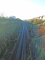
 Olive Mount cutting - 2014-02-09.JPG 4,608 × 3,456; 3.46 MB
-
 Olive Mount Cutting - geograph.org.uk - 1528795.jpg 640 × 480; 85 KB
-
 Olive Mount Cutting from Mill Lane bridge 1.jpg 5,152 × 3,864; 8.59 MB
-
 Olive Mount Cutting from Mill Lane bridge 2.jpg 3,864 × 5,152; 9.34 MB
-
 Olive Mount cutting from Rathbone Road bridge.jpg 4,759 × 3,338; 17.03 MB
-
 Olive Mount cutting from Sturdee Road bridge.jpg 3,864 × 5,152; 9.89 MB
-
 Olive Mount railway cutting, Liverpool (1).JPG 4,320 × 3,240; 4.76 MB
-
 Olive Mount railway cutting, Liverpool (2).JPG 4,320 × 3,240; 4.73 MB
-

-
 Sturdee Road bridge from Mill Lane bridge.jpg 5,152 × 3,864; 11.02 MB
-
 The lost chord is re-opened - geograph.org.uk - 1527450.jpg 640 × 426; 86 KB


.jpg)


.JPG)


