Category:Old maps with Mercator projection
Jump to navigation
Jump to search
Subcategories
This category has only the following subcategory.
Media in category "Old maps with Mercator projection"
The following 18 files are in this category, out of 18 total.
-
 1794 Samuel Dunn Wall Map of the World in Hemispheres - Geographicus - World2-dunn-1794.jpg 6,000 × 5,054; 8.92 MB
-

-
 1801 Cary Map of the World on Mercator Projection - Geographicus - WorldMerc-cary-1801.jpg 5,000 × 4,451; 7.15 MB
-

-
 Beers Ulster County Atlas Page006-007.jpg 6,997 × 4,681; 6.92 MB
-
 Carl Christian Franz Radefeld, Welt karte in Mercators projektion (FL147409163 2725559).jpg 3,818 × 3,096; 11.26 MB
-
 Carte générale des grandes communications télégraphiques du monde.jpg 7,265 × 5,119; 34.73 MB
-
-
 Flammarion - La planète Mars, Tome 1-f185.jpg 2,394 × 1,238; 948 KB
-
 Flammarion - La planète Mars, Tome 2-f113.jpg 1,360 × 868; 425 KB
-
 Mercator 1569.png 1,158 × 737; 811 KB
-

-
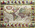
 Nova-totius-terrarum-orbis-geographica-ac-hydrographica-tabula.jpg 3,639 × 2,504; 13.02 MB
-
 Samuel Dunn, A new chart of the world (FL147409185 2725572).jpg 3,360 × 2,470; 9.36 MB
-
 Samuel John Neele, The world on mercators projection (FL147409218 2725603).jpg 3,396 × 2,329; 7.85 MB
-
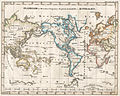 StielerWorld.jpeg 2,798 × 2,233; 964 KB
-

-
 Willem Blaeu - Nova totius terrarum orbis geographica ac hydrographica tabula.png 6,569 × 4,936; 78.53 MB


.jpg)


.jpg)
.jpg)

_-_2_foldout_map_The_Platt_of_Sayling_-_1_full_view.png)
