Category:Old maps of the Northern hemisphere
Jump to navigation
Jump to search
Subcategories
This category has only the following subcategory.
M
Media in category "Old maps of the Northern hemisphere"
The following 26 files are in this category, out of 26 total.
-
 Gerard de Jode 1593 Map Northern hemisphere.jpg 3,795 × 4,600; 3.13 MB
-
 Map - Special Collections University of Amsterdam - OTM- HB-KZL 31-02-47.tif 7,503 × 6,259; 134.36 MB
-
 Map - Special Collections University of Amsterdam - OTM- HB-KZL 31-02-43.tif 7,303 × 6,277; 131.15 MB
-
 Map - Special Collections University of Amsterdam - OTM- HB-KZL 31-02-44.tif 7,320 × 6,659; 139.46 MB
-
 Map - Special Collections University of Amsterdam - OTM- HB-KZL 31-02-45.tif 7,730 × 6,687; 147.89 MB
-
 Map - Special Collections University of Amsterdam - OTM- HB-KZL 31-02-46.tif 7,653 × 6,633; 145.23 MB
-
 Map - Special Collections University of Amsterdam - OTM- HB-KZL 31-02-48.tif 7,779 × 6,621; 147.36 MB
-
 1799 Clement Cruttwell Map of North Pole - Geographicus - NorthPole-cruttwell-1799.jpg 3,500 × 3,289; 2.71 MB
-
-

-
 69 of 'Eclectic Physical Geography' (11200743056).jpg 1,308 × 2,066; 761 KB
-
-
-
 93 of 'Eclectic Physical Geography' (11202003375).jpg 1,315 × 2,066; 762 KB
-

-
-
 Emisfero terrestre settentrionale (13605743014).jpg 2,500 × 1,964; 2.19 MB
-
 Emisfero terrestre settentrionale (14251165728).jpg 2,500 × 1,850; 1.69 MB
-
 Hemisphere Septentrional pour voir plus distinctement les Terres Arctiques (12326436644).jpg 1,987 × 2,000; 2.01 MB
-
 Nieuw Aerdsch Pleyn - CBT 5870830.jpg 5,428 × 4,760; 8.74 MB
-

-
 Nuova Carta Del Polo Artico secondo l'ultime osservazioni.jpg 8,640 × 7,533; 11.07 MB
-
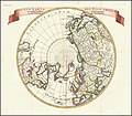
 Tabula Geographica Hemisphaerii Borealis ad emenatiora quae adhuc prodierunt exampla jusqu.jpg 10,302 × 8,666; 16.36 MB
-
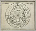 Terres Arctiques (13903409499).jpg 2,345 × 2,000; 1.82 MB
-

-
 World map detail, Die Obere Oder Nördliche Halbkugel Der Erde (cropped).jpg 7,200 × 7,699; 8.89 MB


%27_(11068817654).jpg)
.jpg)
.jpg)
.jpg)
.jpg)


.jpg)
.jpg)
.jpg)

.jpg)


.jpg)

.jpg)