Category:Old maps of the Eastern Mediterranean
Jump to navigation
Jump to search
English: This category collects old maps that show only the Eastern part of the Mediterranean Sea (between Italy and the Levante). This includes (from northwest to east) the Adriatic Sea, the Ionian Sea, the Libyan Sea, the Aegean Sea, the Sea of Marmara, the Levantine Sea and the Cilician Sea.
Incomplete maps (like cut-off double pages) should be categorized according to the full content of the original map, unless it is a deliberate crop.
Incomplete maps (like cut-off double pages) should be categorized according to the full content of the original map, unless it is a deliberate crop.
Subcategories
This category has the following 10 subcategories, out of 10 total.
A
C
O
Media in category "Old maps of the Eastern Mediterranean"
The following 7 files are in this category, out of 7 total.
-
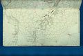
 1375 Atlas Catalan, Eastern Mediterranean 01.jpg 1,454 × 1,558; 1.25 MB
-
-
 Amalfi Coast viewed from the Tyrrhenian Sea 89.jpg 1,152 × 864; 214 KB
-
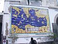
 Book of Roger MS. Greaves 42 176b.jpg 1,000 × 714; 654 KB
-

-
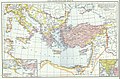 Droysen - Oströmisches Reich.jpg 3,025 × 2,000; 1.09 MB
-
 Insularium Illustratum (Additional MS 15760, ff.47v-48r).jpeg 7,767 × 5,655; 46.49 MB


.jpeg)

.jpeg)