Category:Old maps of cities in Sweden
Jump to navigation
Jump to search
Subcategories
This category has the following 40 subcategories, out of 40 total.
- Maps from Wiblingen Atlas (149 F)
A
- Old maps of Arboga (4 F)
- Old maps of Askersund (5 F)
B
- Old maps of Borås (3 F)
E
- Old maps of Enköping (4 F)
F
- Old maps of Falköping (5 F)
- Old maps of Falun (3 F)
- Old maps of Filipstad (4 F)
G
- Old maps of Gävle (9 F)
H
- Old maps of Haparanda (3 F)
- Old maps of Härnösand (4 F)
J
- Old maps of Jönköping (4 F)
K
- Old maps of Kalmar (9 F)
- Old maps of Karlstad (7 F)
- Old maps of Kristianstad (8 F)
L
- Old maps of Linköping (7 F)
M
- Maps from Ljunggren Atlas (101 F)
- Maps from Werming Atlas (43 F)
N
- Old maps of Norrköping (7 F)
- Old maps of Nyköping (8 F)
O
- Old maps of Karlskrona (11 F)
U
- Old maps of Uddevalla (4 F)
- Old maps of Ulricehamn (5 F)
- Old maps of Umeå (30 F)
V
- Old maps of Vadstena (5 F)
- Old maps of Vänersborg (8 F)
- Old maps of Västervik (3 F)
- Old maps of Västerås (5 F)
- Old maps of Växjö (4 F)
Y
- Old maps of Ystad (7 F)
Ö
- Old maps of Örebro (1 F)
- Old maps of Östhammar (4 F)
Media in category "Old maps of cities in Sweden"
The following 64 files are in this category, out of 64 total.
-

-

-

-
 Alingsås, situationsplan, Nordisk familjebok.png 2,024 × 1,863; 342 KB
-

-
 Arkeologi - Rekonstruktionsritning av staden Nya Lodose.JPG 1,067 × 681; 228 KB
-
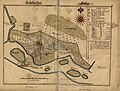
 Borgholm, situationsplan, Nordisk familjebok.png 1,432 × 1,473; 201 KB
-

-
-

-

-
 Karta över Karlshamn, NF.png 629 × 1,052; 85 KB
-
 Karta över Karlskrona vid 1900-talets början.png 801 × 1,191; 162 KB
-
 Karlstad.jpg 1,832 × 2,776; 744 KB
-
 Katrineholm (1924).png 3,158 × 2,605; 214 KB
-

-
 Kungsboken-karta-karlshamn.jpg 5,029 × 6,298; 1.66 MB
-
-

-

-

-

-
 Lidköping Map - Nordisk familjebok.png 360 × 434; 51 KB
-
 Lidköping 1906.jpg 1,980 × 1,379; 927 KB
-
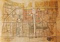
 Ludvika 1925.jpg 778 × 1,252; 344 KB
-
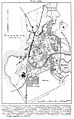
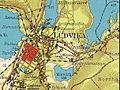 Ludvika 1929.jpg 606 × 455; 189 KB
-

-

-
 Situationsplan af Lund, Nordisk familjebok.png 2,979 × 3,435; 919 KB
-

-
 Map Engelholm Sweden.jpg 811 × 1,968; 2.06 MB
-
 Map Karlshamn Sweden.jpg 907 × 2,866; 2.68 MB
-
 Map Laholm Sweden.jpg 1,118 × 1,987; 2.59 MB
-
 Map of old Skelleftea.jpg 6,678 × 5,070; 10.1 MB
-
 Map Ronneby Sweden.jpg 954 × 1,328; 1.14 MB
-
 Map Solvesborg Sweden.jpg 1,113 × 1,740; 2.26 MB
-
-

-

-

-

-

-
 Skanör med falsterbo.png 753 × 1,035; 79 KB
-

-
 Skellugglanhallman.jpg 545 × 476; 173 KB
-

-

-

-
 Söderhamn 1919.png 780 × 505; 90 KB
-
 Söderhamn 1876.jpg 1,668 × 1,054; 562 KB
-
-

-

-

-
 Trelleborg 1930.png 1,203 × 770; 198 KB
-

-
 Karta över Uddevalla under tidigt 1900-tal.png 766 × 524; 53 KB
-

-
 Karta över Varberg (ur Nordisk familjebok).jpg 781 × 656; 158 KB
-
 Karta över Viborg under tidigt 1900-tal.png 782 × 1,150; 129 KB
-

-
 Vänersborg 1834.jpg 1,881 × 1,197; 531 KB
-

-

.jpg)
.jpg)
.jpg)

.jpg)


.jpg)
.jpg)
.jpg)


.png)
.jpg)

.jpg)
.jpg)
.jpg)
.jpg)
.jpg)


.jpg)
.jpg)

.jpg)


.jpg)
.jpg)
.jpg)
.jpg)
.jpg)
.jpg)

.jpg)

.jpg)
.jpg)
.jpg)


.jpg)
.jpg)
.jpg)
.jpg)

.jpg)

.jpg)
.jpg)

%27_(11174718844).jpg)

.jpg)
.jpg)
.jpg)