Category:Old maps of cities in Ohio
Jump to navigation
Jump to search
States of the United States: Alabama · Alaska · Arizona · Arkansas · California · Colorado · Connecticut · Delaware · Florida · Georgia · Hawaii · Idaho · Illinois · Indiana · Iowa · Kansas · Kentucky · Louisiana · Maine · Maryland · Massachusetts · Michigan · Minnesota · Mississippi · Missouri · Montana · Nebraska · Nevada · New Hampshire · New Jersey · New Mexico · New York · North Carolina · North Dakota · Ohio · Oklahoma · Oregon · Pennsylvania · Rhode Island · South Carolina · South Dakota · Tennessee · Texas · Utah · Vermont · Virginia · Washington · West Virginia · Wisconsin · Wyoming
Subcategories
This category has the following 131 subcategories, out of 131 total.
A
B
C
- Old maps of Canfield, Ohio (4 F)
D
E
- Old maps of Euclid, Ohio (1 F)
F
G
- Old maps of Greenville, Ohio (empty)
H
I
J
K
L
- Old maps of Lakewood, Ohio (1 F)
M
N
O
P
- Old maps of Parma, Ohio (8 F)
R
S
T
U
V
W
- Old maps of Waterville, Ohio (3 F)
X
Y
Z
Media in category "Old maps of cities in Ohio"
The following 37 files are in this category, out of 37 total.
-
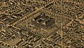 1872 Birds Eye View of Columbus Ohio by Bailey LC (cropped).jpg 1,990 × 1,147; 304 KB
-
 1872 Birds Eye View of Columbus Ohio by Bailey LC.jpg 11,360 × 7,064; 7.78 MB
-
 412 of 'History of Knox County, Ohio ... Illustrated' (11145671996).jpg 1,946 × 2,601; 1.16 MB
-
 Ashtabula Harbor, Ohio 1896. LOC 75694910.tif 9,008 × 6,448; 166.18 MB
-
 Bellevue, Ohio, Sandusky & Huron counties 1888. LOC 75694913.jpg 9,384 × 5,608; 11.09 MB
-
 Bird's eye view of Norwalk, Huron County, Ohio 1870. LOC 73694514.jpg 8,312 × 6,288; 13.8 MB
-
 Bird's eye view of the city of Mount Vernon, Knox County, Ohio 1870. LOC 73694512.jpg 7,936 × 6,976; 13.69 MB
-
 Bird's eye view of Warren, Trumbull County, Ohio 1870. LOC 73694519.jpg 8,408 × 6,576; 14.32 MB
-
 Bird's-eye-view of the city of Sandusky, Erie County, Ohio 1870. LOC 73694516.jpg 8,656 × 6,992; 15.74 MB
-
 Birds eye view of Columbus, Ohio LOC 84690606.jpg 11,360 × 7,064; 16.66 MB
-

-
 Bowling Green, Ohio 1888. LOC 75696644.jpg 8,752 × 5,664; 10.96 MB
-
 Cambridge, Ohio 1899 LOC gm71005373.jpg 10,384 × 6,384; 17.63 MB
-
 Canal Dover, Tuscarawas County, Ohio 1899. LOC gm71005335.jpg 9,224 × 6,528; 18.14 MB
-
 City of Lima, O. 1892. LOC 75694921.jpg 12,384 × 9,152; 23.37 MB
-
 Conneaut, Ohio 1896 LOC gm71005332.jpg 9,216 × 6,384; 12.94 MB
-
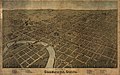
 Dayton, Ohio 1870. LOC 73694508.jpg 9,584 × 6,912; 16.91 MB
-
 Findlay, Ohio, the Gas City. LOC 75694919.jpg 10,544 × 6,784; 16.71 MB
-
 Galion, Ohio, 1891 LOC 2008626631.jpg 16,868 × 12,304; 32.06 MB
-
 Galion, Ohio, 1891 LOC 2010587910.jpg 14,103 × 10,151; 25.94 MB
-
 Lakeside summer resort and camp ground, near Sandusky, Ohio. LOC 75694920.jpg 7,840 × 6,368; 13.03 MB
-
 Lancaster, Ohio (2674659766).jpg 2,000 × 1,566; 2.84 MB
-
 Map of Grand River Harbor, Ohio - NARA - 112061566.jpg 5,100 × 7,206; 1.99 MB
-
 Map of the City of Portsmouth and Wayne Township, Scioto County, Ohio LOC 2016586531.jpg 17,345 × 11,044; 23.95 MB
-
 Map of the City of Portsmouth and Wayne Township, Scioto County, Ohio LOC 2016586531.tif 17,345 × 11,044; 548.05 MB
-
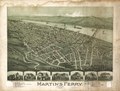 Martin's Ferry, Ohio 1899 LOC gm71005336.tif 8,272 × 6,280; 148.63 MB
-
 Mingo Junction, Ohio 1899. LOC 75694925.jpg 7,360 × 4,600; 7.52 MB
-
 Original Map Norwood Ohio Founded 1888.jpg 6,294 × 8,366; 11.59 MB
-
 Panoramic view of the city of Niles, Trumbull Co., Ohio 1882. LOC 73694513.jpg 7,813 × 5,334; 7.54 MB
-
 Scio, Harrison County, Ohio 1899. LOC 75694928.jpg 7,872 × 5,248; 11.04 MB
-
 Scio, Harrison County, Ohio. LOC 75694929.jpg 7,824 × 5,024; 7.69 MB
-
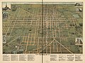
 Sixth ward of Akron, formerly Middlebury, Summit Co., Ohio 1882. LOC 73694504.jpg 5,520 × 3,992; 4.52 MB
-
 The Street railway journal (1906) (14574540870).jpg 3,092 × 2,258; 1.2 MB
-
 Toronto, Ohio 1899. LOC gm71005371.jpg 10,592 × 6,624; 13.95 MB
-
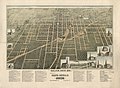
 TownplotpfAkron.jpg 757 × 890; 302 KB
-
 View of Columbus O. From Capitol University.png 13,796 × 8,091; 139.82 MB
-
 Woodsfield, Monroe County, Ohio, 1899 LOC 86691591.jpg 7,313 × 5,136; 7.43 MB
.jpg)

.jpg)


.jpg)


_(14574540870).jpg)


