Category:Old maps of West Prussia
Jump to navigation
Jump to search
Deutsch: Karten von Westpreußen, die älter als 70 Jahre sind.
English: Maps of West Prussia older than 70 years.
Subcategories
This category has the following 2 subcategories, out of 2 total.
M
- Maps by Max Toeppen (6 F)
N
- Old maps of Netzedistrict (6 F)
Media in category "Old maps of West Prussia"
The following 26 files are in this category, out of 26 total.
-

-
 Ost- und Westpreussen.jpg 4,670 × 3,209; 6.63 MB
-
 Löbau on a map of West Prussia and East Prussia.jpg 1,597 × 1,241; 748 KB
-
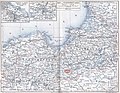
 Westpreußen und DanzigerBucht.png 998 × 860; 1,003 KB
-
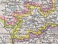
 Kreis Danziger Höhe 1878.jpg 297 × 323; 80 KB
-
 Kreis Deutsch Krone bis 1806.jpg 1,002 × 1,251; 488 KB
-
 Kreis Deutsch Krone bis 1945.jpg 755 × 564; 325 KB
-
 Kreis Dirschau 1772.jpg 1,115 × 1,105; 489 KB
-
 Kreis Dirschau 1887.jpg 350 × 407; 118 KB
-
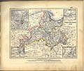
 Karte der Provinz Preußen.png 3,517 × 2,795; 12.02 MB
-
 Kreis Karthaus 1818.jpg 654 × 578; 261 KB
-
 Kreis Schwetz im Regierungs-Bezirke Marienwerder 1879.jpg 10,543 × 10,369; 46.28 MB
-
 Map of Christburg center.jpg 600 × 446; 83 KB
-
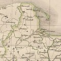
 Kreis Marienburg 1818.jpg 442 × 421; 155 KB
-
 Meyer‘s Zeitungsatlas 027 – Provinz West-Preussen.jpg 7,344 × 6,231; 16.43 MB
-
 Nakel - 35-53.jpg 3,079 × 4,991; 3.01 MB
-
 Kreis Neustadt in Westpreußen 1818.jpg 666 × 621; 260 KB
-
 Kreis Neustadt in Westpreußen 1878.jpg 589 × 532; 229 KB
-
 Ost und Westpreußen.jpg 1,597 × 1,241; 751 KB
-
 OstpreussenWestpreussenSprachen1880.png 491 × 387; 42 KB
-
 Karte ostbahn-A.jpg 2,479 × 1,393; 1.37 MB
-
 Kreis Putzig 1878.jpg 527 × 345; 61 KB
-
 Kreis Preußisch Stargard 1818.jpg 550 × 521; 192 KB
-
 Kreis Stargard 1772.jpg 1,215 × 1,257; 577 KB
-
 Thorn - 36-53.jpg 3,094 × 4,986; 2.97 MB
-
 West-Preussen - entworfen und gezeichnet von F. Handtke - btv1b530253427.jpg 12,236 × 7,484; 16.68 MB
.jpg)


