Category:Old maps of Tuvalu
Jump to navigation
Jump to search
Media in category "Old maps of Tuvalu"
The following 6 files are in this category, out of 6 total.
-
 TROOST(1829) p405 Platte Grond van het Nederlandsch-Eiland.jpg 3,775 × 2,553; 3.37 MB
-
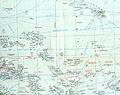
 TURNER(1884) MAP OF THE TOKELU, ELLICE AND GILBERT ISLANDS.jpg 2,003 × 1,265; 892 KB
-

-
 Map of Funafuti.jpg 853 × 854; 60 KB
-
 USA-P-Gilberts-I.jpg 805 × 635; 162 KB
-
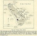 Vaitupu ellice islands.jpg 636 × 625; 141 KB
_p405_Platte_Grond_van_het_Nederlandsch-Eiland.jpg)
_MAP_OF_THE_TOKELU,_ELLICE_AND_GILBERT_ISLANDS.jpg)
.jpg)


