Category:Old maps of Tasmania
Jump to navigation
Jump to search
Subcategories
This category has the following 3 subcategories, out of 3 total.
1
- Tasman map (14 F)
- 19th-century maps of Tasmania (35 F)
M
Media in category "Old maps of Tasmania"
The following 28 files are in this category, out of 28 total.
-
 AMH-7220-KB Map showing the route taken by Abel Tasman.jpg 2,400 × 1,580; 534 KB
-
 Furneaux Benard Terre de V Diemen 1778.tif 1,705 × 2,563; 9.43 MB
-
 1798 map of Norfolk bay Frederick Henry Bay (matthew flinders).png 595 × 420; 287 KB
-
 Smooth Island - 1863 survey 1.png 1,647 × 2,548; 225 KB
-
 The Harmsworth atlas and Gazetter 1908 (135852565).jpg 9,568 × 12,365; 114.71 MB
-

-
 Admiralty Chart No 3090 Pavilion Point to Dowsing Point, Published 1899, Large Corrections 1958.jpg 13,667 × 14,496; 66.74 MB
-
 Admiralty Chart No 3410 Bathurst Channel Sheet 1, Published 1928, Corrections Copyright 1963.jpg 16,368 × 11,287; 62.64 MB
-
 Admiralty Chart No 3411 Bathurst Channel Sheet 2, Published 1928, Corrections 1963.jpg 16,400 × 11,352; 78.04 MB
-
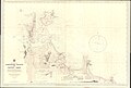 Admiralty Chart No 3687 Albatross Island to Rocky Cape, Published 1916, Large Corrections 1953.jpg 16,297 × 11,058; 38.36 MB
-
 Admiralty Charts No 3410 3411 Bathurst Channel Composite, Published 1928, Corrections Copyright 1963.jpg 19,238 × 11,438; 80.15 MB
-
-

-

-
 Burgerzaal - Australië.JPG 3,264 × 2,448; 1.62 MB
-
 Carte De La Terre Van-Diemen.jpg 4,853 × 3,222; 3.6 MB
-
 Early history of tasmania (Flinders map of Norfolk Bay).jpg 2,561 × 2,089; 1.2 MB
-
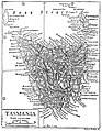 EB1911 Tasmania.jpg 1,064 × 1,364; 350 KB
-
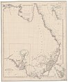
 EB9 Tasmania.png 2,765 × 3,605; 13.02 MB
-
 Freycinet, 1812.jpg 1,898 × 1,974; 1,011 KB
-
 Map of D'Entrecasteaux 1793.png 1,253 × 836; 1.24 MB
-
 Map of Pembroke County (Tasmania) 1886.png 514 × 467; 444 KB
-
 Map of Tasmania (Last of the Tasmanians).png 2,966 × 3,104; 440 KB
-
 Navigantium atque itinerantium bibliotheca Fleuron N010532-15.png 2,204 × 1,673; 122 KB
-
 Tasmania southern coast 1916.jpg 369 × 304; 69 KB
-
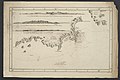
 Thomas Scott's map of Norfolk Bay and Frederick Henry Bay, 1824.jpg 858 × 516; 260 KB
-
 Tourist map of Tasmania (15208803451).jpg 6,190 × 8,302; 5.92 MB
-
 Van Diemen's Land (15202418751).jpg 4,001 × 4,961; 1.57 MB

.png)

.jpg)


.jpg)
.jpg)


.jpg)


_1886.png)
.png)


.jpg)
.jpg)