Category:Old maps of Schouwen-Duiveland
Jump to navigation
Jump to search
| NO WIKIDATA ID FOUND! Search for Old maps of Schouwen-Duiveland on Wikidata | |
| Upload media |
Media in category "Old maps of Schouwen-Duiveland"
The following 17 files are in this category, out of 17 total.
-
 Heerlijkheid Oosterland.jpg 1,028 × 1,403; 290 KB
-

-

-
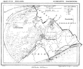
 1857 Schouwen Duiveland 72dpi.jpg 4,120 × 2,268; 7.73 MB
-
 Bruinisse Kuyper.jpg 2,426 × 2,671; 4.83 MB
-

-
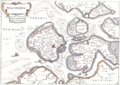
 Brouwershaven 1560.jpg 2,541 × 3,501; 5.97 MB
-
 Brouwershaven 1613 Guicciardini copy.jpg 2,533 × 2,025; 2.33 MB
-
 Haamstede 1865.gif 3,056 × 2,538; 788 KB
-
-
 Map of Walcheren 1660.gif 500 × 356; 55 KB
-
 Plattegrond van J.v.Deventer - Brouwershaven - 20044146 - RCE.jpg 1,200 × 869; 168 KB
-
 Schouwen 1753.jpg 4,638 × 2,492; 10.3 MB
-
 Schouwen Duiveland 1664 Blaeu HR.JPG 7,628 × 6,625; 12.14 MB
-
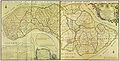 Schouwen Duiveland 1752 Hattinga².jpg 5,786 × 2,960; 21.8 MB
-
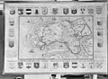
 Schouwen-Duiveland 1650 Comitatus Zelandiae.jpg 967 × 537; 287 KB
-
 Walcheren 1696.jpg 1,282 × 895; 173 KB

,_RP-P-AO-15-17-1.jpg)
,_RP-P-AO-15-17-2.jpg)


