Category:Old maps of Pearl River
Jump to navigation
Jump to search
Media in category "Old maps of Pearl River"
The following 21 files are in this category, out of 21 total.
-
 Admiralty Chart No 1740 Canton River Sheet 3, Published 1930.jpg 10,928 × 16,090; 49.78 MB
-
 Admiralty Chart No 1741 Chu Kiang or Canton River Sheet 1, Published 1908, New Edition 1950.jpg 11,003 × 16,179; 35.48 MB
-
 Canton to Bocca Tigris.jpg 2,580 × 1,442; 1.69 MB
-
 Cantonriver.jpg 779 × 1,000; 100 KB
-

-
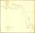 Chart of the Canton River.jpg 2,484 × 2,324; 264 KB
-
 Descripción del Río Tigris desde Canton hasta la Ysla de Lankeet. LOC 91680526.jpg 6,375 × 8,908; 5.76 MB
-
 Descripción del Río Tigris desde Canton hasta la Ysla de Lankeet. LOC 91680526.tif 6,375 × 8,908; 162.47 MB
-
 Map of Canton River.jpg 1,732 × 1,509; 266 KB
-
 Plan of the channel from Lintin to the Bocca Tigris LOC 88691800.jpg 5,082 × 7,444; 4.09 MB
-
 Plan of the channel from Lintin to the Bocca Tigris LOC 88691800.tif 5,082 × 7,444; 108.23 MB
-
 Plan of the channel from Lintin to the Bocca Tigris LOC 88691802.jpg 5,132 × 7,496; 4 MB
-
 Plan of the channel from Lintin to the Bocca Tigris LOC 88691802.tif 5,132 × 7,496; 110.06 MB
-
 Si Kiang or West River - Canton to Wuchow.jpg 3,574 × 1,016; 317 KB
-
 Survey of Canton River.jpg 2,143 × 1,507; 3.25 MB
-
 The Canton River.tif 4,035 × 2,230; 25.76 MB
-
 The Macao - Bocca Tigris - Canton approach.jpg 898 × 1,046; 773 KB
-
 This chart of the different passages leading to Macao Roads LOC 88691655.jpg 11,162 × 8,337; 8.85 MB
-
 This chart of the different passages leading to Macao Roads LOC 88691655.tif 11,162 × 8,337; 266.24 MB
-
 七省沿海圖-新安至陽江.png 2,748 × 1,024; 4.17 MB
-
 海不揚波圖(珠江口).jpg 4,592 × 2,584; 6.7 MB


