Category:Old maps of Overijssel
Jump to navigation
Jump to search
Provinces of the Netherlands: Drenthe · Friesland · Gelderland · Groningen · North Brabant · North Holland · Overijssel · South Holland · Zeeland
Subcategories
This category has the following 14 subcategories, out of 14 total.
B
- Old maps of Blokzijl (9 F)
D
H
- Hottinger kaarten (92 F)
K
M
O
- Old maps of Ommen (5 F)
S
- Old maps of Steenwijk (5 F)
T
V
- Old maps of Vollenhove (12 F)
Z
- Old maps of Zwartsluis (4 F)
Media in category "Old maps of Overijssel"
The following 44 files are in this category, out of 44 total.
-
 Enschede jvd.jpg 531 × 439; 315 KB
-
 Accuratissima ditionis Sylvae Ducensis tabula - btv1b8469220z.jpg 8,467 × 6,643; 9.3 MB
-
 Blaeu 1645 - Transiselania Dominium vernacule Over-Yssel.jpg 3,577 × 3,053; 4.3 MB
-
 Hasselt 1649 Blaeu.jpg 1,590 × 1,151; 386 KB
-
 Janssonius1658.gif 671 × 502; 356 KB
-

-
 Detailkaart ten Have.png 587 × 359; 485 KB
-

-
 De VII Vereenigde Nederlandsche Provinciën COLLBN Port 3 N 87 - sheet 2.tif 6,807 × 6,365; 123.96 MB
-

-
 Vestingplattegrond van Zwolle Swol (titel op object), RP-T-AO-3-46C.jpg 6,038 × 4,324; 1.58 MB
-
 Hengelo 1900.jpg 3,507 × 2,480; 3.16 MB
-
 Hengelo1900.jpg 382 × 323; 101 KB
-
 De Lichtmis op de topografische kaart van 1934.jpg 505 × 460; 70 KB
-
 Ditio Trans-Isulana auctore Bartholdo Wicheringe. - CBT 6612298.jpg 5,669 × 4,416; 7.6 MB
-
 Hamelant 1700.jpg 1,050 × 970; 1.31 MB
-
 Historische kaart met de locatie van de Windesheimer Korenmolen.jpg 1,677 × 837; 781 KB
-
 Huis Den Doorn.jpg 451 × 334; 143 KB
-
 Jacob van Deventer - Frieslandt.jpg 10,056 × 10,918; 34.07 MB
-
 Landkaarten, Bestanddeelnr 253-6850.jpg 2,379 × 3,413; 3.03 MB
-
 Landkaarten, overzichten, nederduitsch hervormde diaconie, Bestanddeelnr 253-6852.jpg 2,328 × 3,455; 1.48 MB
-
 Landkaarten, vechtdal, Bestanddeelnr 253-6837.jpg 3,473 × 2,367; 2.72 MB
-
 Landkaarten, wegenverbeteringen, zandwegen, Bestanddeelnr 253-6812.jpg 3,516 × 2,354; 3.44 MB
-
 Landkaarten, wegverbeteringen, Bestanddeelnr 253-6801.jpg 2,408 × 3,499; 3.87 MB
-
 NW-Oaveriessel1773.gif 650 × 484; 287 KB
-
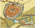 Oostmarsum JVD.jpg 548 × 436; 324 KB
-
 OUDE kaart BLAD 28 AANKOOP ARA DEN HAAG KRT VD L - Unknown - 20468138 - RCE.jpg 1,200 × 900; 171 KB
-
 OUDE kaart BLAD 31 AANKOOP ARA DEN HAAG KRT VD L - Unknown - 20468142 - RCE.jpg 1,200 × 900; 149 KB
-
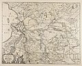
 Overijssel 1757.jpg 2,470 × 2,240; 4.89 MB
-
 Overijssel1559-1608.png 466 × 512; 400 KB
-
 Siege of Steenwijk by Maurice of Orange (1592) - Stenovicium Obsessa.jpg 5,500 × 4,424; 2.1 MB
-
 Steenwijk 1592.jpg 550 × 635; 48 KB
-
 Steenwijk 1649 Blaeu.jpg 2,661 × 2,058; 1.03 MB
-
 Ten Brink's nieuwe Zak-Atlasje van Nederland voor sport en op reis 1922 scan05.jpg 5,687 × 4,886; 4.03 MB
-
 Topografie De Krim 1914.jpg 1,156 × 696; 201 KB
-
 Topografie Heemse 1914.jpg 668 × 488; 71 KB
-
 Topografie Mariënberg 1914.jpg 473 × 475; 120 KB
-
 Transisalania provincia (8342903362).jpg 800 × 645; 151 KB
-
 Transisalania Provincia ; Vulgo Over-yssel (Nicolaas ten Have).jpg 5,500 × 4,341; 4.21 MB
-
 Transisalania provincia vulgo Over-yssel - CBT 6605731.jpg 5,807 × 4,657; 9.52 MB
-
 Transiselania Dominium vernaculè Over-Yssel - Overijssel (Bartholdus Wicheringe, 1664).jpg 5,500 × 4,430; 3.36 MB
-
 Vollenhove 1649 Blaeu.jpg 1,590 × 1,255; 470 KB
-
 Zwartsluis 1649 Blaeu ¿.JPG 3,063 × 2,495; 7.2 MB
-
 Zwolle Mastenbroek Oude Kaart.PNG 556 × 547; 649 KB


.jpg)

,_RP-T-AO-3-46C.jpg)


_-_Stenovicium_Obsessa.jpg)


.jpg)
.jpg)
.jpg)
.jpg)