Category:Old maps of Oulu
Jump to navigation
Jump to search
Use the appropriate category for maps showing all or a large part of Oulu. See subcategories for smaller areas:
| If the map shows | Category to use |
|---|---|
| Oulu on a recently created map | Category:Maps of Oulu or its subcategories |
| Oulu on a map created more than 70 years ago | Category:Old maps of Oulu or its subcategories |
| the history of Oulu on a recently created map | Category:Maps of the history of Oulu or its subcategories |
| the history of Oulu on a map created more than 70 years ago | Category:Old maps of the history of Oulu or its subcategories |
Media in category "Old maps of Oulu"
The following 11 files are in this category, out of 11 total.
-
 Charta Öfver Uleåborg 1799.jpg 3,000 × 2,549; 1.69 MB
-
 Claes Claesson Map Oulu 1651.jpg 3,144 × 4,096; 1.51 MB
-
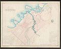
 Geographisk Charta Öfver Uleåborgs Lähn, uti Finland.jpg 9,912 × 14,031; 6.88 MB
-
 Karta öfver Uleåborgs stad 1876.jpg 7,490 × 5,937; 5.61 MB
-
 Map of Oulu in 1886.jpg 8,880 × 7,176; 37.87 MB
-
 Oulun kaupungin asemakartta ympäristöineen 1939.jpg 6,248 × 9,629; 5.94 MB
-
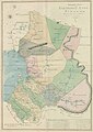
 Oulun maaherrakunta 1798.jpg 1,200 × 1,115; 226 KB
-
 Plan af Uleåborg 1839.jpg 6,911 × 5,536; 4.1 MB
-
 Plan de la Ville Uleåborg 1824.jpg 10,176 × 8,166; 9.22 MB
-
 Plan for Oulu Cemetery 1851.jpg 7,953 × 5,478; 3.19 MB
-
 The city plan of Oulu 1937 (JOKAKAL3B-3909).tif 3,923 × 5,333; 20 MB


