Category:Old maps of Nassau County, New York
Jump to navigation
Jump to search
Media in category "Old maps of Nassau County, New York"
The following 96 files are in this category, out of 96 total.
-

-
-
 1873hogInlet.jpg 482 × 241; 27 KB
-
-
 Aero view of Freeport, Long Island, N.Y. 1909.jpeg 11,312 × 6,752; 25.36 MB
-
 Aero view of Freeport, Long Island, N.Y. 1909.tif 11,312 × 6,752; 172.2 MB
-

-
 Bayville NYPL1633817.tiff 5,428 × 6,812; 105.79 MB
-
 Bellmore NYPL1633853.tiff 5,428 × 6,812; 105.79 MB
-
 Elmont Terrace; Interurban Co. NYPL1633875.tiff 5,428 × 6,812; 105.79 MB
-
 Floral Park - Mineola - Garden City and Hempstead NYPL1633771.tiff 7,230 × 4,468; 92.42 MB
-
 Franklin Square NYPL1633849.tiff 5,428 × 6,812; 105.79 MB
-
 Frederick Farms and Smithville South NYPL1633844.tiff 5,428 × 6,820; 105.91 MB
-
 Freeport, NY 1921 map.jpg 1,666 × 1,783; 710 KB
-
 Garden City Estates North NYPL1633796.tiff 5,428 × 6,812; 105.79 MB
-
 Garden City Estates NYPL1633791.tiff 5,428 × 6,812; 105.79 MB
-
 Greenfield NYPL1633799.tiff 5,428 × 6,812; 105.79 MB
-
 Hempstread Gardens; Forest Park NYPL1633838.tiff 5,428 × 6,820; 105.91 MB
-
 Hempstread Square and Hempstread Estates; Fairlawn Park NYPL1633797.tiff 5,428 × 6,820; 105.91 MB
-
 Hewlett Bay Park NYPL1633792.tiff 5,428 × 6,820; 105.91 MB
-
 Hicksville NYPL1633863.tiff 7,230 × 4,468; 92.42 MB
-
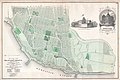
 Hughes & Bailey 1909 map of Freeport, NY.jpg 2,828 × 1,688; 1.22 MB
-
 Inwood, Cedarhurst Vicinity NYPL1633770.tiff 5,428 × 6,820; 105.91 MB
-
 Ira (Township) NYPL1583066.tiff 5,414 × 6,542; 101.34 MB
-
 Jericho; East Norwich NYPL1633843.tiff 5,428 × 6,812; 105.79 MB
-
 Manor Grove NYPL1633876.tiff 5,428 × 6,812; 105.79 MB
-

-

-

-
 New Hyde Park; Wampage Shores NYPL1633847.tiff 5,428 × 6,820; 105.91 MB
-
 New map of Kings and Queens counties, New York - from actual surveys. LOC 2013593269.tif 16,713 × 15,018; 718.11 MB
-
 No.Hemp.2.jpg 1,248 × 1,188; 242 KB
-
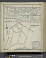
 NoHempsteadSection1.jpg 1,210 × 2,162; 2.07 MB
-
 NoHempsteadSection1Subsection1.jpg 766 × 467; 167 KB
-
 Northerly Part of Baldwin NYPL1633857.tiff 7,230 × 4,468; 92.42 MB
-
 Northerly Part of Lynbrook NYPL1633845.tiff 7,230 × 4,468; 92.42 MB
-
 Oyster Bay NYPL1633842.tiff 7,230 × 4,468; 92.42 MB
-
 Part of Floral Park NYPL1633788.tiff 7,230 × 4,468; 92.42 MB
-
 Part of Floral Park NYPL1633790.tiff 7,230 × 4,468; 92.42 MB
-
 Part of Garden City NYPL1633802.tiff 7,230 × 4,468; 92.42 MB
-
 Part of Garden City NYPL1633827.tiff 7,230 × 4,468; 92.42 MB
-
 Part of Glen Cove (Easternly Portion) NYPL1633864.tiff 7,230 × 4,468; 92.42 MB
-
 Part of Glen Cove (Easternly Portion) NYPL1633865.tiff 7,230 × 4,468; 92.42 MB
-
 Part of Glen Cove (Harbor Portion) NYPL1633862.tiff 7,230 × 4,468; 92.42 MB
-
 Part of Great Neck Estate; Glen Head NYPL1633820.tiff 5,428 × 6,812; 105.79 MB
-
 Part of Port Jefferson NYPL1633996.tiff 7,230 × 4,960; 102.6 MB
-
 Part of Stewart Manor NYPL1633878.tiff 5,428 × 6,812; 105.79 MB
-
 Plate 33- Town of North Hempstead. - Part of Flushing Village. NYPL1523103.tiff 6,001 × 4,002; 68.74 MB
-
 QueensCountyNY1891.jpg 760 × 514; 60 KB
-
 Red Spring and North Country Colony; Elm Point (Great Neck Landing) NYPL1633812.tiff 5,428 × 6,820; 105.91 MB
-
 Rockville Centre Terrace NYPL1633829.tiff 5,428 × 6,812; 105.79 MB
-
 Roosevelt NYPL1633874.tiff 7,230 × 4,468; 92.42 MB
-
 Roslyn Estates; Bulls Head NYPL1633787.tiff 5,428 × 6,820; 105.91 MB
-
 Roslyn NYPL1633789.tiff 7,230 × 4,468; 92.42 MB
-
 Sand Point, Centre Island and Cove Neck NYPL1633813.tiff 7,230 × 4,468; 92.42 MB
-
 Sea Cliff Environ and Thompson Park NYPL1633776.tiff 5,428 × 6,820; 105.91 MB
-
 Sea Cliff NYPL1633778.tiff 7,230 × 4,468; 92.42 MB
-
 Sea Cliff NYPL1633826.tiff 7,230 × 4,468; 92.42 MB
-
 Sea Cliff, (East to) Brookville - East Norwich - Syosset, Etc. NYPL1633822.tiff 7,230 × 4,468; 92.42 MB
-
 Seaford NYPL1633869.tiff 5,428 × 6,812; 105.79 MB
-
 Section 1 of Freeport NYPL1633828.tiff 7,230 × 4,468; 92.42 MB
-
 Section 1 of Northern Part of Hempstead NYPL1633858.tiff 7,230 × 4,468; 92.42 MB
-
 Section 1 of Rockville Centre NYPL1633866.tiff 7,230 × 4,468; 92.42 MB
-
 Section 1 of Southern Part of Hempstead NYPL1633854.tiff 7,230 × 4,468; 92.42 MB
-
 Section 2 of Freeport NYPL1633831.tiff 7,230 × 4,468; 92.42 MB
-
 Section 2 of Northern Part of Hempstead NYPL1633859.tiff 7,230 × 4,468; 92.42 MB
-
 Section 2 of Rockville Centre NYPL1633868.tiff 7,230 × 4,468; 92.42 MB
-
 Section 2 of Southern Part of Hempstead NYPL1633856.tiff 7,230 × 4,468; 92.42 MB
-
 Section 3 of Freeport NYPL1633834.tiff 7,230 × 4,468; 92.42 MB
-
 Section 3 of Rockville Centre NYPL1633871.tiff 7,230 × 4,468; 92.42 MB
-
 Section 4 of Freeport NYPL1633836.tiff 7,230 × 4,468; 92.42 MB
-
 Section 4 of Rockville Centre NYPL1633867.tiff 7,230 × 4,468; 92.42 MB
-
 Section 5 of Freeport NYPL1633839.tiff 7,230 × 4,468; 92.42 MB
-
 Section 6 of Freeport NYPL1633833.tiff 5,428 × 6,820; 105.91 MB
-
 South Oyster Bay NYPL1633786.tiff 5,428 × 6,812; 105.79 MB
-
 Southerly Part of Baldwin NYPL1633861.tiff 7,230 × 4,468; 92.42 MB
-
 Southerly Part of Lynbrook NYPL1633848.tiff 7,230 × 4,468; 92.42 MB
-
 Sub Plan; Westbury NYPL1633877.tiff 7,230 × 4,468; 92.42 MB
-
 Syossett NYPL1633841.tiff 5,428 × 6,820; 105.91 MB
-
 T23-li.jpg 13,217 × 8,822; 6.85 MB
-
 T25-li.jpg 9,122 × 9,772; 4.39 MB
-
 T26-li.jpg 8,791 × 7,686; 4.31 MB
-
 T27-li.jpg 9,020 × 12,568; 4.96 MB
-
 T33-Bis-li.jpg 11,289 × 8,963; 6.3 MB
-
 T34-li.jpg 10,620 × 13,667; 5.8 MB
-
 T37-li.jpg 10,807 × 9,218; 6.12 MB
-
 T39-li.jpg 11,892 × 9,120; 4.79 MB
-
 T66.jpg 12,501 × 9,237; 4.23 MB
-
 T77-2.jpg 9,452 × 12,711; 4.38 MB
-
 Town of Babylon. (Township); Map of Oak and Cap Islands and Beach. NYPL1602989.tiff 7,230 × 5,194; 107.44 MB
-

-
 Valley Stream NYPL1633784.tiff 5,428 × 6,820; 105.91 MB
-
 Valley Stream, Lynbrook, Rockville Centre, Woodmere, Etc. NYPL1633777.tiff 7,230 × 4,468; 92.42 MB
-
 Wantagh; West Central Park NYPL1633873.tiff 5,428 × 6,812; 105.79 MB
-
 West Garden City and Garden City Park NYPL1633783.tiff 5,428 × 6,812; 105.79 MB
-
 Westbury - Jericho - Hicksville - Locust - Grove, Etc. NYPL1633768.tiff 7,230 × 4,468; 92.42 MB


